Subject: United States & Canada
Period: 1840 (circa)
Publication: Stieler's Schul-Atlas
Color: Hand Color
Size:
9.4 x 7.5 inches
23.9 x 19.1 cm
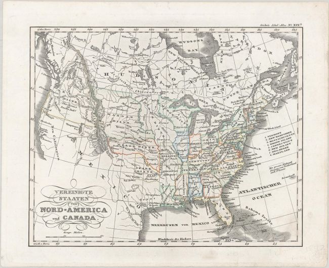
This German map of the United States features some fascinating territorial configurations in the west. It identifies several Indian Districts, including Huron, Sioux, Mandan, Osage, and Ozark. Texas is shown in an odd squat configuration, bordered by the Nueces River on the west and the Red River and Ozark District in the north. The Oregon District appears in the northwest, and Neu Californien and Neu Albion are located along the western coast. The map locates the mythical lakes Timpanogos and Tegujo, with a conjectural river flowing from Timpanogos into the San Francisco Bay. The National Road is traced from St. Louis to Cumberland. A large stretch of Canada is labeled Hudsonia.
References:
Condition: A
Contemporary color on a bright sheet with minor soiling at bottom right.