Subject: Eastern United States
Period: 1830 (circa)
Publication: New Edinburgh General Atlas
Color: Hand Color
Size:
13.3 x 10.8 inches
33.8 x 27.4 cm
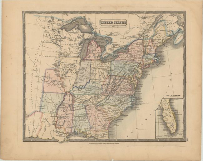
This uncommon map shows interesting and sometimes outdated state and territory boundaries. Indiana is still labeled as a territory even though it had become a state in 1818. The newest state of Missouri is also shown, and Arkansas is shown as a state although it did not achieve statehood until 1836. The remaining region to the west is labeled as "Western Territory" and the area of present-day Texas is still "Mexico." Michigan Territory and North West Territory are shown in the north, and numerous Native American Indian tribes are noted throughout. Mississippi appears to be mis-colored (as it is on other examples as well) to include the western portion of Tennessee. The Florida peninsula is shown in an inset at right. Published by Gellatly and Washbourne.
References:
Condition: B+
Light toning with one small chip along the bottom edge of the sheet.