Subject: Northeastern United States & Canada
Period: 1834 (dated)
Publication:
Color: Hand Color
Size:
19 x 23.6 inches
48.3 x 59.9 cm
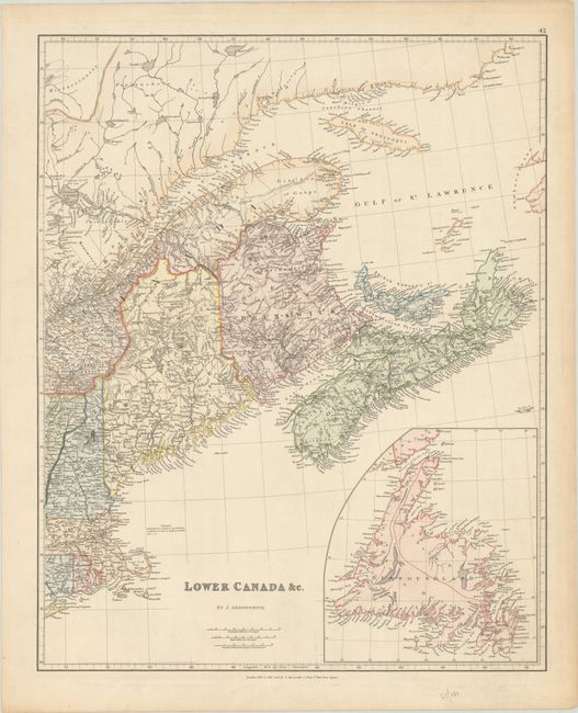
This handsome map details the area from the Gulf of St. Lawrence to Cape Cod. It includes the provinces of Nova Scotia, Prince Edwards Island, New Brunswick, and a portion of Quebec and New England. There is also a large inset of Newfoundland at bottom right. Each of the provinces and states have individual colors with nice detail of towns, rivers, and roads. The proposed railroad from Boston to Albany is delineated. A dotted line in northern Maine indicates the disputed border in the region, but it is not labeled as it is in later editions of this map.
References:
Condition: A
On a sturdy sheet with minor soiling and marginal toning.