Subject: United States
Period: 1953-58 (circa)
Publication:
Color: Printed Color
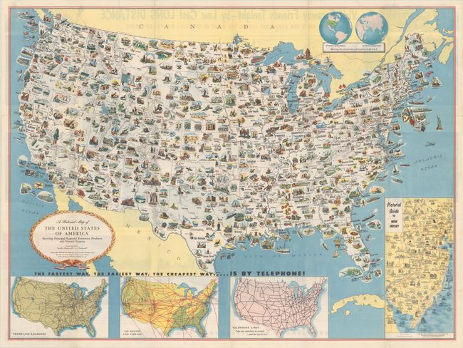
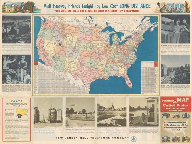
A. A Pictorial Map of the United States of America Showing Principal Regional Resources, Products, and Natural Features, by General Drafting Co., circa 1953 (31.1 x 23.3"). This information-packed map was create by the General Drafting Company for the New Jersey Bell Telephone Company. The main map features over 700 drawings in full color including points of interest, natural resources, and agricultural products. At bottom are inset maps showing railroad lines, air routes, telephone lines, as well as a pictorial map of New Jersey. The verso contains a road map of the United States with both a mileage chart and a telephone long distance pricing chart. This issue differs from the 1954 Department of State version which replaced the inset map of New Jersey with a table of facts about the United States. Self-folding (5.7 x 8.1"). Reference: Rumsey #12399.002. Condition: A clean example with some minor rippling, issued folding. (A)
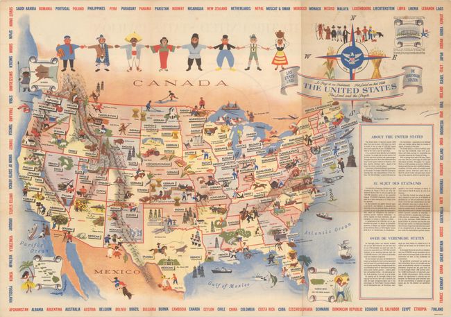
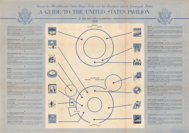
B. The United States - The Land and the People, by Mary Ronin, dated 1958 (25.9 x 18.2"). This very decorative pictorial map of the United States was designed by commercial artist Mary Ronin and published to promote the Brussels Universal and International Exhibition of 1958 (or Expo 58). It is a celebration of the diversity of cultures found in the United States, with common background nationalities noted in each state (for instance: Greek, Spanish, and Cuban in Florida; Finnish, Dutch, Belgian, Rumanian, and Syrian in Michigan). The map is filled with small illustrations highlighting history and culture: one of Christopher Columbus' ships sails across the Atlantic; the Statue of Liberty looms over a traffic cop and a rabbi off the coast of New York; a jazz trio plays on the Tennessee-Alabama state line; a cowboy lassoes a steer just above the Alamo in Texas; a film cameraman shoots the Pacific just to the north of an 18th-century Franciscan missionary in southern California. Four small insets in the corners show Alaska, Hawaii, Puerto Rico, and the United States Pavilion at the Expo. Figures representing different ethnicities and backgrounds hold hands above the map. The border is made up of alternating red and blue text listing the various nations of the world. Includes text and alternative titles in French and German. Verso features a diagram of, and guide to, the United States Pavilion. Accompanied by a single-page flyer promoting the Expo. Reference: PJ Mode Collection #1360. Condition: Issued folding with a few tiny splits at the fold junctions and minor soiling. (B+)
References:
Condition:
See description above.