Subject: Eastern United States & Canada
Period: 1850 (circa)
Publication:
Color: Hand Color
Size:
34.3 x 22.5 inches
87.1 x 57.2 cm
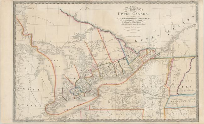
A large and boldly engraved copper plate map. It extends westward to include Lake George, part of Lake Superior and Detroit, eastward to Quebec, and as far south to include New Salem, Sandusky and Fort Miamis. Filled with towns and settlements and individual named townships, roads and trails including an unfinished one heading west from Detroit. Many interesting notations, e.g., "This Creek in the Western Boundary of the Six Indian Nations has many Rapids," and "This River is a good Harbour for Vessels of 60 Tons." This is the seventh and final edition with the first appearance of railroads. The border has been updated to a keyboard-style.
References: Tooley (Amer) p.102 #82g.
Condition: B+
A crisp impression with contemporary outline color on a sturdy sheet, issued folding with light soiling, faint offsetting, and a few tiny abrasions along the left-hand fold at bottom. There are archival repairs to several minor separations along the folds.