Subject: Eastern United States
Period: 1812 (dated)
Publication: Brooke’s General Gazetteer Improved…
Color: Black & White
Size:
9.7 x 7.8 inches
24.6 x 19.8 cm
Mathew Carey was a seminal figure in early American publishing; establishing the first publishing firm to specialize in cartography and issuing the first atlas devoted exclusively to American maps. He set up an elaborate cottage system of craftsmen for compiling, engraving, printing, and coloring maps. This practice was emulated by later American cartographic publishers such as John Melish and Henry S. Tanner. The American Atlas concept was also adopted by other publishers in both the United States and Europe.
Three maps of the early United States from Brooke’s General Gazetteer Improved:
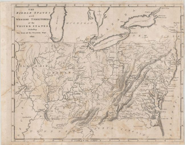
The Middle States and Western Territories of the United States Including the Seat of the Western War, dated 1812. This map covers the region from New Jersey to Illinois and names Indiana, Kentucky, Virginia, Ohio, Pennsylvania, Maryland, and Delaware. The northern borders of Illinois and Indiana are aligned with Ohio, so they are south of Lake Michigan. Chicago and Fort Dearborn are correctly on the lake, but occupy an unnamed region west of Lake Michigan. Michigan is named, and Detroit is located. The capitals of Illinois, Indiana, and Ohio are given as Kaskaskia, St. Vincennes, and Chilicothe, respectively. The map was made to show the region involved in the War of 1812 with the British.
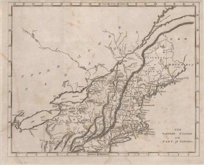
The Eastern States with Part of Canada. Covers New England south to Philadelphia and west to Detroit. Includes good detail of the watershed of the St. Lawrence from Lake Erie to its mouth. Locates several towns and settlements along the river including Quebec, Montreal and Kingston. Maine is the District of Maine.
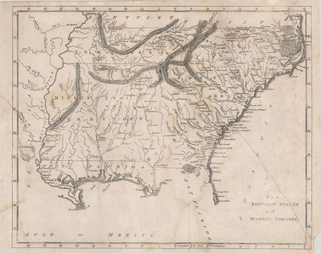
The Southern States and Missisippi Territory. This map depicts Tennessee, North Carolina, South Carolina, Georgia, and Mississippi Territory including Alabama. Place names are primarily located east of the Appalachian mountains along with Nashville and Knoxville in Tennessee. The Spanish possession of East and West Florida are also shown.
References:
Condition: B
Issued folding with scattered foxing and light dampstains along the left border. The first map is trimmed to the border at right, and the third map has a long tear at right that has been closed on verso with archival tape.