Subject: United States
Period: 1795-1829 (circa)
Publication:
Color: Hand Color
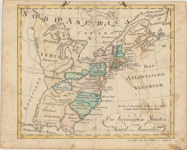
A. Die Vereinigten Staaten von Nord-Amerika, by Johannes Walch, circa 1795 (8.6 x 7.3"). Nice little German map of the early United States. The only state shown west of the Appalachian Mountains is Kentucky. Above which is a strangely shaped unnamed region (Ohio) with the only settlement being Mariette. Large Indian tribal territories are noted up to the Mississippi River. Condition: Contemporary color with moderate soiling (B)
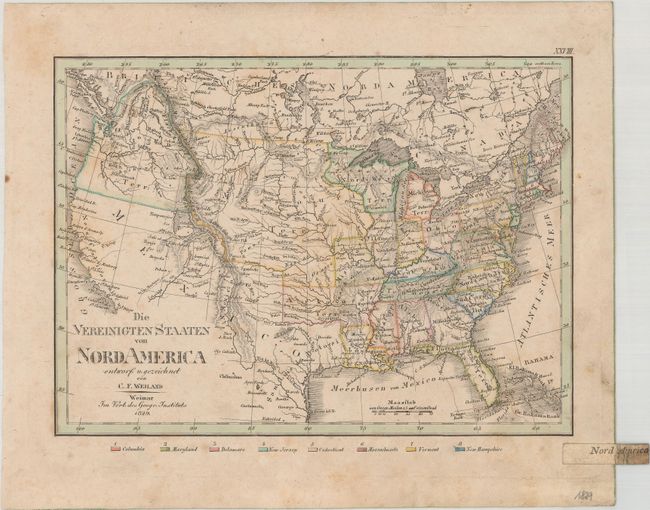
B. Die Vereinigten Staaten von Nord America, by Carl Ferdinand Weiland, dated 1829 (9.2 x 6.7"). This small German map of the United States shows interesting territorial configurations west of the Mississippi. Arkansas Territory encompasses most of present-day Oklahoma and the Northwest Territory includes parts of Wisconsin and Minnesota. The remaining west is filled with large Missouri and Oregon Territories, with the latter extending well into present-day Canada. There is good detail of state boundaries, key cities, rivers, topography, and the locations of Indian tribes. Condition: Contemporary outline color with light toning, foxing and soiling. (B+)
References:
Condition:
See description above.