Subject: Eastern United States
Period: 1857 (circa)
Publication: National Atlas
Color: Hand Color
Size:
24.3 x 19.4 inches
61.7 x 49.3 cm
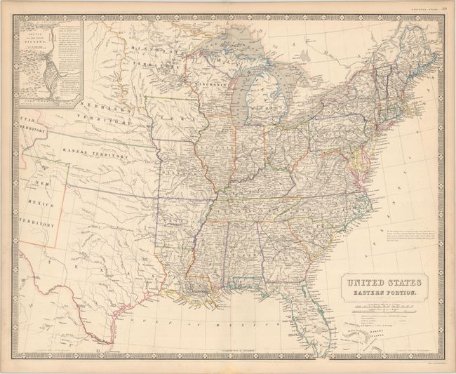
This is a later, and much less common, edition of this map that was first published in 1842. This version incorporates many changes reflecting the rapid westward expansion and provides excellent detail of the extensive road and railroad networks. An oversized Minnesota Territory contains those portions of the Dakotas east of the Missouri River, beyond which is the Nebraska Territory. Kanzas Territory extends to the Rockies and both Utah and New Mexico territories appear on the western extreme of the map. The most striking feature of the map is a unique configuration for Texas that incorporates most of present-day Oklahoma (with no mention of Indian Territory). Includes the inset "Sketch of the River Niagara" and an interesting notation above the title concerning slaveholding states. Surrounded by keyboard style borders.
References:
Condition: A
On a heavy bright sheet with a few minor spots of foxing.