Subject: Eastern United States
Period: 1836 (dated)
Publication:
Color: Hand Color
Size:
19.8 x 16 inches
50.3 x 40.6 cm
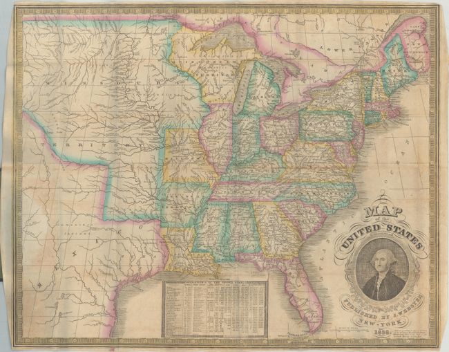
This scarce pocket map was published by James Webster from Humphrey Phelps' plate of 1832. Phelp's name has been erased and Webster's has been added on the lower right. George Washington's portrait decorates this map along with a chart of the population of the United States in 1830. The map shows a large Missouri Territory reaching from Missouri and stretching to the Rocky Mountains. Wisconsin (here named Ouisconsin) Territory is oversized and includes the Upper Peninsula of Michigan and a portion of Minnesota. Arkansas gained statehood the year this map was published, but it is still shown as a territory. Texas is named and included as part of Mexico. The map folds into original blue paper covers (3.5 x 5.3").
References:
Condition: B+
Issued folding with some minor toning and offsetting along the right and left borders along with several tiny splits at the fold junctions. Covers are lightly worn with a crease in the top corner of the front cover.