Subject: Colonial Great Lakes
Period: 1790 (circa)
Publication:
Color: Hand Color
Size:
12.5 x 8.3 inches
31.8 x 21.1 cm
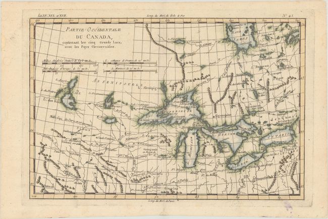
This is one of the most interesting maps of the Great Lakes, depicting frontier forts, missions, and fur trade routes. It covers the region from James Bay south to show Ft. St. Louis, and from Lake Ontario through the Great Plains. It contains numerous Indian tribe names and forts including Detroit, St. Louis, Toronto, and Chicagou. Lake Superior contains Isle Royale, as well as the phantom islands of St. Anne, Maurepas and Ponchartrain, which were reported by the Jesuit explorer Charlevoix. The Keweenaw Peninsula is noted as Pt. de Kiaonan. The source of the Mississippi is noted as inconnue or unknown. This is the final state without Bonne's name in the title.
References: Kershaw #976; Sellers and Van Ee #173.
Condition: B+
A nice impression with a few short splits across the centerfold, a tiny dampstain at center, and faint offsetting concentrated along the centerfold.