Catalog Archive
Auction 180, Lot 121

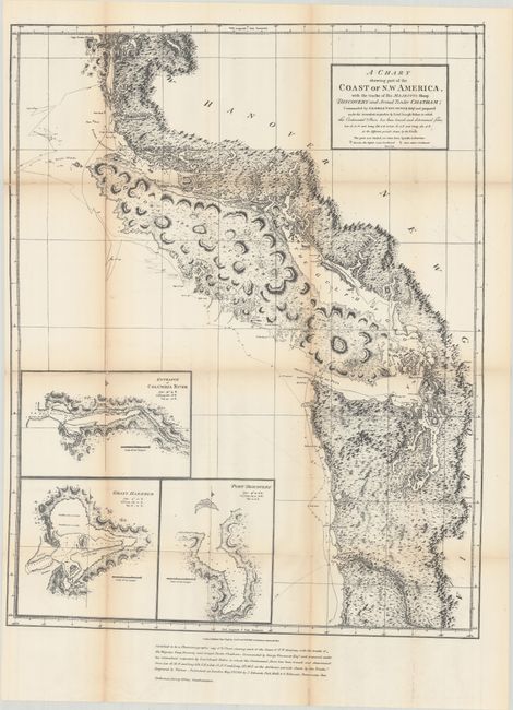
"A Chart Shewing Part of the Coast of N.W. America, with the Tracks of His Majesty’s Sloop Discovery and Armed Tender Chatham...", Vancouver, George (Capt)

Subject: Northwestern United States & Canada

Period: 1872 (circa)

Publication:

Color: Black & White

Size:
21.8 x 27.9 inches
55.4 x 70.9 cm
Download High Resolution Image
(or just click on image to launch the Zoom viewer)

This is the 1872 reproduction of Vancouver’s 1798 map that was part of the British presentation in the Berlin Arbitration, concluded in 1872, that settled the boundary dispute between the United States and Britain over San Juan Island that had precipitated the Pig War of 1859. This is an example of the process of photozincography the British Ordnance office had developed and noted at bottom as "certified to be a photozinco-graphic copy."

References:

Condition: B+

Issued folding with light toning along the fold lines and a few fold separations with minimal loss that have been closed on verso with archival tape.

Estimate: $160 - $190

Sold for: $130

Closed on 11/18/2020

Archived