Subject: United States
Period: 1845 (dated)
Publication:
Color: Hand Color
Size:
67 x 52.5 inches
170.2 x 133.4 cm
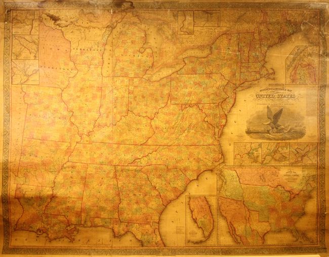
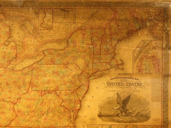
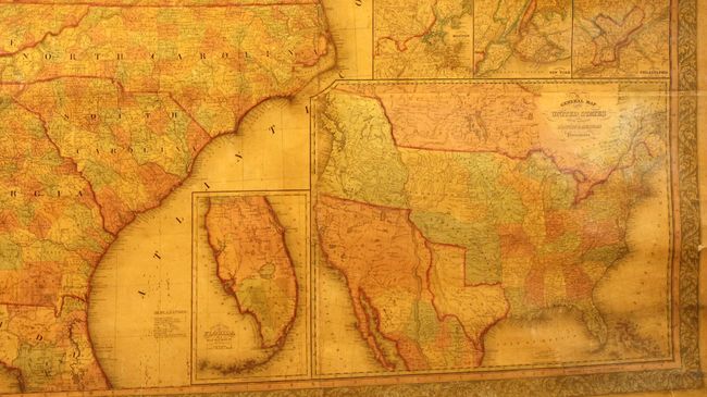
This stunning wall map portrays the nation at the end of the Jacksonian era and at the beginning of the movement that would become known as Manifest Destiny. Rapid settlement is evident in the county development, which is delineated in full hand color on this edition. The emerging railroad system is shown along with the highly developed canal network. Beneath the title is a large engraved composite view designed by W. Mason that includes the capitol building in Washington, D.C. and a large American eagle perched on a seashell boat. This theme is echoed in the surrounding decorative border with seashells in each corner and at the bottom. The map was compiled and engraved by James H. Young with the assistance of F. Dankworth, E. Yeager and E.F. Woodward.
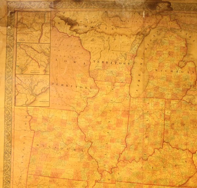
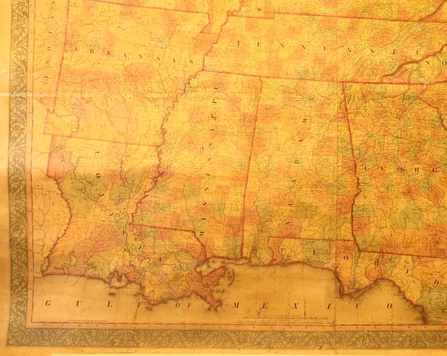
Illustrating an era of rapidly expanding westward settlement, the large map covers the United States westward to include all of Missouri, Arkansas and Louisiana with a portion of Iowa Territory. It is highly detailed showing counties, townships, parishes, towns and settlements, trails and wagon routes, canals, and railroads. Eleven inset maps and city plans provide additional information. The largest inset (17" x 21"), General Map of the United States with the contiguous British & Mexican Possessions, includes information for the Great Basin from John Arrowsmith's important map. It features the Independent Republic of Texas in its large configuration with the early settlements of Houston, San Felipe de Austin and San Antonio. It shows the huge Oregon Territory extending far to the north into present-day British Columbia, illustrating the growing tensions between the United States and Britain in the Oregon boundary dispute. It also delineates the large Iowa, Missouri and Indian territories and traces nascent wagon roads and trails. The other insets are: Vicinity of Boston; Vicinity of New York; Vicinity of Philadelphia; North Part of Maine; the South Part of Florida; Vicinity of Rochester; Vicinity of the Falls of the Niagara; Vicinity of Albany; Vicinity of Baltimore and Washington; and the Vicinity of Charleston.
This is a good example of Mitchell's rarely offered wall map, which was first issued in 1834 without Mitchell's name in the title. The edition of 1841 eliminated insets of Cincinnati and New Orleans to provide a better depiction of expanding settlement in Iowa Territory including the first counties along the eastern boundary. This edition has the 1833 copyright date along with Mitchell's imprint dated 1845.
References: Ristow, pp. 309-310.
Condition: B
A good example with the typical light toning caused by the varnish and minor foxing. There are some minor cracks and abrasions at top right, and a dampstain at top left that extends about 7" into the image. There are a few edge tears in the margins and decorative border at top, and the ribbon edges are mostly gone. Lacks the top roller and the bottom roller is detached.