Subject: New England & Mid-Atlantic United States
Period: 1783-86 (circa)
Publication:
Color: Black & White
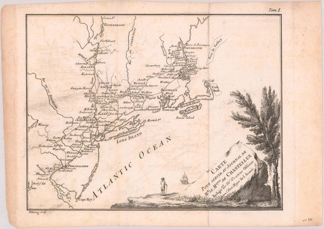
A. Carte pour Servir au Journal de Mr. le Mquis. de Chastellux, by Francois Jean, Marquis de Chastellux, published in Travels in North-America, in the Years 1780, 1781, and 1782... circa 1786 (9.5 x 7.3"). This map was used to illustrate Chastellux's Travels in North-America, in the Years 1780, 1781, and 1782... This work provided a first-hand perspective of the American Revolution and is one of the great contemporary Revolutionary War accounts. The Marquis de Chastellux was one of the forty members of the French Academy and a Major General in the French army in the late 1700's. He served under the Count de Rochambeau and joined forces with General Washington in the famous march on Yorktown that led to Cornwalis' surrender. Cartographically, the map covers the region from central New England south to Wilmington, Delaware, and displays his route through these regions while serving under Rochambeau. Engraved by Aldring. Reference: Howes #C324. Condition: A dark impression, issued folding with light offsetting, some printer's ink residue at left, and light toning along the edges of the sheet. (B+)
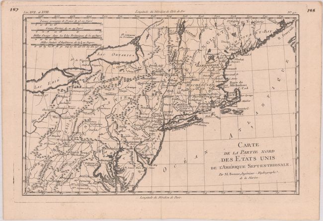
B. Carte de la Partie Nord des Etats Unis de l'Amerique Septentrionale, by Rigobert Bonne, published in Atlas de Toutes les Parties Connues du Globe Terrestre, circa 1783 (12.4 x 8.1"). This very early map presents the northern part of the newly-formed United States. It covers the region from northern Virginia to Maine (Machasuzet Bay), and westward to include Lake Erie. The map has good topographical detail, and it also includes numerous settlements, forts, and Indian villages. It locates Baltimore, Annapolis, Alexandria, New York, Boston, Ft. Halifax, and much more. There are four distance scales at upper left. References: McCorkle #782.1B; Sellers & van Ee #744. Condition: A dark impression with minor toning and a faint damp stain at top center. (A)
References:
Condition: B+
See description above for details.