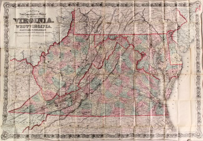
Subject: Virginia & West Virginia, Mid-Atlantic
Period: 1885 (dated)
Publication:
Color: Hand Color
Size:
44.8 x 31 inches
113.8 x 78.7 cm
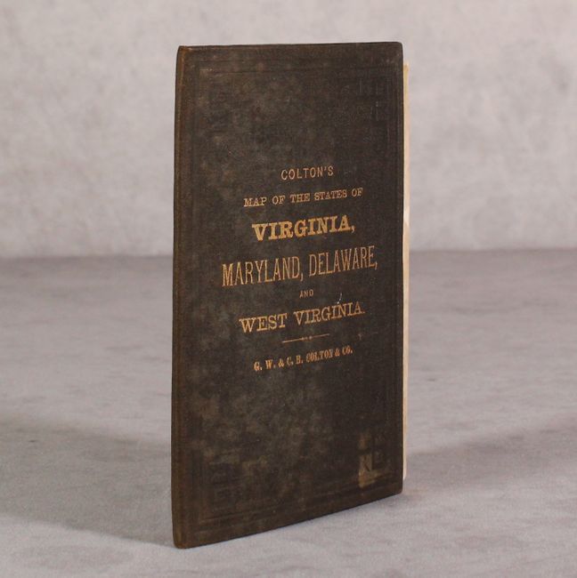
A very large pocket map that is hand-colored by county and presents excellent detail of the region on a scale of 12 miles per inch. Shows towns and settlements, roads, canals, topography, and the river systems. The rapidly evolving railroad network is also well depicted, with the recently formed Richmond & Allegheny Railroad (1880) shown along the old towpath of the James River & Kanawha Canal, extending from Richmond to just west of Lynchburg. The map is embellished with fancy titling and a wide and elaborate strapwork border. Folds into original brown embossed cloth boards with gilt title on the front cover.
References:
Condition: B+
A very clean, bright example with a number of small fold separations that have been mostly closed on verso with archival tissue. There are three small repaired chips (in the Chesapeake Bay and Atlantic Ocean) resulting in minor image loss. Light wear and stains to covers.