Subject: United States
Period: 1835 (dated)
Publication:
Color: Hand Color
Size:
11.7 x 8.6 inches
29.7 x 21.8 cm
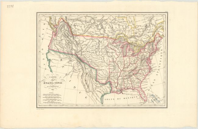
An attractive map of the United States that was issued just prior to Texas declaring independence from Mexico. Missouri and Arkansas form the western frontier, and a huge Missouri Territory takes up all lands to their west. In the Pacific Northwest, the boundary with Canada extends well into present-day British Columbia, reflecting United States' interests in the region. In the Great Basin, two spurious rivers connect L. Timpanogos and L. Teguayo to the Pacific Ocean. Fancy titling and 4 distance scales complete the map.
References:
Condition: A
A nice impression on a clean sheet.