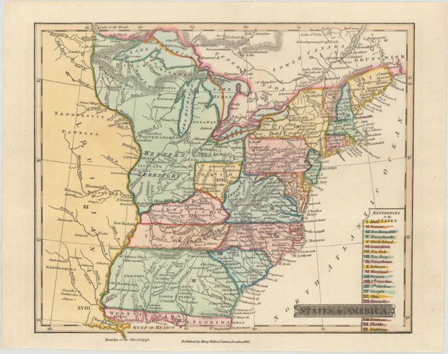
Subject: Eastern United States, Franklinia
Period: 1823 (dated)
Publication: An Account of the United States of America
Color: Hand Color
Size:
8.7 x 7.4 inches
22.1 x 18.8 cm
A colorful map that focuses on the eastern states up to the Mississippi River. It features the short-lived state of Franklinia along the Great Smokey Mountains. In 1785, settlers in western North Carolina and eastern Tennessee organized a state government to be named in honor of Benjamin Franklin. Congress turned down their appeal, but the state maintained a legislature and governor until 1788. The map also shows a large Western Territory that covers today's Indiana, Illinois, Michigan, Wisconsin, and eastern Minnesota. Only the southern half of present-day Ohio is labeled Ohio. The region of today's West Virginia is labeled Indiana (Indiana Land Company) without color distinction. Includes a reference to states at bottom. This is the first state of the map, published by Henry Fisher in London. Interestingly, the first edition (1814) of this map does not include Franklinia.
References: Dotson & Baker (OWA) #32.1; Baynton-Williams (TMC-72) #16.
Condition: A+
A fine example on watermarked paper.