Catalog Archive
Auction 177, Lot 89

"Kaart van het Eiland Terre-Neuve, van Nieuw Schotland, het Eiland St. Jan en het Oostelyk Gedeelte van Kanada", Bachiene, Willem Albert

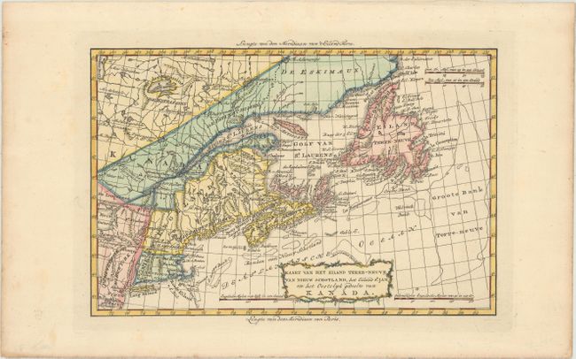
Subject: Eastern United States & Canada

Period: 1785 (published)

Publication: Atlas tot Opheldering der Hedendaagsche Historie…

Color: Hand Color

Size:
12.4 x 8.2 inches
31.5 x 20.8 cm
Download High Resolution Image
(or just click on image to launch the Zoom viewer)

This uncommon map covers the area from New Jersey to Newfoundland. New England is shown reaching from Connecticut to Novia Scotia, and Massachuset Baay extends from Boston way up into Northern Maine. The map is based on Bonne's similar map of 1782 but is adorned with a delicately engraved title cartouche.

References: Kershaw #729; McCorkle #785.7; Shirley (BL Atlases) T.BACH-3a.

Condition: A

A crisp impression on a clean and bright sheet of watermarked paper with minor soiling confined to the blank margins.

Estimate: $275 - $350

Sold for: $150

Closed on 4/29/2020

Archived