Subject: Eastern United States
Period: 1800-12 (circa)
Publication:
Color: Hand Color
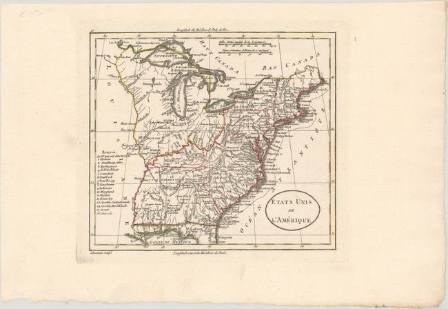
A. Etats Unis de l'Amerique, by Alexandre Blondeau, circa 1800 (8.0 x 7.1"). Nice view of the early United States with its western boundary on the Mississippi River and sixteen states listed. Includes a large unnamed Northwest Territory that extends to the Mississippi and Ohio Rivers and includes Illinois. Everything west of the Mississippi is named as Louisiane. Good detail throughout including locating the several Army lands (Wabash, Illinois, Ohio, and New Jersey Companies) and numerous native tribes. Condition: A crisp impression on a bright sheet. (A+)
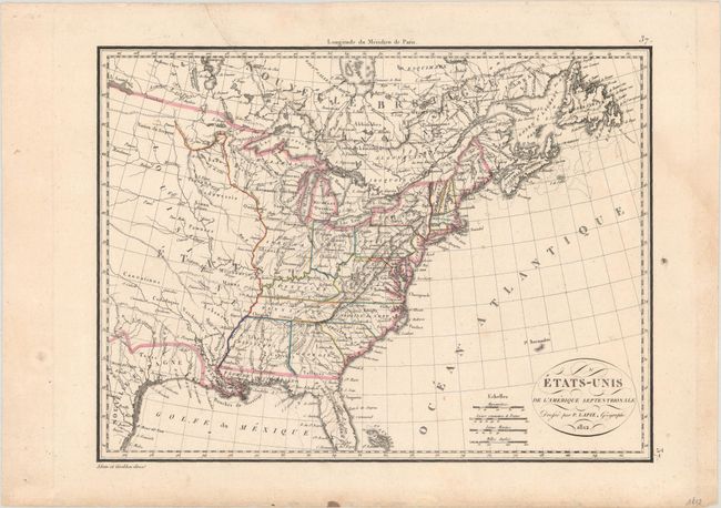
B. Etats-Unis de l'Amerique Septentrionale, by Pierre Lapie, dated 1812 (11.8 x 8.8"). Interesting map of the United States in the first part of the 19th century that only shows southern Texas as still part of Mexico. Mississippi encompasses Alabama and Indiana, which would become a state 4 years later, is labeled but not delineated. The region west of the Mississippi River is labeled Louisiane and is filled with various Indian tribes. Fancy titling in a small oval cartouche. Four distance scales with longitude measured only from Paris. Condition: A nice impression on a watermarked sheet with light soiling and an archivally repaired tear that extends 3" into the image at top. (B+)
References:
Condition:
See description above.