Filtered by Category:United States(Show All Categories)
Showing results for:Auction 122
Catalog Archive
222 lots
Page 1 of 5
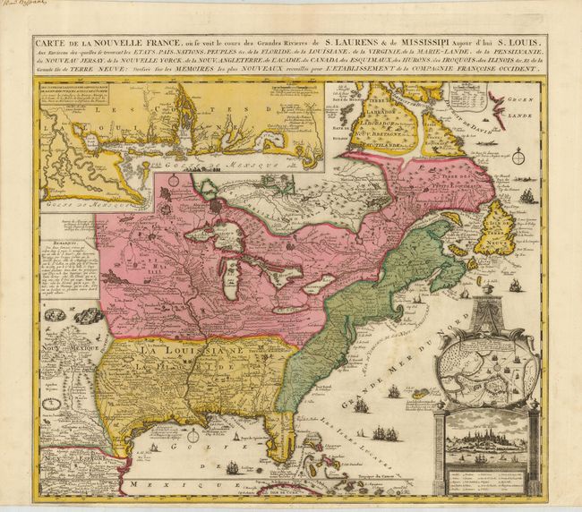
Auction 122, Lot 129
Subject: Colonial North America
Fer, Nicolas de
Carte de la Nouvelle France, ou se voit le cours des Grandes Rivieres de S. Laurens & de Mississipi, Aujour d'hui S. Louis…, 1720
Size: 21.8 x 19.8 inches (55.4 x 50.3 cm)
Estimate: $2,100 - $2,500
Sold for: $1,900
Closed on 12/5/2007
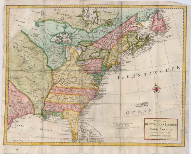
Auction 122, Lot 131
Subject: Colonial North America
Bell, Peter
Charte der Brittischen Laender in Nord America, nach den Frieden von 1763, 1772
Size: 15 x 11.7 inches (38.1 x 29.7 cm)
Estimate: $250 - $300
Sold for: $425
Closed on 12/5/2007
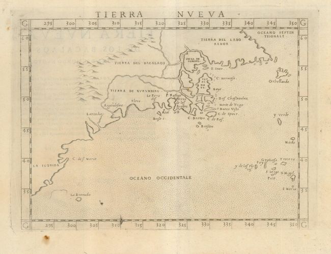
Auction 122, Lot 143
Subject: Colonial United States & Canada
Ruscelli, Girolamo
Tierra Nueva, 1574
Size: 9.5 x 7 inches (24.1 x 17.8 cm)
Estimate: $1,200 - $1,400
Sold for: $1,400
Closed on 12/5/2007
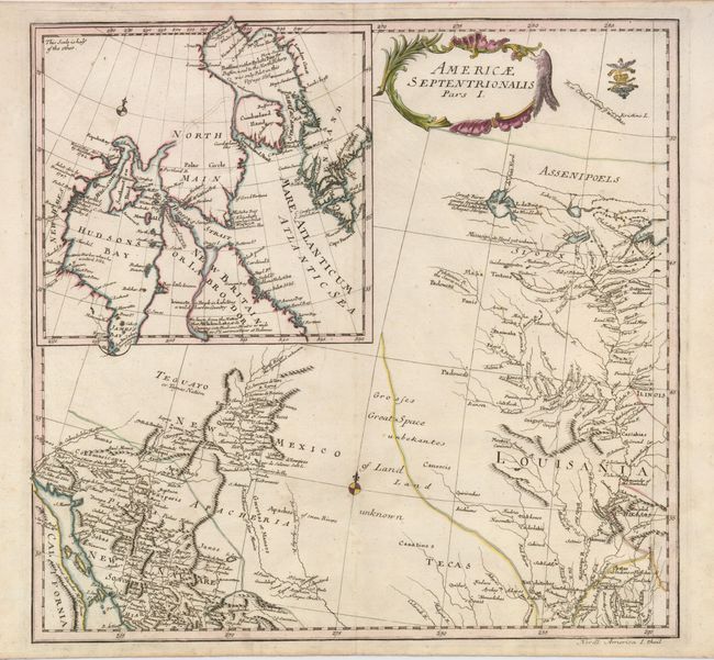
Auction 122, Lot 144
Subject: United States and Canada
Von Euler, Leonhard
Americae Septentrionalis Pars I, 1753
Size: 14.5 x 13.5 inches (36.8 x 34.3 cm)
Estimate: $400 - $500
Unsold
Closed on 12/5/2007
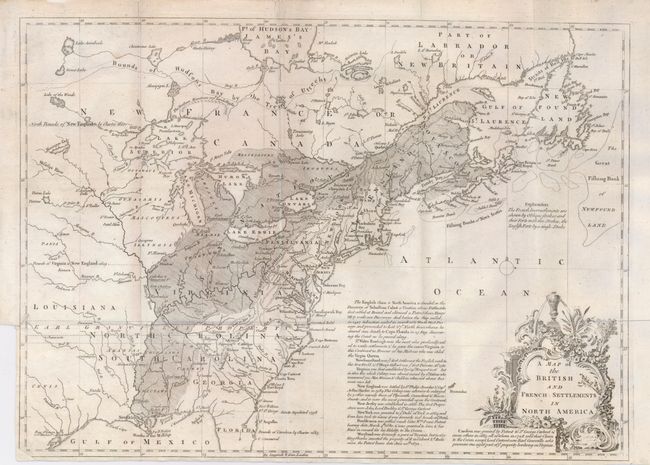
Auction 122, Lot 145
Subject: Eastern Canada & United States
Lodge, John
A Map of the British and French Settlements in North America, 1755
Size: 15 x 11 inches (38.1 x 27.9 cm)
Estimate: $400 - $500
Sold for: $450
Closed on 12/5/2007
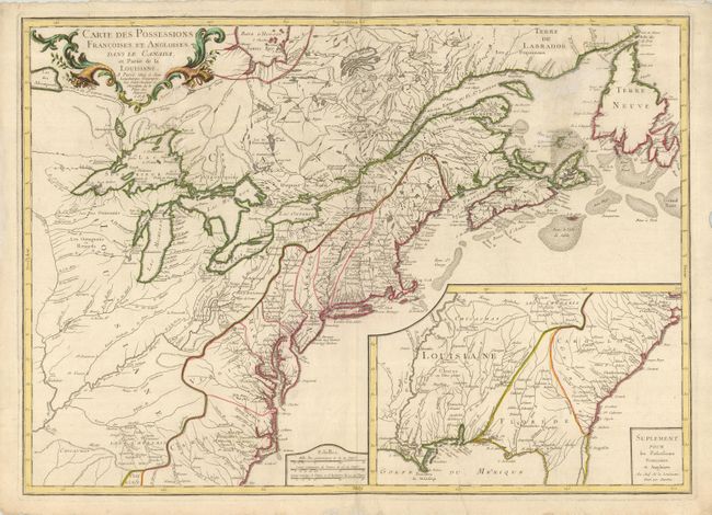
Auction 122, Lot 146
Subject: Colonial United States and Canada
Longchamp, S. G. (Sieur)
Carte des Possessions Francoises et Angloises dans le Canada, et Partie de la Louisiane, 1756
Size: 30.5 x 22 inches (77.5 x 55.9 cm)
Estimate: $1,400 - $1,700
Sold for: $1,200
Closed on 12/5/2007
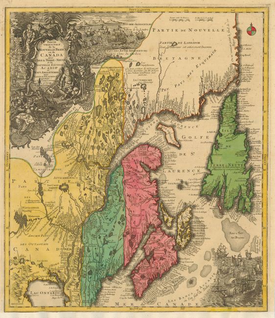
Auction 122, Lot 148
Subject: Colonial United States and Canada
Seutter/Lotter
Partie Orientale de la Nouvelle France ou du Canada avec l'Isle de Terre-Neuve et de Nouvelle Ecosse, Acadie et Nouv. Angleterre…, 1756
Size: 19.3 x 22.3 inches (49 x 56.6 cm)
Estimate: $800 - $1,100
Sold for: $600
Closed on 12/5/2007
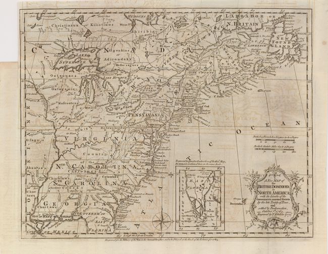
Auction 122, Lot 149
Subject: Colonial United States and Canada
Kitchin, Thomas
A New Map of the British Dominions in North America; with the Limits of the Governments Annexed thereto by the Late Treaty of Peace, and Settled by Proclamation, October 7th, 1763, 1763
Size: 11.8 x 9.4 inches (30 x 23.9 cm)
Estimate: $400 - $500
Sold for: $250
Closed on 12/5/2007
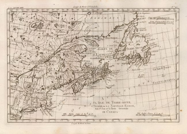
Auction 122, Lot 150
Subject: Eastern Canada, New England
Bonne, Rigobert
L'Isle de Terre-Neuve, L'Acadie, ou la Nouvelle Ecosse, l'Isle St Jean et la Partie Orientale du Canada, 1775
Size: 12.6 x 8.5 inches (32 x 21.6 cm)
Estimate: $140 - $180
Sold for: $95
Closed on 12/5/2007
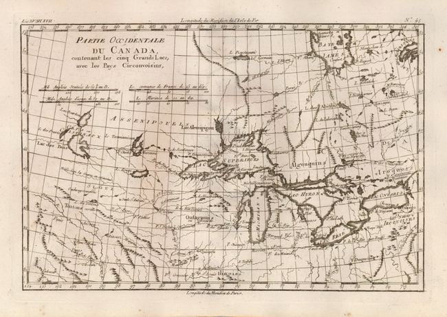
Auction 122, Lot 151
Subject: Great Lakes
Bonne, Rigobert
Partie Occidentale du Canada, contenant les cinq Grands Lacs, avec les Pays Circonvoisins, 1780
Size: 12.3 x 8.3 inches (31.2 x 21.1 cm)
Estimate: $180 - $240
Sold for: $425
Closed on 12/5/2007
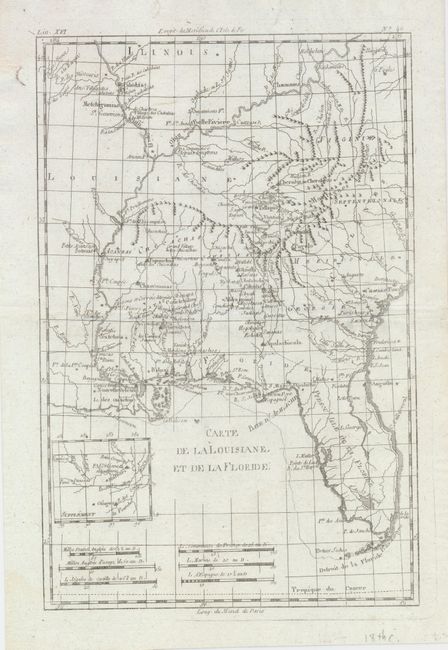
Auction 122, Lot 152
Subject: Eastern Canada & United States
Bonne, Rigobert
[Lot of 3] Carte de la Louisiane, et de la Floride [and] Carte de la Partie Sud des Etats Unis de l'Amerique Septentrionale. [and] L'Isle de Terre-Neuve, l'Acadie on la Nouvelle Ecosse, l'Isle St. Jean et la Partie Orientale du Canada, 1785
Size: 12 x 8 inches (30.5 x 20.3 cm)
Estimate: $300 - $400
Sold for: $400
Closed on 12/5/2007
Auction 122, Lot 153
Subject: Canada & United States
[blank]
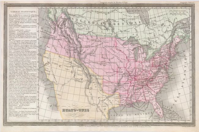
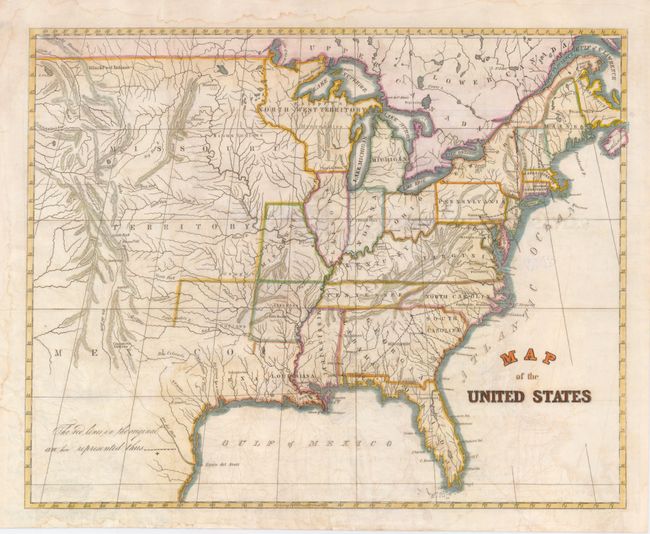
[Lot of 2] United States [and] United States of America, 1797-1820
Size: See Description
Estimate: $200 - $250
Sold for: $160
Closed on 12/5/2007
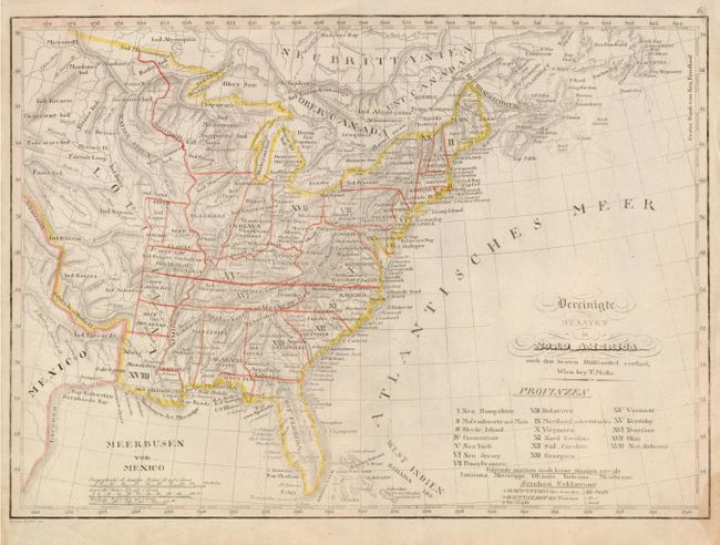
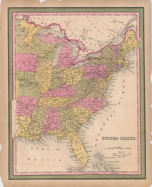
Auction 122, Lot 154
Subject: Canada & United States
[blank]
[Lot of 2] Etats-Unis [and] United States, Southern Part., 1835
Size: See Description
Estimate: $150 - $200
Sold for: $120
Closed on 12/5/2007
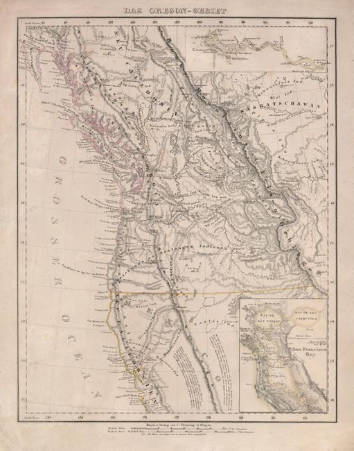
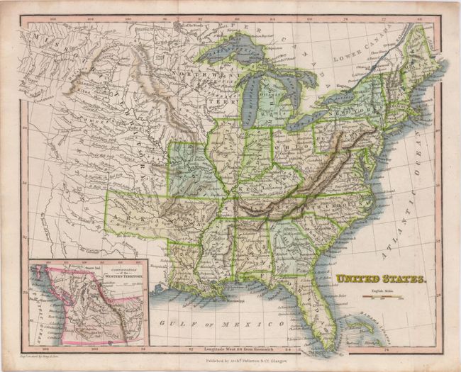
Auction 122, Lot 155
Subject: Northwestern United States and Canada
Flemming, Carl
Das Oregon-Gebiet, 1848
Size: 12.8 x 17 inches (32.5 x 43.2 cm)
Estimate: $300 - $400
Sold for: $160
Closed on 12/5/2007
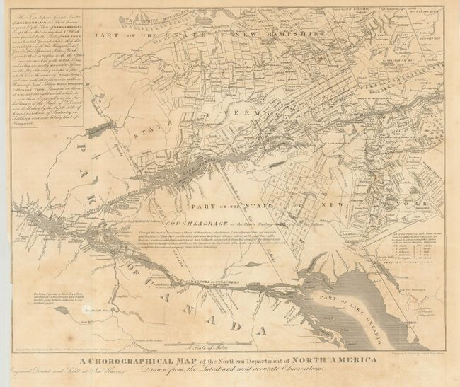
Auction 122, Lot 156
Subject: United States & Canada
Gavit, John
A Chorographical Map of the Northern Department of North America Drawn from the Latest and Most Accurate Observations, 1850
Size: 12.4 x 10 inches (31.5 x 25.4 cm)
Estimate: $90 - $130
Unsold
Closed on 12/5/2007
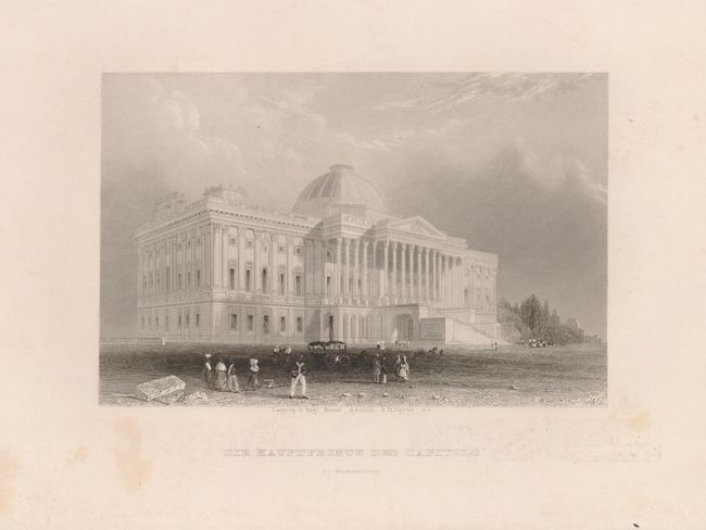
Auction 122, Lot 157
Subject: United States
[Lot of 17 - United States Views], 1840-1850
Size: 6 x 4 inches (15.2 x 10.2 cm)
Estimate: $300 - $375
Unsold
Closed on 12/5/2007
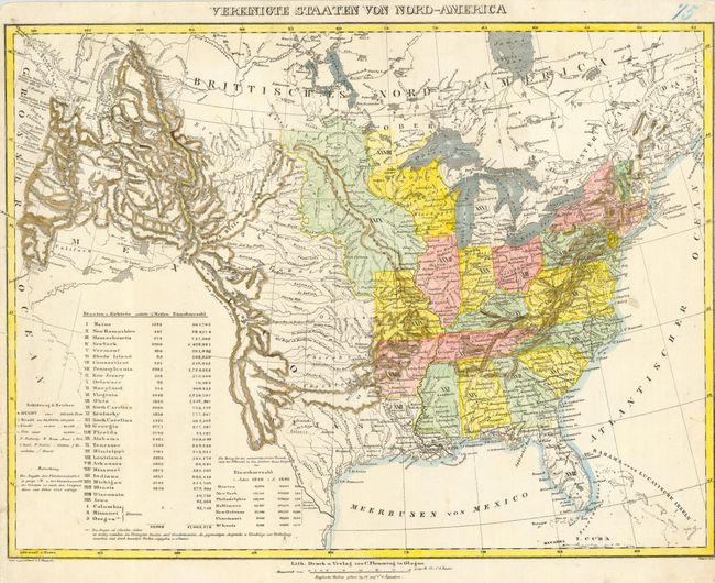
Auction 122, Lot 158
Subject: United States
Flemming, Carl
Vereinigte Staaten Von Nord-America, 1844
Size: 16 x 12.2 inches (40.6 x 31 cm)
Estimate: $300 - $400
Sold for: $220
Closed on 12/5/2007
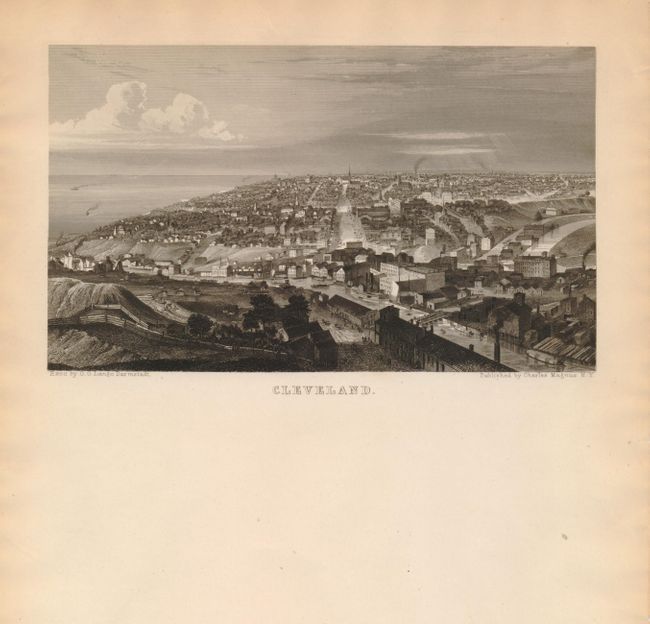
Auction 122, Lot 159
Subject: Cleveland, Philadelphia and Rochester
[Lot of 4 - U.S. Cites] Cleveland [and] Rochester [and] Philadelphia [and] Philadelphia, 1845
Size: 7.5 x 4.5 inches (19.1 x 11.4 cm)
Estimate: $100 - $180
Sold for: $130
Closed on 12/5/2007
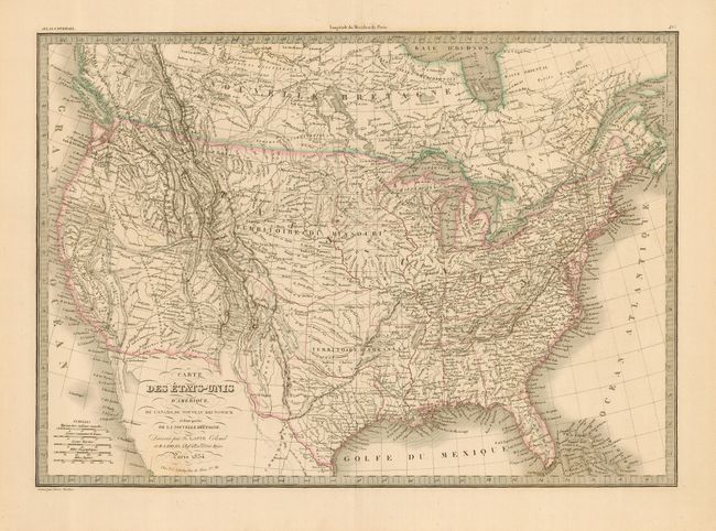
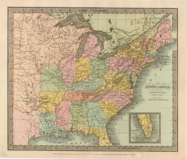
Auction 122, Lot 161
Subject: United States
Lapie, Alexander Emile & Pierre
Carte des Etats-Unis d'Amerique, du Canada, du Nouveau Brunswick et d'une partie de la Nouvelle Bretagne, 1854
Size: 21.5 x 15.3 inches (54.6 x 38.9 cm)
Estimate: $200 - $250
Sold for: $240
Closed on 12/5/2007
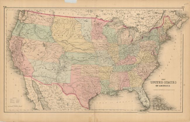
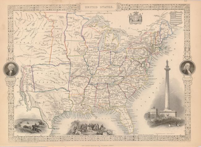
Auction 122, Lot 162
Subject: United States
Colton, Joseph Hutchins
The United States of America, 1857
Size: 25 x 14.5 inches (63.5 x 36.8 cm)
Estimate: $160 - $220
Sold for: $160
Closed on 12/5/2007
Auction 122, Lot 163
Subject: United States
Ettling, Theodor
[Lot of 6] United States of North America, 1858-63
Size: 12 x 16.8 inches (30.5 x 42.7 cm)
Estimate: $300 - $450
Sold for: $325
Closed on 12/5/2007
Auction 122, Lot 164
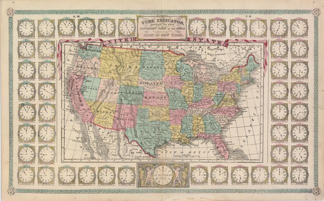
Subject: United States
Schonberg & Co.
Time Indicator Showing the Hour in Different Parts of the World when it is Noon in New York, 1864
Size: 22 x 13 inches (55.9 x 33 cm)
Estimate: $500 - $600
Sold for: $800
Closed on 12/5/2007
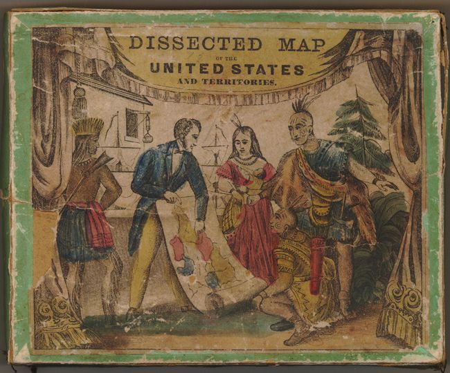
Auction 122, Lot 165
Subject: United States Puzzle Map
Colton, Joseph Hutchins
Colton's United States of America (Dissected Map of the United States and Territories], 1865
Size: 13.5 x 10.5 inches (34.3 x 26.7 cm)
Estimate: $300 - $400
Sold for: $450
Closed on 12/5/2007
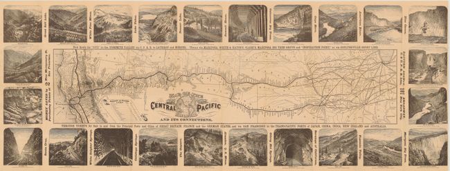
Auction 122, Lot 166
Subject: United States
Railroad Companies, (Various)
Map of the Central Pacific Railroad and its Connections, 1875
Size: 35 x 13 inches (88.9 x 33 cm)
Estimate: $300 - $400
Sold for: $800
Closed on 12/5/2007
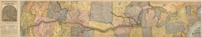
Auction 122, Lot 167
Subject: Northern United States
Railroad Companies, (Various)
New Map of the Chicago and North-Western Railway and its Connections, 1876
Size: 35 x 7.5 inches (88.9 x 19.1 cm)
Estimate: $80 - $100
Sold for: $140
Closed on 12/5/2007
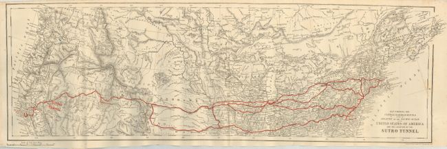
Auction 122, Lot 168
Subject: United States
Stanford, E.
Map Shewing the Central Railroad Routes from the Atlantic to the Pacific Ocean in the United States of America and the Location of the Sutro Tunnel, 1878
Size: 26 x 9 inches (66 x 22.9 cm)
Estimate: $150 - $200
Sold for: $160
Closed on 12/5/2007
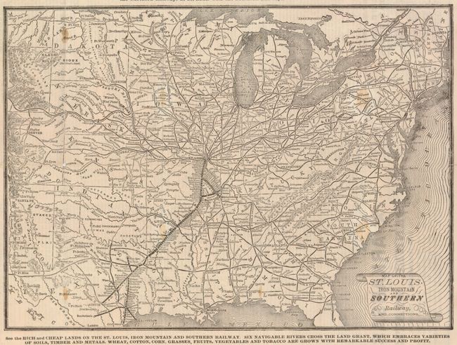
Auction 122, Lot 169
Subject: Central United States - Railroad
Railroad Companies, (Various)
Map of the St. Louis, Iron Mountain and Southern Railway, and Connections, 1878
Size: 14 x 12 inches (35.6 x 30.5 cm)
Estimate: $180 - $240
Unsold
Closed on 12/5/2007
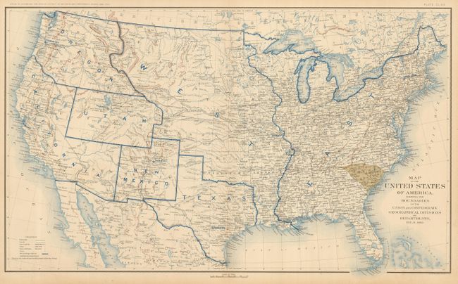
Auction 122, Lot 170
Subject: United States
U.S. Government
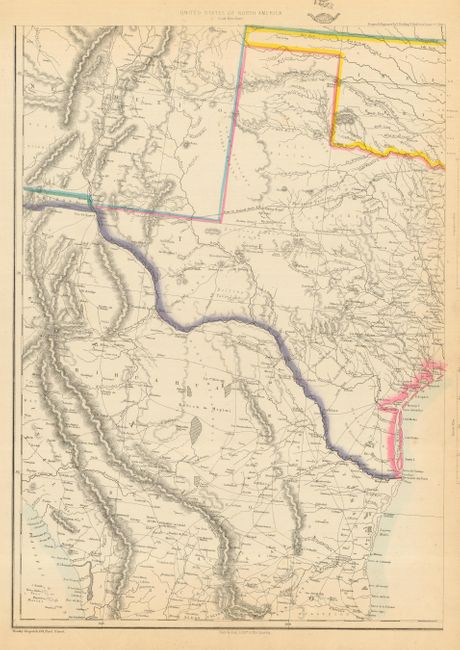
[Lot of 10] Map of the United States of America, Showing the Boundaries of the Union and Confederate Geographical Divisions and Departments, 1891-95
Size: 27.7 x 16.5 inches (70.4 x 41.9 cm)
Estimate: $1,300 - $1,500
Unsold
Closed on 12/5/2007
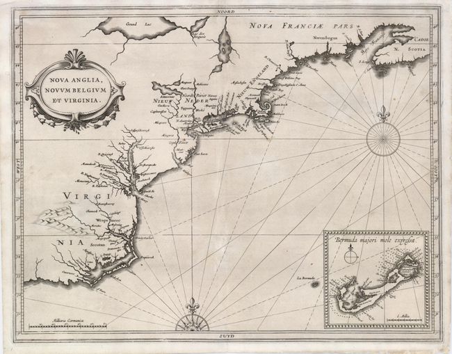
Auction 122, Lot 171
Subject: Colonial United States
Gerritsz/De Laet
Nova Anglia, Novum Belgium et Virginia, 1630
Size: 14.2 x 11 inches (36.1 x 27.9 cm)
Estimate: $5,500 - $6,500
Sold for: $5,500
Closed on 12/5/2007
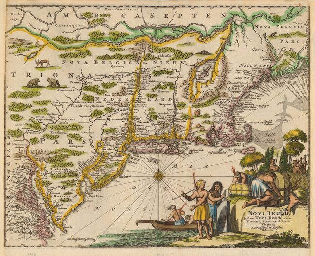
Auction 122, Lot 172
Subject: Colonial United States
Montanus, Arnoldus
Novi Belgii, quod nunc Novi Jorck Vocatur, Novae qz. Angliae & Partis Virginiae Accuratissima et Novissima Delineatio, 1671
Size: 14.3 x 11.3 inches (36.3 x 28.7 cm)
Estimate: $1,600 - $1,800
Sold for: $1,400
Closed on 12/5/2007
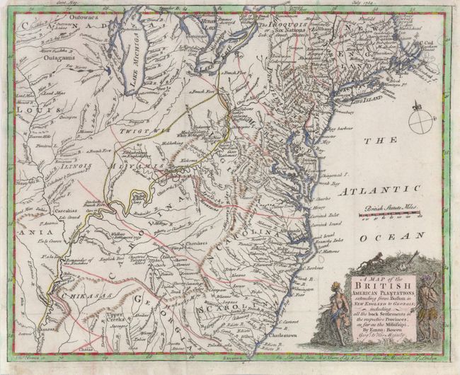
Auction 122, Lot 173
Subject: Colonial United States
Bowen, Emanuel
A Map of the British American Plantations extending from Boston in New England to Georgia; including all the back Settlements in the respective Provinces, as far as the Mississipi, 1754
Size: 10.7 x 8.6 inches (27.2 x 21.8 cm)
Estimate: $450 - $550
Sold for: $500
Closed on 12/5/2007
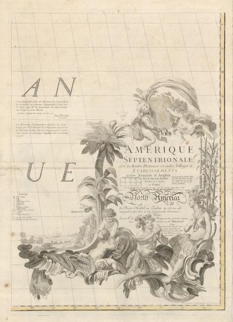
Auction 122, Lot 174
Subject: Colonial United States
Le Rouge, George Louis
[Lot of 4] Amerique Septentrionale avec les Routes, Distances en Miles, Villages et Establissements Francois et Anglois par le Docteur Mitchel, 1776
Size: 19 x 26 inches (48.3 x 66 cm)
Estimate: $2,000 - $4,000
Sold for: $2,750
Closed on 12/5/2007
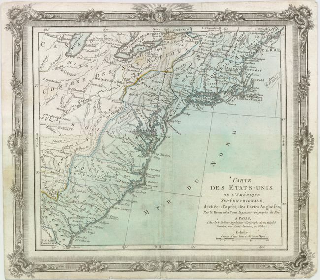
Auction 122, Lot 175
Subject: Colonial United States
Brion de la Tour/Desnos
Carte des Etats-Unis de l'Amerique Septentrionale, Dressee d'apres des Cartes Anglaises, 1780
Size: 12 x 10.8 inches (30.5 x 27.4 cm)
Estimate: $250 - $350
Sold for: $180
Closed on 12/5/2007
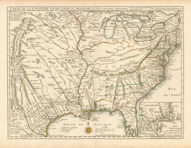
Auction 122, Lot 176
Subject: Colonial United States
Delisle/Dezauche
Carte de la Louisiane et du Cours du Mississipi avec les Colonies Anglaises, 1782
Size: 26 x 19.5 inches (66 x 49.5 cm)
Estimate: $1,800 - $2,200
Sold for: $1,200
Closed on 12/5/2007
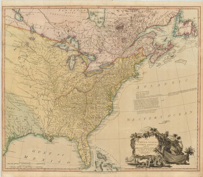
Auction 122, Lot 177
Subject: Eastern United States
Brown, Thomas
A New and Accurate Map of the United States of America, &c. from the best Authorities, 1790
Size: 13.3 x 10.8 inches (33.8 x 27.4 cm)
Estimate: $500 - $600
Sold for: $450
Closed on 12/5/2007
Auction 122, Lot 178
Subject: Eastern United States
Faden, William
The United States of North America: with the British Territories and Those of Spain, according to the Treaty of 1784, 1796
Size: 24.7 x 20.7 inches (62.7 x 52.6 cm)
Estimate: $2,000 - $2,500
Sold for: $3,250
Closed on 12/5/2007
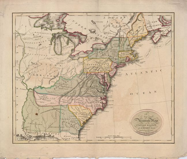
Auction 122, Lot 179
Subject: Eastern United States
Mollo, Tranquillo
Vereinigte Staaten in Nord America nach den Besten Hulfsmittel Verfast, 1800
Size: 17.5 x 12.5 inches (44.5 x 31.8 cm)
Estimate: $400 - $550
Sold for: $300
Closed on 12/5/2007
Auction 122, Lot 180
Subject: Eastern United States
[blank]
[Lot of 2] United States [and] The United States of North America with the British Territorys According to the Treaty of 1783, 1811-1835
Size: 9.8 x 7.8 inches (24.9 x 19.8 cm)
Estimate: $160 - $220
Sold for: $120
Closed on 12/5/2007
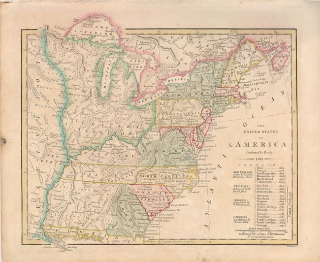
Auction 122, Lot 181
Subject: Eastern United States
Wilkinson, Robert
The United States of America Confirmed by Treaty 1783, 1812
Size: 11 x 9.3 inches (27.9 x 23.6 cm)
Estimate: $500 - $600
Sold for: $700
Closed on 12/5/2007
Auction 122, Lot 182
Subject: Eastern United States
Burr/Illman
United States, 1833
Size: 13 x 8 inches (33 x 20.3 cm)
Estimate: $180 - $250
Sold for: $130
Closed on 12/5/2007
Auction 122, Lot 183
Subject: Eastern United States
U.S. Government
Map of the United States, 1838
Size: 14.8 x 12 inches (37.6 x 30.5 cm)
Estimate: $110 - $150
Sold for: $80
Closed on 12/5/2007
Auction 122, Lot 184
Subject: Eastern United States
Tallis, John
United States, 1850
Size: 13.5 x 9.5 inches (34.3 x 24.1 cm)
Estimate: $275 - $325
Sold for: $200
Closed on 12/5/2007
Auction 122, Lot 185
Subject: Eastern United States
Mitchell/Cowperthwait
United States, 1854
Size: 12.5 x 15.8 inches (31.8 x 40.1 cm)
Estimate: $110 - $140
Unsold
Closed on 12/5/2007
Auction 122, Lot 186
Subject: Eastern United States
Ettling, Theodor
United States of North America (Eastern & Central), 1860
Size: 36 x 33.5 inches (91.4 x 85.1 cm)
Estimate: $500 - $600
Sold for: $375
Closed on 12/5/2007
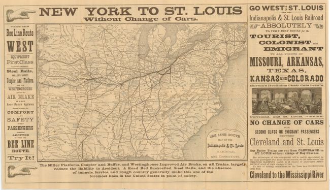
Auction 122, Lot 187
Subject: Eastern United States
Rand McNally & Co.
Bee Line Route Map of the Indianapolis & St. Louis Railroad, and Connections, 1880
Size: 18.5 x 12 inches (47 x 30.5 cm)
Estimate: $200 - $300
Unsold
Closed on 12/5/2007
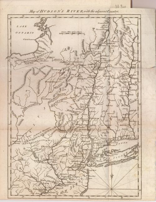
Auction 122, Lot 188
Subject: Colonial New England
Anon.
Map of Hudson's River, with the Adjacent Country, 1778
Size: 8.4 x 11.6 inches (21.3 x 29.5 cm)
Estimate: $200 - $240
Sold for: $180
Closed on 12/5/2007
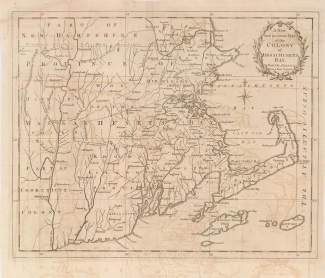
Auction 122, Lot 189
Subject: United States - New England
Anon.
A New and accurate Map of the Colony of Massachusets Bay, in North America from a Late Survey [with text page], 1780
Size: 12.8 x 10.2 inches (32.5 x 25.9 cm)
Estimate: $140 - $180
Sold for: $140
Closed on 12/5/2007
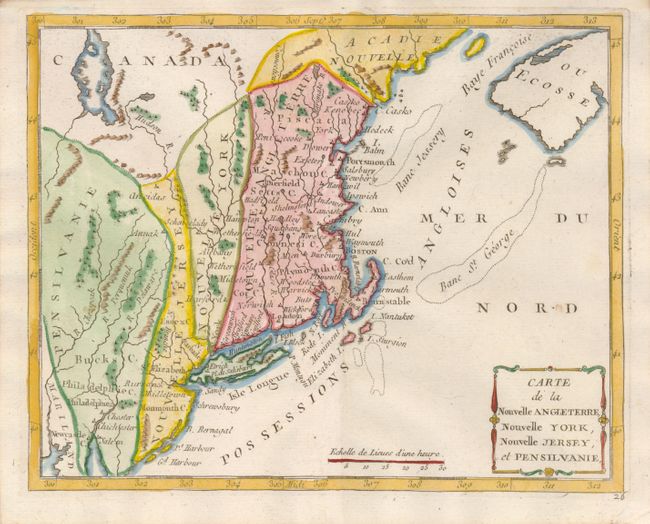
Auction 122, Lot 190
Subject: Colonial Northeast
Laporte, Joseph de
Carte de la Nouvelle Angleterre, Nouvelle York, Nouvelle Jersey, et Pensilvanie, 1780
Size: 8.7 x 7 inches (22.1 x 17.8 cm)
Estimate: $250 - $325
Sold for: $180
Closed on 12/5/2007
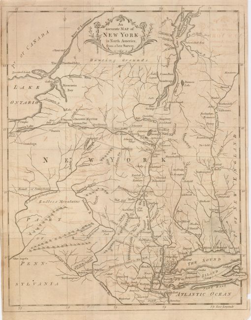
Auction 122, Lot 191
Subject: United States - New England
Anon.
An Accurate Map of New York in North America, from a late Survey, 1780
Size: 10.5 x 13 inches (26.7 x 33 cm)
Estimate: $120 - $160
Sold for: $110
Closed on 12/5/2007
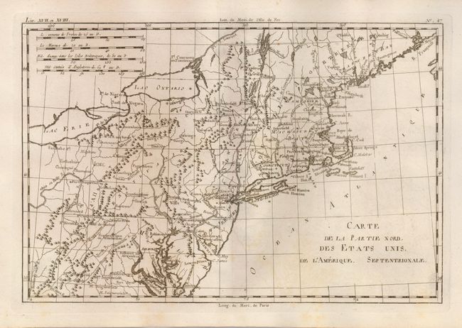
Auction 122, Lot 192
Subject: Colonial Northeast
Bonne, Rigobert
Carte de la Partie Nord, des Etats Unis, de l'Amerique Septentrionale, 1783
Size: 12.7 x 8.4 inches (32.3 x 21.3 cm)
Estimate: $120 - $140
Sold for: $60
Closed on 12/5/2007
222 lots
Page 1 of 5