Subject: Great Lakes
Period: 1780 (circa)
Publication: Atlas de toutes les parties connues du Globe Terrestre…
Color: Black & White
Size:
12.3 x 8.3 inches
31.2 x 21.1 cm
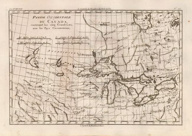
A nice example of one of the most interesting maps of the Great Lakes depicts frontier forts, missions, and fur trade routes. It covers the region from James Bay south to show Ft. St. Louis, and from Lake Ontario through the Great Plains. It contains numerous Indian tribe names and forts including Detroit, St. Louis, Toronto and Chicagon. Lake Superior contains Isle Royale, as well as the phantom islands of St. Anne, Maurepas and Ponchartrain, which were reported by the Jesuit explorer Charlevoix. The Keweenaw Peninsula is noted as Pt. de Kiaonan. The source of the Mississippi is noted as inconue or unknown. Final state without Bonne's name in the title.
References: Kershaw #976; Sellers and Van Ee #173
Condition: A
Crisp impression on thick hand laid paper with original margins. A couple insignificant spots.