Subject: Colonial North America
Period: 1720 (circa)
Publication:
Color: Hand Color
Size:
21.8 x 19.8 inches
55.4 x 50.3 cm
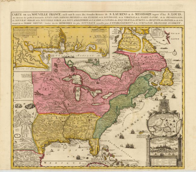
A striking and informative map derived from Nicholas de Fer's important four-sheet map of 1718, this describes the French possessions in North America in the early 18th century. Very similar to the 1719 Chatelain map of the same title, but this has a much more decorative cartouche and simpler border for the inset map. Louisiana and the Mississippi valley are based on Delisle's manuscript map of 1701, while the geography of New England and eastern Canada originates with Franquelin. Inset at top left is a large-scale depiction of the Mississippi Delta and Mobile Bay, based on the voyage of Pierre Le Moyne d'Iberville. Quebec is shown in both a chart with many tiny ships, and a view enclosed in an elegant architectural cartouche at bottom right. The map is filled with minutely engraved wildlife, scenes of Indians hunting, Indian villages and notations. The oceans are embellished with numerous ships, canoes and sea monsters.
References: Kershaw #336; McCorkle #719.5.
Condition: A
Nice original color with a little color transfer in the Atlantic. Close margin at the bottom with a repaired tear, still sufficient for framing. Manuscript on top margin and verso, not affecting the map.