Subject: United States
Period: 1844 (circa)
Publication:
Color: Hand Color
Size:
16 x 12.2 inches
40.6 x 31 cm
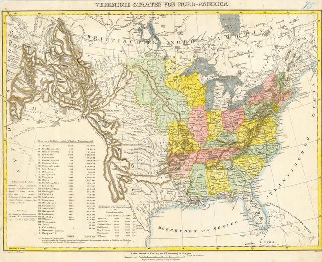
This interesting German map of the United States shows 29 states and 3 districts (Columbia, Missouri, Oregon). It shows the topography and political situation of the country, including the Republic of Texas. The mountains and rivers in the northwest are shown quite graphically. The Great Basin is shown with two large lakes in the vicinity of the Great Salt Lake; from the southern lake a non-existent Rio San Felipe flows to the Pacific Ocean. A numbered key in the lower left is used to name the states and territories, and to give their areas and populations. An unusual feature of interest is the Grosse National Strasse (Great National Road) that is shown running from Washington D.C. to St. Louis.
References:
Condition: B
Closely trimmed margins, apparently original with a couple of small repaired tears into border.