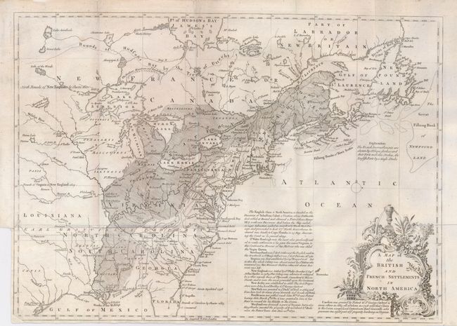
Subject: Eastern Canada & United States
Period: 1755 (circa)
Publication: Gentleman's Magazine
Color: Black & White
Size:
15 x 11 inches
38.1 x 27.9 cm
This is the first of several similar maps illustrating the French/British conflict in North America. It was issued just before the French and Indian War was officially declared and depicts, by hachures, the French encroachment into British claimed territory. Earl Granville's Property is shown in North Carolina and extending to the western-most edge of the map, which is about the 100th Meridian. Several treaty lines are shown, with British and French forts and numerous Indian tribes. Decorative title cartouche and lengthy description of the history of the colonies.
References: Jolly GENT-91; McCorkle #755.24.
Condition: B
Folding as issued. Binding trim at lower left leaves 1/8" margin. A tiny binding tear entering the border has been repaired with archival tape on verso. The bottom left corner has been replaced with small loss of neatline.