Catalog Archive
Auction 122, Lot 156

"A Chorographical Map of the Northern Department of North America Drawn from the Latest and Most Accurate Observations", Gavit, John

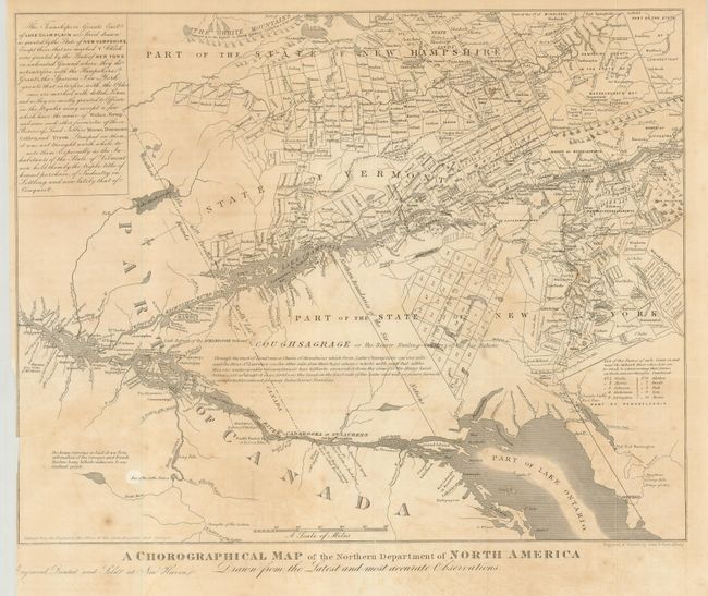
Subject: United States & Canada

Period: 1850 (circa)

Publication:

Color: Black & White

Size:
12.4 x 10 inches
31.5 x 25.4 cm
Download High Resolution Image
(or just click on image to launch the Zoom viewer)

Smaller edition of a 1778 map of the same title made by Bernard Romans, the first to name the state of Vermont. The map is on an unusual orientation, showing Lake Ontario and the St. Lawrence at the bottom of the map, with the White Mountains and Connecticut at the top. The map shows all the large land grants in the vicinity.

References: cf McCorkle #778.17; cf Cobb (NH) #49.

Condition: B

A dark imprint on a sheet with folds as issued, with some offsetting and a few spots of foxing. Trimmed to neatline at left for binding, with a tape repair on the verso closing a short binding tear.

Estimate: $90 - $130

Unsold

Closed on 12/5/2007

Archived