Subject: Eastern United States
Period: 1811-1835 (circa)
Publication:
Color: Hand Color
Size:
9.8 x 7.8 inches
24.9 x 19.8 cm
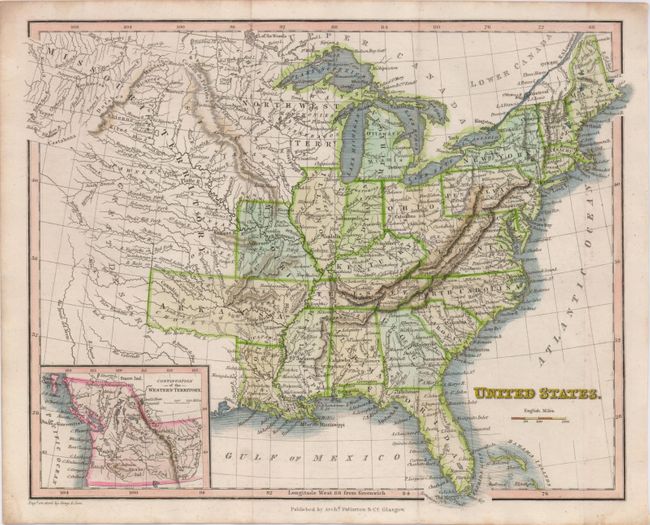
The United States and Great Britain established in 1818 joint claim over the Oregon Territory - the region north of Spanish controlled Upper California up to the southern boundary of Russia's Alaska Territory at North latitude 54°40'. By the late 1830's this arrangement was beginning to fall apart.
In the 1840's the expansionist Democrats, including their 1844 presidential candidate, James Polk, claimed the entire region for the United States. Their expansionist desires were expressed by Polk's famous campaign slogan, "Fifty-four Forty or Fight!" The slogan also became a rally cry for Americans desiring to settle the territory. Following Polk's election, the dispute was resolved by the 1846 Treaty of Oregon, which struck a compromise that fixed the U.S./Canadian boundary at 49º North.
A nice pair of 19th century maps showing the growth of the United States.
1) A map of the United States features an oversized Arkansas Territory extending west into present-day Oklahoma. Missouri Territory reaches into the Pacific Northwest, and the Northwest Territory takes the place of today's Wisconsin, Minnesota and the Dakotas, with very good detail of the river systems. An inset of the "Continuation of the Western Territory" takes in what will be Oregon and Washington north to 54°40'. Archibald Fullarton & Co, published in Glasgow, circa 1835 (9.8 x 7.8").
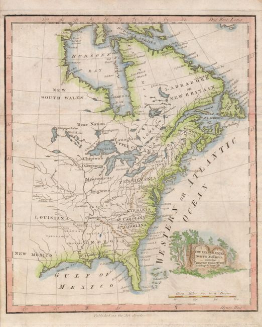
2) The United States of North America with the British Territorys According to the Treaty of 1783 extends from Hudson Bay to Florida and west just past the Mississippi River. A landscape cartouche adorns the map. Anonymous, circa 1811 (7.8 x 9").
References:
Condition: B+
Both maps with attractive later color, issued folding, now flattened. Map 1 with faint edge toning and one marginal fold separation. Map 2 is lightly soiled.