Subject: United States - New England
Period: 1780 (published)
Publication: Universal Magazine,
Color: Black & White
Size:
12.8 x 10.2 inches
32.5 x 25.9 cm
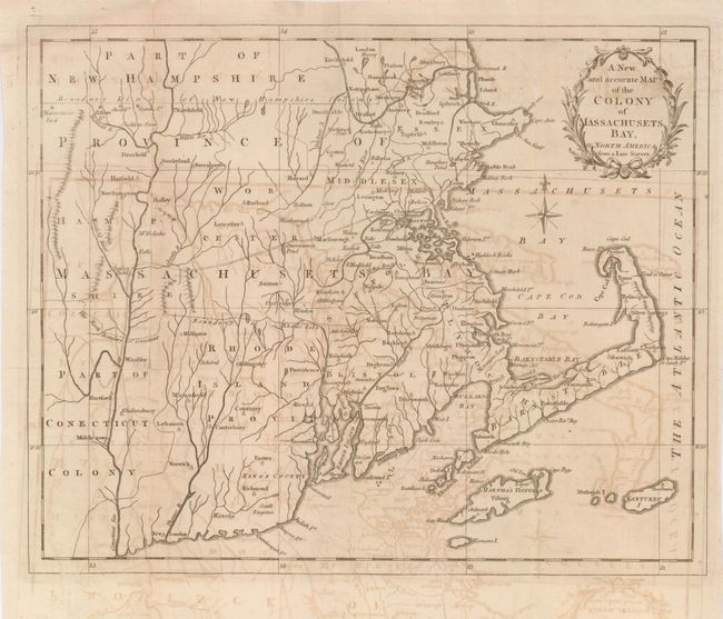
Copper engraved Revolutionary War era map that details the towns, villages and roads of the time. In addition to Massachusetts, the map includes all of Rhode Island and parts of Connecticut and New Hampshire. Handsomely adorned with a wreath-style title cartouche and delicate compass rose. The maps issued in the Universal Magazine are among the best executed and attractive of the British magazine maps, this being no exception. These maps were issued during a crucial point in history and provided the British public with up-to-date information on the war in America. Also included is the original text page from the December 1780 issue, titled "A Description of the Province of Massachusets-Bay…"
References: Jolly UNIV-190; McCorkle #780-12
Condition: B
The map has overall light offsetting. The map is on fine hand laid paper with two large watermarks. There are long splits along some folds with slight loss visible when held to light, all well closed on verso with archival tape.