Subject: Colonial United States and Canada
Period: 1756 (dated)
Publication:
Color: Hand Color
Size:
30.5 x 22 inches
77.5 x 55.9 cm
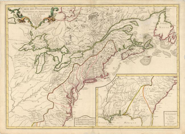
This is the first edition of this separately published map of the colonial United States and Canada. It was issued to provide information about the theater of the French and Indian War, which was formally declared in 1756 and continued until 1763. The map shows the region from Labrador and Hudson Bay across to Assiniboine Lake and south to the Carolinas, including the Mississippi and Ohio River valleys. The Great Lakes are mapped with the inclusion of the imaginary islands of Phelipeaux, Maurepas, and St. Anne in Lake Superior. The Southeast, excluding the southern tip of Florida is shown in a large inset map, featuring a triangular Florida and amorphous Georgia, with the mouth of the Mississippi and a portion of its course and tributaries delineated.
References: Sellers & Van Ee #70; McCorkle #756.9.
Condition: B
A dark impression on a heavy sheet with deckled edges and some short, repaired marginal tears. The map has a repair of some mildew under the cartouche and a filled hole in the blank sea left of Newfoundland. Minor printer's crease at bottom.