Subject: United States Puzzle Map
Period: 1865 (dated)
Publication:
Color: Hand Color
Size:
13.5 x 10.5 inches
34.3 x 26.7 cm
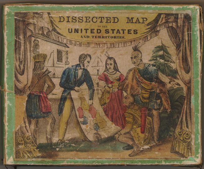
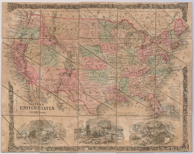
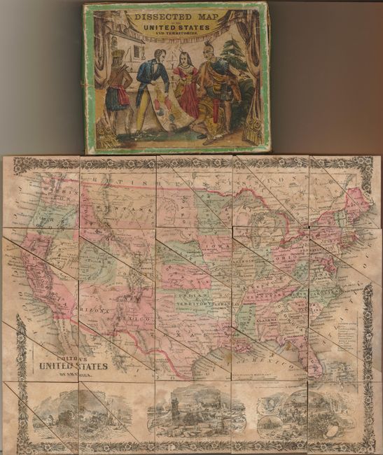
This scarce Colton puzzle map uses an updated version of the floral-bordered map of the United States that first appeared in Colton's Cabinet Atlas of 1859. Arizona Territory has the triangular portion that is ceded to Nevada later in 1864. Dakota Territory is shown prior to its split into north and south in 1889. The bottom of the the map is filled with scenes of pioneers in the western states, commerce in the middle states, and agriculture in the southern states. The box cover is quite decorative and colorful, with a scene of a group of natives being taught geography. It is unlike the Colton map boxes we have seen before, and the map itself is cut into simpler triangular shapes rather than curved pieces, and mounted onto dense cardboard rather than wood. Quite an unusual puzzle, with all pieces intact.
References:
Condition: B
The map is in good shape and complete, but with some irregular toning. The cardboard box is complete, but it is weak at the corners with the original stitching loosened. The cover illustration has a small loss at left. Still a nice example with some historic pencil notations inside, including one referring to the puzzle's receipt on Christmas of 1867.