Subject: Colonial North America
Period: 1772 (dated)
Publication: Geschichte der englishen Kolonien in Nord-Amerika
Color: Hand Color
Size:
15 x 11.7 inches
38.1 x 29.7 cm
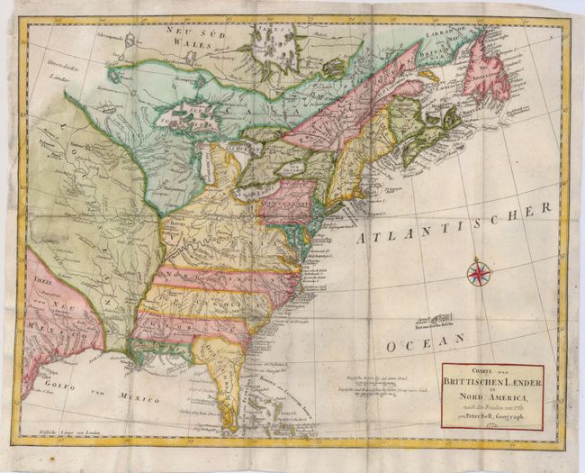
This attractive and detailed map of the British Colonies focuses on the eastern half of North America and describes the region according to the treaty of 1763. The area shown is from James Bay to Newfoundland in the north and from the Gulf of Mexico to the Florida Keys in the south. The colonies of Virginia, the Carolinas, Georgia and Florida all extend to the Mississippi River. There is a large amount of coastal and interior detail with towns, Indian villages, rivers and fishing banks. This is a German edition of Bell's 1772 map, published in 1775.
References: McCorkle #772.1; Sellers & Van Ee #98 (British edition).
Condition: B
Issued folding, now backed with tissue. There are a couple repaired tears on the binding side of the map and a short tear just past the top border. Later coloring.