Showing Featured Lots(remove filter)
Filtered by Category:United States(Show All Categories)
Showing results for:Auction 106
Catalog Archive
33 lots
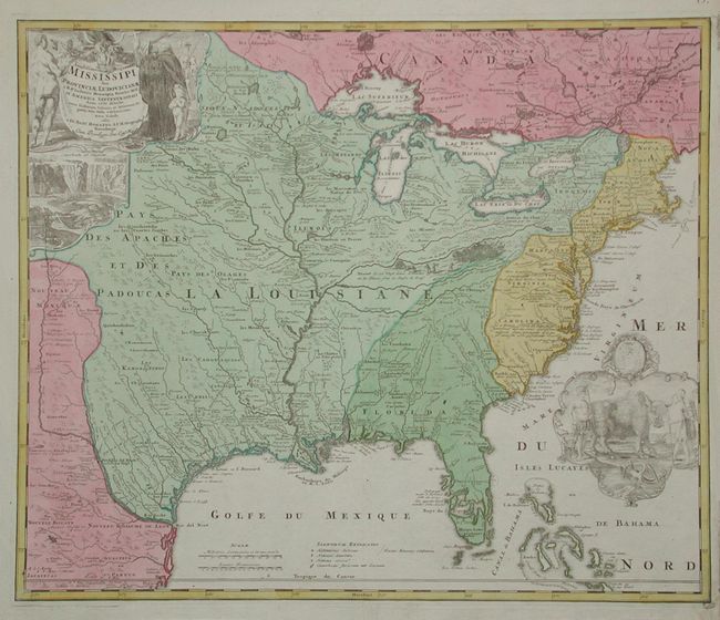
Auction 106, Lot 102
Subject: Colonial North America
Homann Heirs
Amplissimae Regionis Mississipi Seu Provinciae Ludovicianae…, 1730
Size: 22.8 x 19.2 inches (57.9 x 48.8 cm)
Estimate: $2,200 - $2,400
Sold for: $2,200
Closed on 3/3/2004
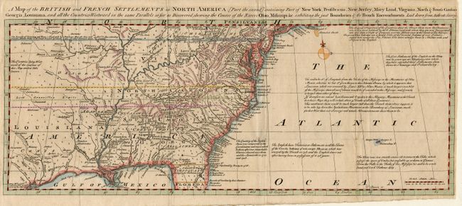
Auction 106, Lot 106
Subject: Colonial United States and Canada
Bowen, Thomas
A Map of the British and French Settlements in North America…, 1755
Size: 19.2 x 7.5 inches (48.8 x 19.1 cm)
Estimate: $400 - $450
Sold for: $400
Closed on 3/3/2004
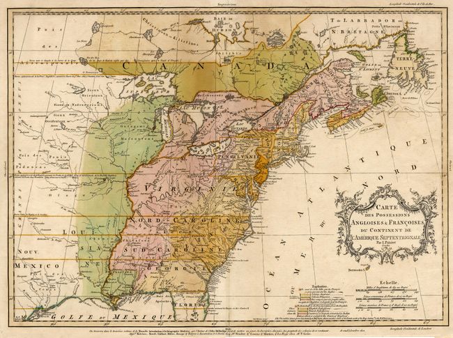
Auction 106, Lot 108
Subject: Colonial United States and Canada
Palairet, Jean
Carte des Possessions Angloises & Francoises du Continent de l'Amerique Septentrionale, 1756
Size: 22.5 x 16.7 inches (57.2 x 42.4 cm)
Estimate: $2,000 - $2,200
Sold for: $2,750
Closed on 3/3/2004
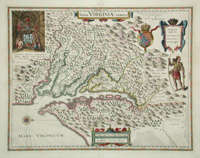
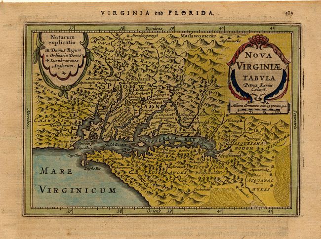
Auction 106, Lot 109
Subject: Colonial Virginia
Hondius/Blaeu
Nova Virginiae Tabula, 1642
Size: 18.8 x 14.6 inches (47.8 x 37.1 cm)
Estimate: $2,750 - $3,000
Sold for: $3,250
Closed on 3/3/2004
Auction 106, Lot 110
Subject: Colonial Virginia
Jansson, Jan
Nova Virginiae Tabula, 1631
Size: 7.3 x 5.1 inches (18.5 x 13 cm)
Estimate: $700 - $800
Sold for: $550
Closed on 3/3/2004
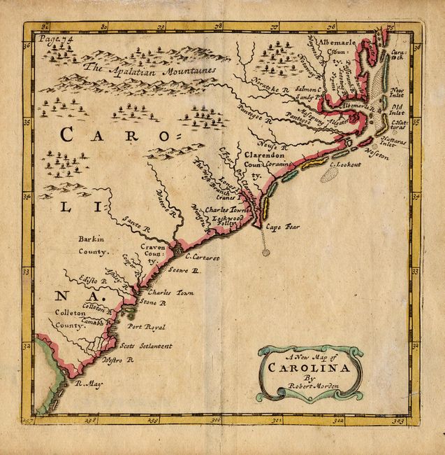
Auction 106, Lot 111
Subject: Colonial Carolinas
Morden, Robert
A New Map of Carolina, 1700
Size: 4.8 x 5 inches (12.2 x 12.7 cm)
Estimate: $350 - $400
Sold for: $250
Closed on 3/3/2004
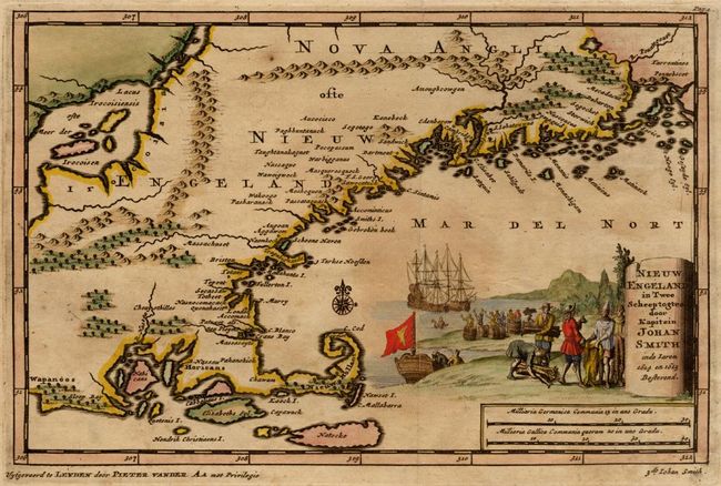
Auction 106, Lot 112
Subject: Colonial New England
Aa, Pieter van der
Nieuw Engeland in Twee Scheepstogten door Kapitein Johan Smith in de Jaren 1614 en 1615, 1707
Size: 9.2 x 6 inches (23.4 x 15.2 cm)
Estimate: $1,200 - $1,500
Sold for: $1,300
Closed on 3/3/2004
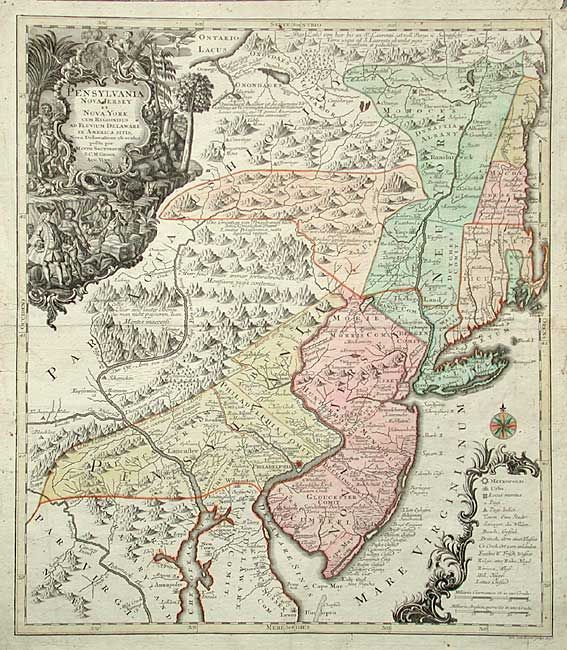
Auction 106, Lot 113
Subject: Colonial Mid Atlantic
Seutter/Lotter
Pensylvania Nova Jersey et Nova York cum Regionibus ad Fluvium Delaware in America Sitis…, 1750
Size: 19.4 x 22.5 inches (49.3 x 57.2 cm)
Estimate: $2,200 - $2,400
Sold for: $2,100
Closed on 3/3/2004
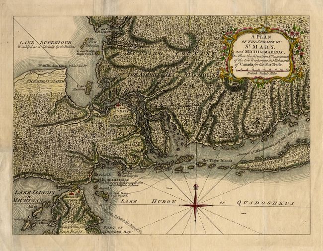
Auction 106, Lot 114
Subject: Colonial Great Lakes
Anon.
A Plan of the Straits of St. Mary, and Michilimakinac to Shew the Situation & Importance of the two Westernmost Settlements of Canada for the Fur Trade, 1761
Size: 12.7 x 9.2 inches (32.3 x 23.4 cm)
Estimate: $350 - $400
Sold for: $375
Closed on 3/3/2004
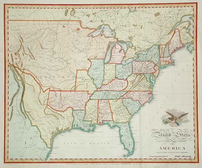
Auction 106, Lot 121
Subject: United States
Melish, John
United States of America Compiled from the latest & best Authorities, 1822
Size: 19.5 x 15.9 inches (49.5 x 40.4 cm)
Estimate: $1,000 - $1,200
Sold for: $950
Closed on 3/3/2004
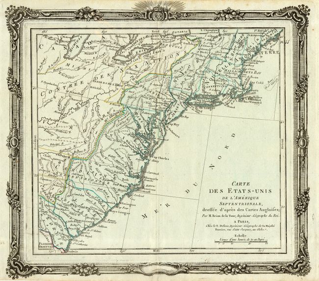
Auction 106, Lot 125
Subject: United States - Eastern
Brion de la Tour/Desnos
Carte des Etats-Unis de l'Amerique Septentrionale, dressee d'apres des Cartes Anglaises, 1780
Size: 12.2 x 11.4 inches (31 x 29 cm)
Estimate: $400 - $450
Sold for: $300
Closed on 3/3/2004
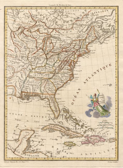
Auction 106, Lot 127
Subject: United States - Eastern
Chamouin, Jean Baptiste Marie
Etats Unis et Grandes Antilles, 1805
Size: 8.6 x 11.7 inches (21.8 x 29.7 cm)
Estimate: $200 - $240
Sold for: $250
Closed on 3/3/2004
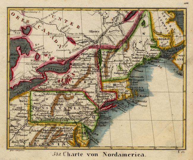
Auction 106, Lot 130
Subject: United States - Northeast
Anon.
Charte von Nordamerica, 1830
Size: 6.7 x 5.4 inches (17 x 13.7 cm)
Estimate: $70 - $90
Sold for: $50
Closed on 3/3/2004
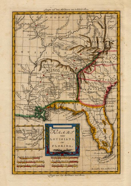
Auction 106, Lot 136
Subject: Southern United States
Bachiene, Willem Albert
Kaart van Louisiana, en Florida, 1785
Size: 8.2 x 12.5 inches (20.8 x 31.8 cm)
Estimate: $230 - $300
Sold for: $325
Closed on 3/3/2004
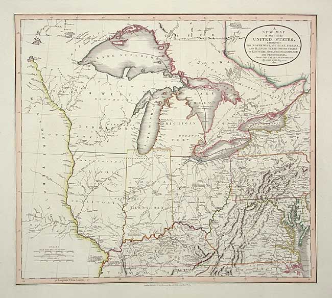
Auction 106, Lot 140
Subject: United States - Midwest and Mid Atlantic
Cary, John
A New Map of Part of the United States, exhibiting the North West, Michigan, Indiana, and Illinois Territory, the States of Kentucky, Ohio, Virginia, Maryland and Pennsylvania, 1821
Size: 20 x 18 inches (50.8 x 45.7 cm)
Estimate: $800 - $900
Sold for: $1,500
Closed on 3/3/2004
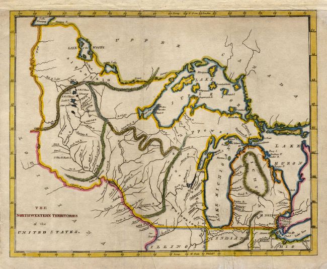
Auction 106, Lot 141
Subject: United States - Midwest
Brookes, Richard
The Northwestern Territories of the United States, 1812
Size: 9.6 x 7.6 inches (24.4 x 19.3 cm)
Estimate: $300 - $350
Sold for: $250
Closed on 3/3/2004
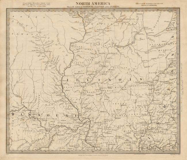
Auction 106, Lot 142
Subject: United States - Central
SDUK Society for the Diffusion of Useful Knowledge
North America Sheet IX Parts of Missouri, Illinois and Indiana, 1833
Size: 14.5 x 12 inches (36.8 x 30.5 cm)
Estimate: $100 - $140
Sold for: $75
Closed on 3/3/2004
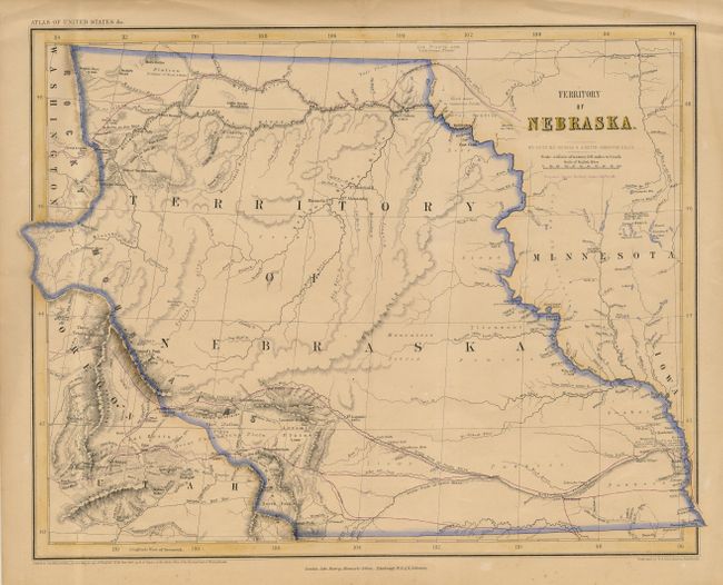
Auction 106, Lot 145
Subject: United States - Central
Rogers, Henry Darwin
Territory of Nebraska, 1857
Size: 16.6 x 13 inches (42.2 x 33 cm)
Estimate: $350 - $400
Sold for: $425
Closed on 3/3/2004
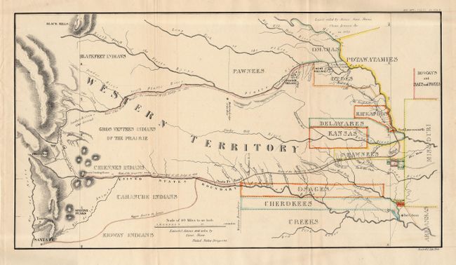
Auction 106, Lot 146
Subject: United States - Central
U.S. War Department
[Great Plains: Fort Leavenworth to Santa Fe], 1860
Size: 17.5 x 10 inches (44.5 x 25.4 cm)
Estimate: $200 - $250
Sold for: $230
Closed on 3/3/2004
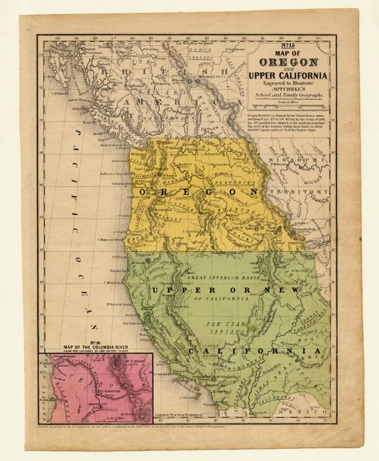
Auction 106, Lot 150
Subject: United States - Western
Thomas, Cowperthwait & Co.
No. 15 Map of Oregon and Upper California, 1846
Size: 8 x 10.2 inches (20.3 x 25.9 cm)
Estimate: $150 - $200
Sold for: $275
Closed on 3/3/2004
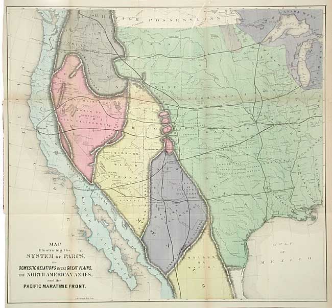
Auction 106, Lot 156
Subject: United States - Western
Gilpin, William
Map Illustrating the System of Parcs, the Domestic Relations of the Great Plains, the North American Andes, and the Pacific Maratime Front, 1873
Size: 22.7 x 21.2 inches (57.7 x 53.8 cm)
Estimate: $300 - $350
Sold for: $275
Closed on 3/3/2004
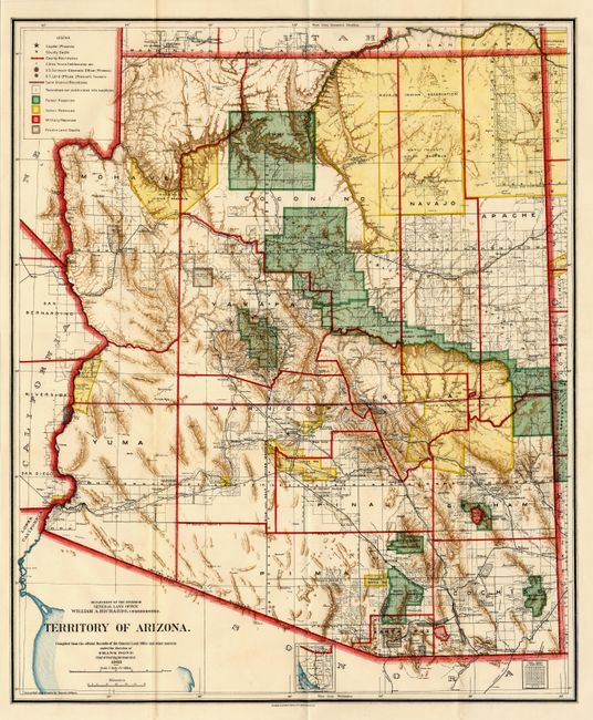
Auction 106, Lot 168
Subject: Arizona
General Land Office
Territory of Arizona, 1903
Size: 17 x 20.5 inches (43.2 x 52.1 cm)
Estimate: $180 - $220
Sold for: $375
Closed on 3/3/2004
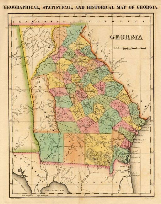
Auction 106, Lot 191
Subject: Georgia
Carey & Lea
Geographical, Statistical, and Historical Map of Georgia, 1822
Size: 9 x 11.5 inches (22.9 x 29.2 cm)
Estimate: $350 - $400
Sold for: $300
Closed on 3/3/2004
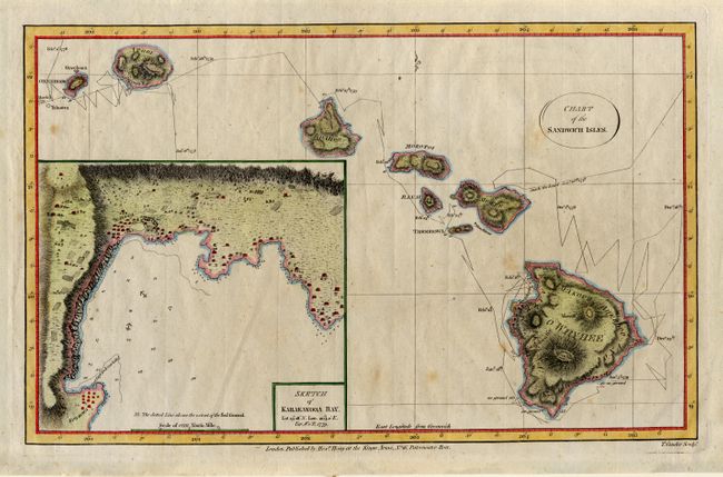
Auction 106, Lot 192
Subject: Hawaii
Cook/Hogg
Chart of the Sandwich Isles, 1784
Size: 13.2 x 8.4 inches (33.5 x 21.3 cm)
Estimate: $300 - $375
Sold for: $375
Closed on 3/3/2004
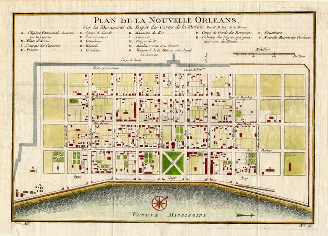
Auction 106, Lot 196
Subject: Louisiana
Bellin, Jacques Nicolas
Plan de la Nouvelle Orleans Sur les Manuscrits du Depot des Cartes de la Marine, 1750
Size: 11 x 7.8 inches (27.9 x 19.8 cm)
Estimate: $350 - $400
Sold for: $400
Closed on 3/3/2004
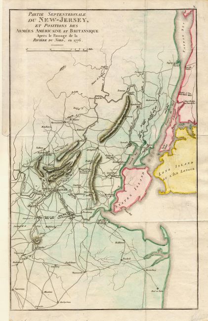
Auction 106, Lot 204
Subject: New Jersey and New York
Marshall, John
Partie Septentrionale du New-Jersey, et Positions des Armees Americaine et Britannique Apres le Passage de la Riviere du Nord, en 1776, 1807
Size: 9.7 x 15.5 inches (24.6 x 39.4 cm)
Estimate: $200 - $250
Sold for: $150
Closed on 3/3/2004
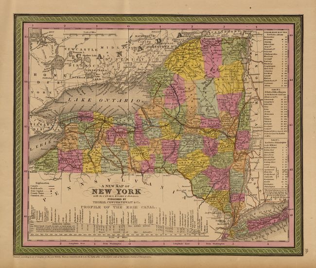
Auction 106, Lot 208
Subject: New York
Thomas, Cowperthwait & Co.
A New Map of the State of New York with its Canals, Roads & Distances, 1853
Size: 26 x 16 inches (66 x 40.6 cm)
Estimate: $120 - $160
Sold for: $120
Closed on 3/3/2004
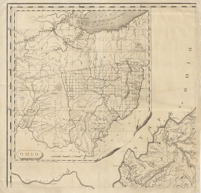
Auction 106, Lot 211
Subject: Ohio
Madison, Bishop James
Ohio, 1807
Size: 23 x 22.4 inches (58.4 x 56.9 cm)
Estimate: $600 - $700
Sold for: $1,100
Closed on 3/3/2004
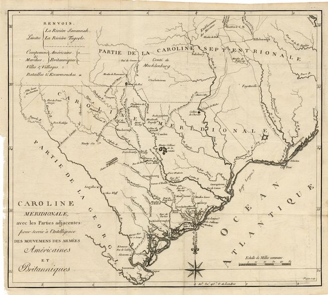
Auction 106, Lot 216
Subject: South Carolina
Ramsay, David
Caroline Meridionale, avec les Parties adjacentes: pour servir a l'Intelligence des mouvemens des armees Americaines et Britanniques, 1787
Size: 16.4 x 14.2 inches (41.7 x 36.1 cm)
Estimate: $400 - $450
Sold for: $425
Closed on 3/3/2004
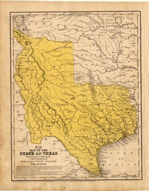
Auction 106, Lot 217
Subject: Texas
Thomas, Cowperthwait & Co.
No. 13 Map of the State of Texas, 1846
Size: 8 x 10.2 inches (20.3 x 25.9 cm)
Estimate: $180 - $220
Sold for: $375
Closed on 3/3/2004

Auction 106, Lot 219
Subject: Texas & Oklahoma
Pope, John
Geological Map of the Route explored by Capt. Jno. Pope…From the Red River to the Rio Grande…, 1854
Size: 22.3 x 9.8 inches (56.6 x 24.9 cm)
Estimate: $120 - $140
Sold for: $60
Closed on 3/3/2004
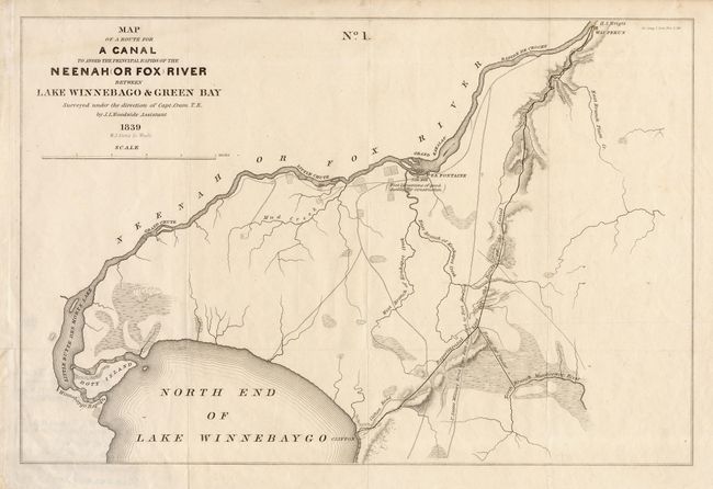
Auction 106, Lot 227
Subject: Wisconsin
U.S. Government
Map of a Route for a Canal to avoid the principal rapids of the Neenah (Or Fox) River between lake Winnebago & Green Bay, 1839
Size: 15.2 x 10.4 inches (38.6 x 26.4 cm)
Estimate: $110 - $140
Sold for: $110
Closed on 3/3/2004
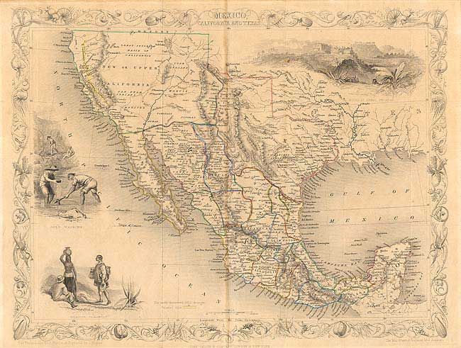
Auction 106, Lot 229
Subject: United States & Mexico
Tallis, John
Mexico, California and Texas, 1851
Size: 13 x 9.7 inches (33 x 24.6 cm)
Estimate: $300 - $375
Sold for: $400
Closed on 3/3/2004
33 lots