Catalog Archive
Auction 106, Lot 217

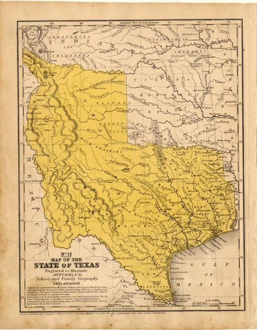
"No. 13 Map of the State of Texas", Thomas, Cowperthwait & Co.
Subject: Texas

Period: 1846 (dated)

Publication: Mitchell's School Atlas…

Color: Hand Color

Size:
8 x 10.2 inches
20.3 x 25.9 cm
Download High Resolution Image
(or just click on image to launch the Zoom viewer)

This map features the "Stovepipe" configuration that also has the western boundary of the state at the Rio Grande del Norte, putting Santa Fe in Texas. Part of Texas continues to the northwest above Taos in the Green Mountains region. This edition is first to name Dallas. Indian tribes noted; no counties formed west of 99°. Bright original yellow wash hand coloring.

References:

Condition: B

Lightly toned or stained through part of title in lower left corner, else very good.

Estimate: $180 - $220

Sold for: $375

Closed on 3/3/2004

Archived