Catalog Archive
Auction 106, Lot 227
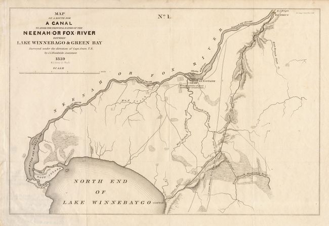
"Map of a Route for a Canal to avoid the principal rapids of the Neenah (Or Fox) River between lake Winnebago & Green Bay", U.S. Government
Subject: Wisconsin
Period: 1839 (dated)
Publication: Sen. Doc. 318, Report from the Secretary of War.
Color: Black & White
Size:
15.2 x 10.4 inches
38.6 x 26.4 cm
Download High Resolution Image
(or just click on image to launch the Zoom viewer)
(or just click on image to launch the Zoom viewer)