Catalog Archive
Auction 106, Lot 216

"Caroline Meridionale, avec les Parties adjacentes: pour servir a l'Intelligence des mouvemens des armees Americaines et Britanniques", Ramsay, David

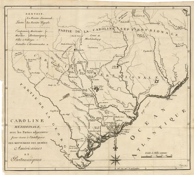
Subject: South Carolina

Period: 1787 (circa)

Publication: Histoire de la Revolution d'Amerique

Color: Black & White

Size:
16.4 x 14.2 inches
41.7 x 36.1 cm
Download High Resolution Image
(or just click on image to launch the Zoom viewer)

Handsome map of South Carolina showing the important rivers and streams but little other topographical information. The map instead focuses on the military action of the American Revolution with various battles, advances, routes and retreats noted by means of dotted lines. In the west is a boundary marked Anciennes Limites des Cherokees, and further west another boundary isolates a couple of Villes basses des Cherokees.

References: Wheat & Brun #597.

Condition: A

Fine crisp impression with a bit of light offsetting, which erases easily.

Estimate: $400 - $450

Sold for: $425

Closed on 3/3/2004

Archived