Filtered by Category:Books, Atlases, Travel Guides, Geography & Reference Books(Show All Categories)
Showing results for:Auction 176
Catalog Archive
46 lots
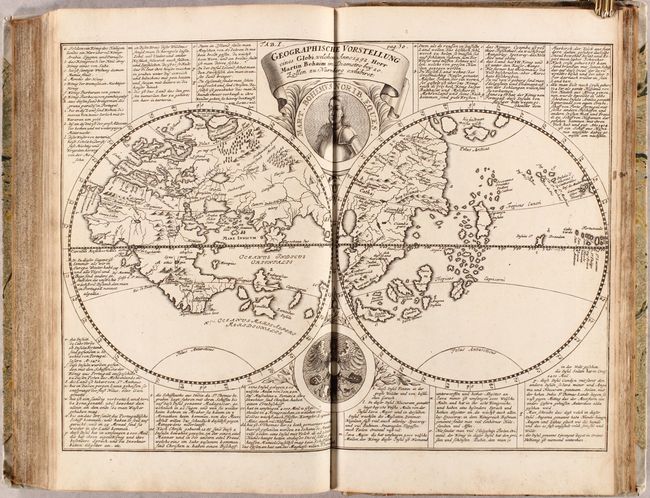
Auction 176, Lot 10
Subject: World
Doppelmayr, Johann Gabriel
Geographische Vorstellung eines Globi, Welchen Anno 1492. Herr Martin Behaim... [bound in] Historische Nachricht von den Nurnbergischen Mathematicis und Kunstlern..., 1730
Size: 9.1 x 14.6 inches (23.1 x 37.1 cm)
Estimate: $1,000 - $1,400
Sold for: $600
Closed on 2/12/2020
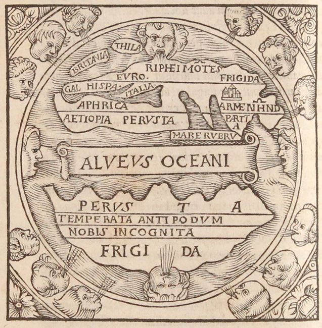
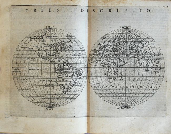
Auction 176, Lot 22
Subject: Ancient World
Macrobius, Ambrosius Aurelius Theodo
Macrobii Ambrosii Aurelii Theodosii, Viri Consularis, & Illustris, in Somnium Scipionis, Lib. II. Saturnaliorum, Lib. VII..., 1556
Size: 4.7 x 7.1 inches (11.9 x 18 cm)
Estimate: $900 - $1,100
Macrobius' Miniature Ancient World Map
Sold for: $600
Closed on 2/12/2020
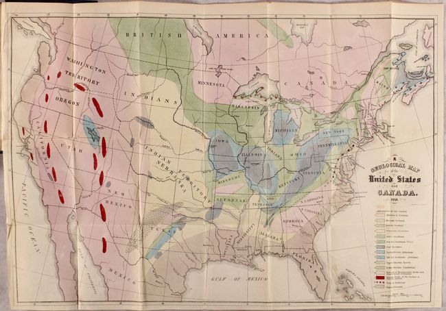
Auction 176, Lot 88
Subject: United States & Canada, World
Hitchcock, Edward
[Maps with Report] A Geological Map of the United States and Canada [and] Outline of the Geology of the Globe, 1853
Size: 5.5 x 8.8 inches (14 x 22.4 cm)
Estimate: $1,200 - $1,500
Includes Hitchcock's First Geological Map of the United States
Sold for: $850
Closed on 2/12/2020
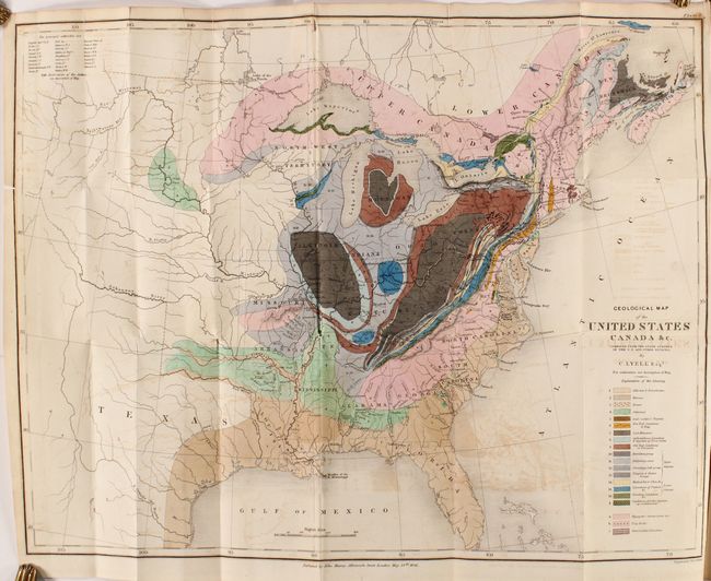
Auction 176, Lot 97
Subject: Eastern United States & Canada, Geology
Lyell, Charles
Geological Map of the United States Canada &c. [with] [2 Volumes] Travels in North America, in the Years 1841-2; with Geological Observations on the United States, Canada, and Nova Scotia, 1845
Size: 19.8 x 15.1 inches (50.3 x 38.4 cm)
Estimate: $600 - $750
First American Edition of Lyell's Important Account & Geological Map
Sold for: $600
Closed on 2/12/2020
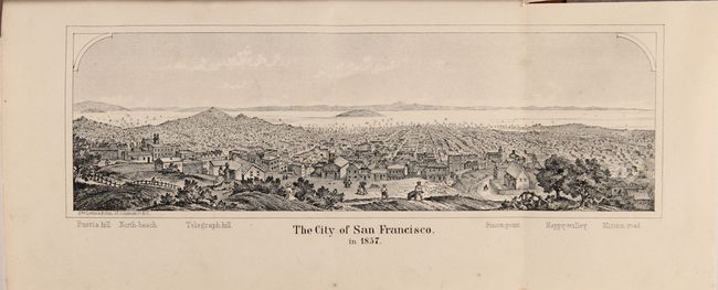
Auction 176, Lot 173
Subject: California
California and Its Resources. A Work for the Merchant, the Capitalist, and the Emigrant, 1858
Size: 5.7 x 9 inches (14.5 x 22.9 cm)
Estimate: $800 - $950
Sold for: $600
Closed on 2/12/2020
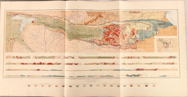
Auction 176, Lot 224
Subject: Upper Peninsula - Michigan, Atlas, Geology
U.S. Geological Survey (USGS)
Atlas to Accompany Monograph XXVIII on the Marquette Iron-Bearing District of Michigan, 1896
Size: 18.3 x 21.1 inches (46.5 x 53.6 cm)
Estimate: $250 - $325
Sold for: $130
Closed on 2/12/2020
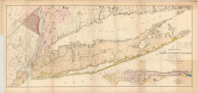
Auction 176, Lot 230
Subject: New York, Long Island, Geology
Mather, W. W.
Natural History of New York. Geology of New York. Part I [with map] Geological Map of Long & Staten Islands with the Environs of New York, 1843
Size: 50.8 x 22.4 inches (129 x 56.9 cm)
Estimate: $750 - $900
Includes a Detailed, Large-Format Map of Long Island
Sold for: $500
Closed on 2/12/2020
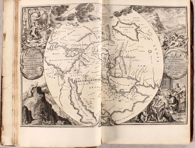
Auction 176, Lot 580
Subject: Holy Land, History Book
Le Grand Tableau de l'Univers, ou l'Histoire des Evenemens de l'Eglise, Depuis la Creation du Monde Jusqu'a l'Apocalypse de S. Jean..., 1714
Size: 10.8 x 16.4 inches (27.4 x 41.7 cm)
Estimate: $1,100 - $1,400
French History of the Old and New Testaments with Five Maps and over 100 Illustrations
Sold for: $700
Closed on 2/12/2020
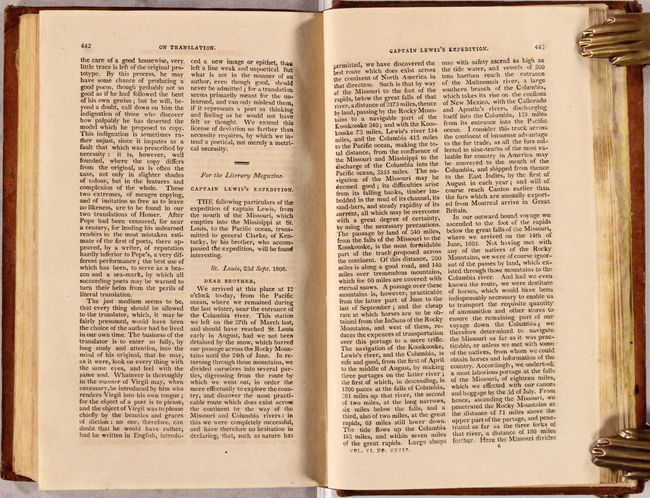
Auction 176, Lot 726
Subject: Document - Lewis & Clark
"Captain Lewis's Expedition" [in] The Literary Magazine and American Register for 1806 ... Vol. VI, 1806
Size: 5.5 x 8.7 inches (14 x 22.1 cm)
Estimate: $400 - $500
Contains the First Substantive Account of the Lewis and Clark Expedition
Sold for: $700
Closed on 2/12/2020
Auction 176, Lot 742
Subject: Atlases
Ptolemy/Ruscelli
La Geografia di Claudio Tolomeo Alessandrino..., 1574
Size: 6.6 x 9.1 inches (16.8 x 23.1 cm)
Estimate: $10,000 - $13,000
Ruscelli's Complete, Third Edition Atlas
Sold for: $7,000
Closed on 2/12/2020
Auction 176, Lot 743
Subject: Atlases
Homann, Johann Baptist
Grosser Atlas uber die Gantze Welt..., 1751
Size: 13.3 x 21.3 inches (33.8 x 54.1 cm)
Estimate: $16,000 - $19,000
Featuring 110 Maps in Contemporary Color
Sold for: $11,000
Closed on 2/12/2020
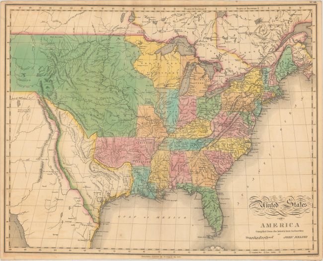
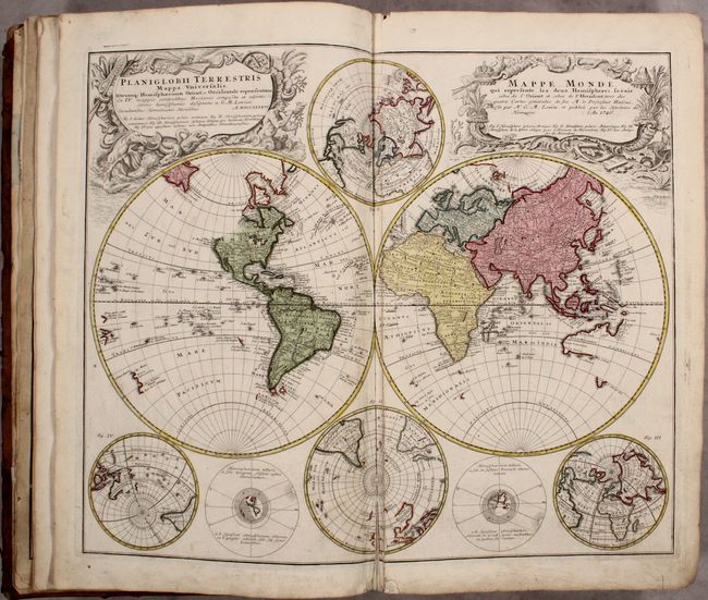
Auction 176, Lot 744
Subject: Atlases
Lavoisne/Aspin
A Complete Genealogical, Historical, Chronological, and Geographical Atlas; Being a General Guide to History, Both Ancient and Modern..., 1820
Size: 12.4 x 17.9 inches (31.5 x 45.5 cm)
Estimate: $1,600 - $1,900
Includes Melish's Popular Map of the United States
Sold for: $1,300
Closed on 2/12/2020
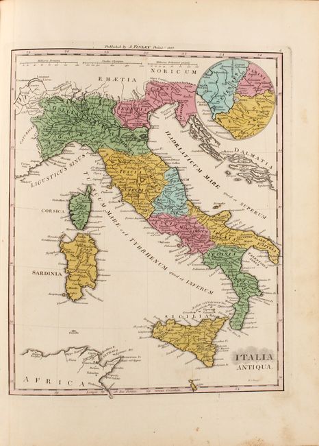
Auction 176, Lot 745
Subject: Atlases
Finley, Anthony
Atlas Classica; or Select Maps of Ancient Geography, Both Sacred and Profane..., 1829
Size: 11 x 14.2 inches (27.9 x 36.1 cm)
Estimate: $350 - $425
Sold for: $250
Closed on 2/12/2020
Auction 176, Lot 746
Subject: Atlases
Arrowsmith, John
The London Atlas of Universal Geography, Exhibiting the Physical & Political Divisions of the Various Countries of the World..., 1835
Size: 15.4 x 22 inches (39.1 x 55.9 cm)
Estimate: $5,000 - $6,500
One of the Finest 19th Century English Atlases
Sold for: $3,500
Closed on 2/12/2020
Auction 176, Lot 747
Subject: Atlases
Tanner, Henry Schenck
A New Universal Atlas Containing Maps of the Various Empires, Kingdoms, States and Republics of the World..., 1836
Size: 13 x 16.1 inches (33 x 40.9 cm)
Estimate: $7,000 - $8,500
First Edition of Tanner's Universal Atlas - Complete
Unsold
Closed on 2/12/2020
Auction 176, Lot 748
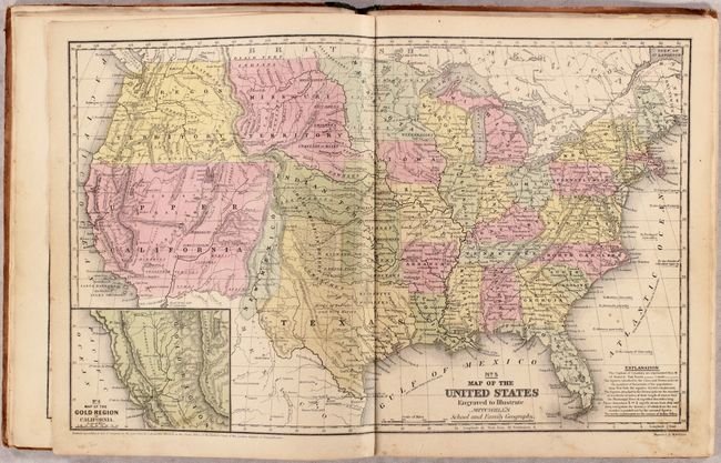
Subject: Atlases
Mitchell/Cowperthwait
Mitchell’s School Atlas: Comprising the Maps, Etc., Designed to Illustrate Mitchell's School and Family Geography, 1850
Size: 9.8 x 12.1 inches (24.9 x 30.7 cm)
Estimate: $400 - $500
Sold for: $270
Closed on 2/12/2020
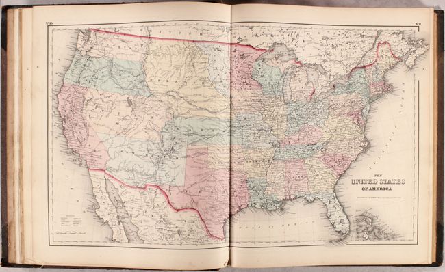
Auction 176, Lot 749
Subject: Atlases
Colton, Joseph Hutchins
Colton's General Atlas, Containing One Hundred and Seventy Steel Plate Maps and Plans, on One Hundred Imperial Folio Sheets..., 1857
Size: 14.8 x 17.8 inches (37.6 x 45.2 cm)
Estimate: $2,750 - $3,500
Colton's Impressive General Atlas
Sold for: $2,000
Closed on 2/12/2020
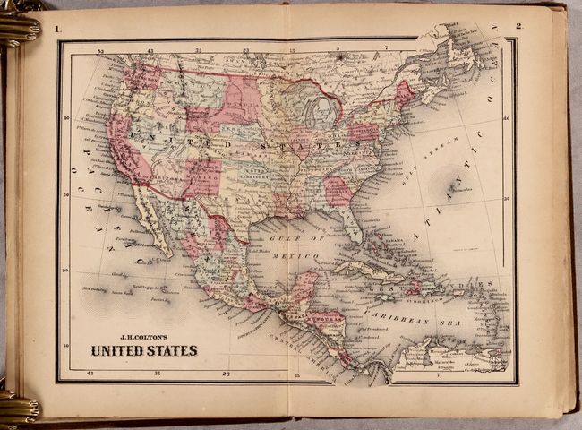
Auction 176, Lot 750
Subject: Atlases
Colton, Joseph Hutchins
Colton's Condensed Octavo Atlas of the Union: Containing Maps of All the States and Territories of the United States of America, 1864
Size: 9.6 x 6.6 inches (24.4 x 16.8 cm)
Estimate: $900 - $1,100
Sold for: $575
Closed on 2/12/2020
Auction 176, Lot 751
Subject: Geography Books
Pinkerton, John
Modern Geography. A Description of the Empires, Kingdoms, States, and Colonies; with the Oceans, Seas, and Isles..., 1803
Size: 5.6 x 9 inches (14.2 x 22.9 cm)
Estimate: $400 - $475
Sold for: $325
Closed on 2/12/2020
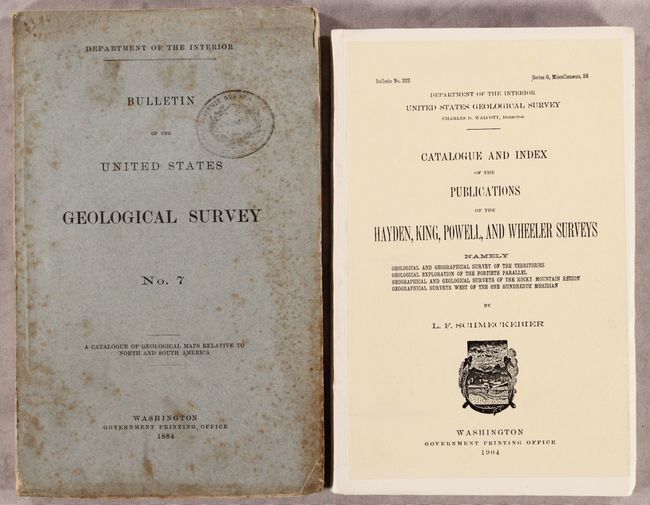
Auction 176, Lot 752
Subject: References, Geology
[Lot of 2] Mapoteca Geologica Americana - A Catalogue of Geological Maps of America (North and South) 1752-1881... [and] Catalogue and Index of the Publications of the Hayden, King, Powell, and Wheeler Surveys..., 1884-1904
Size: See Description
Estimate: $100 - $130
NO RESERVE - First Editions
Sold for: $36
Closed on 2/12/2020
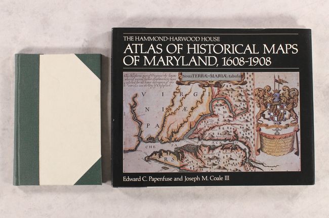
Auction 176, Lot 753
Subject: References, Washington, D.C. & Maryland
[Lot of 2] List of Maps and Views of Washington and District of Columbia in the Library of Congress [and] The Hammond-Harwood House - Atlas of Historical Maps of Maryland, 1608-1908, 1900-82
Size: See Description
Estimate: $60 - $80
NO RESERVE
Sold for: $22
Closed on 2/12/2020
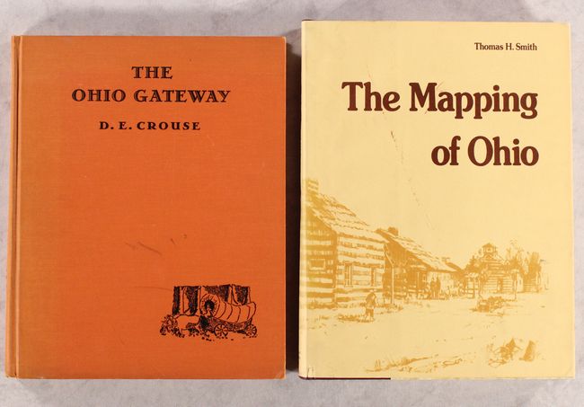
Auction 176, Lot 754
Subject: References, Ohio
[Lot of 2] The Ohio Gateway [and] The Mapping of Ohio - The Delineation of the State of Ohio Through the Use of Manuscript Maps, Printed Maps, and Plats..., 1938-77
Size: See Description
Estimate: $120 - $150
NO RESERVE
Unsold
Closed on 2/12/2020
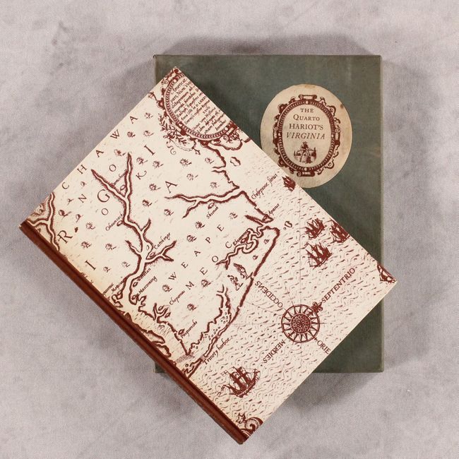
Auction 176, Lot 755
Subject: References, Facsimile - Roanoke Colony
[Facsimile] A Brief and True Report of the New Found Land of Virginia, 1951
Size: 5.5 x 7.6 inches (14 x 19.3 cm)
Estimate: $50 - $70
NO RESERVE
Sold for: $150
Closed on 2/12/2020
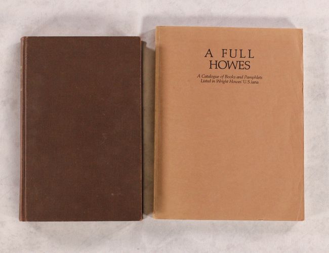
Auction 176, Lot 756
Subject: References, Americana
[Lot of 2] U.S. Iana (1650-1950) - A Selective Bibliography in Which Are Described 11,620 Uncommon and Significant Books... [and] A Full Howes - A Catalogue of Books and Pamphlets Listed in Wright Howes' U.S.iana, 1962-81
Size: See Description
Estimate: $55 - $75
NO RESERVE
Sold for: $23
Closed on 2/12/2020
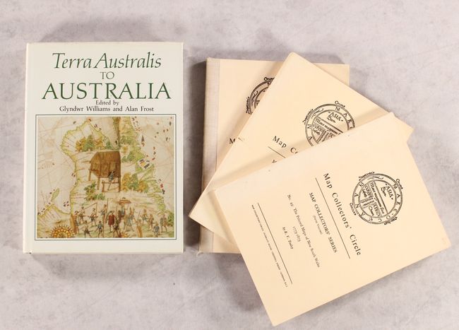
Auction 176, Lot 757
Subject: References, Australia
[Lot of 5] Terra Australis to Australia [and] Map Collectors' Circle - Map Collectors' Series No. 5 [and] No. 12 [and] No. 23 [and] No. 44, 1963-88
Size: See Description
Estimate: $75 - $95
NO RESERVE
Sold for: $49
Closed on 2/12/2020
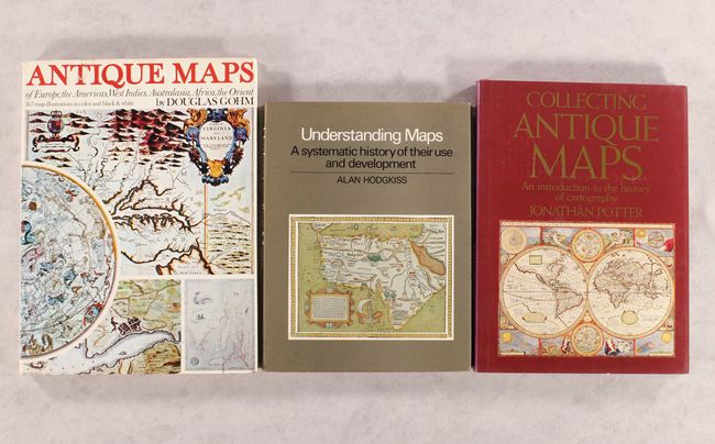
Auction 176, Lot 758
Subject: References
[Lot of 3] Antique Maps of Europe, the Americas, West Indies, Australasia, Africa, the Orient [and] Understanding Maps... [and] Collecting Antique Maps..., 1972-92
Size: See Description
Estimate: $80 - $100
NO RESERVE
Sold for: $41
Closed on 2/12/2020
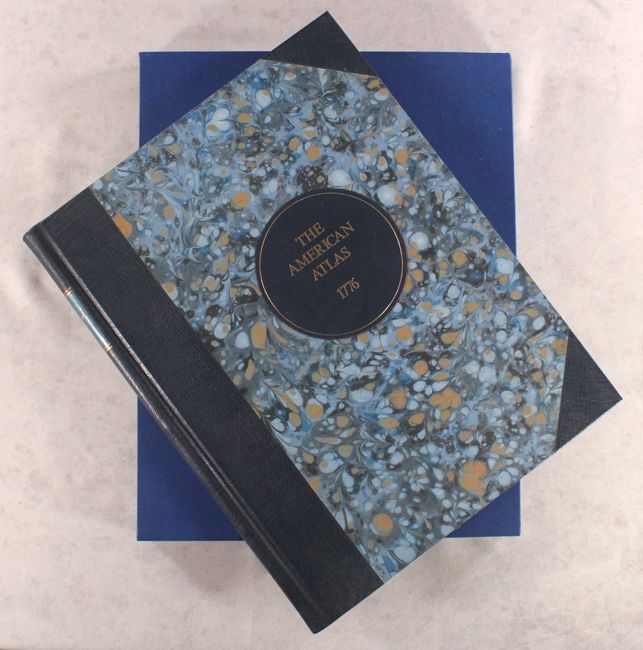
Auction 176, Lot 759
Subject: References, Facsimile Atlas
Jefferys, Thomas
[Facsimile] The American Atlas, 1976
Size: 16.6 x 21.3 inches (42.2 x 54.1 cm)
Estimate: $800 - $950
Sold for: $475
Closed on 2/12/2020
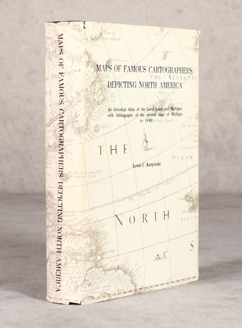
Auction 176, Lot 760
Subject: References, Great Lakes & Michigan
Karpinski, Louis C.
Maps of Famous Cartographers Depicting North America - An Historical Atlas of the Great Lakes and Michigan, with Bibliography of the Printed Maps of Michigan to 1880, 1977
Size: 6.1 x 9 inches (15.5 x 22.9 cm)
Estimate: $150 - $180
Sold for: $90
Closed on 2/12/2020
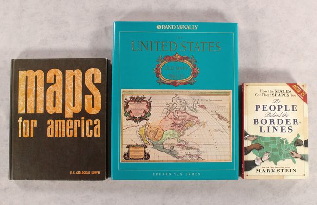
Auction 176, Lot 761
Subject: References, United States
[Lot of 3] The United States in Old Maps and Prints [and] Maps for America - Cartographic Products of the U.S. Geological Survey and Others [and] How the States Got Their Shapes Too - The People Behind the Borderlines, 1979-2011
Size: See Description
Estimate: $60 - $80
NO RESERVE
Sold for: $27
Closed on 2/12/2020
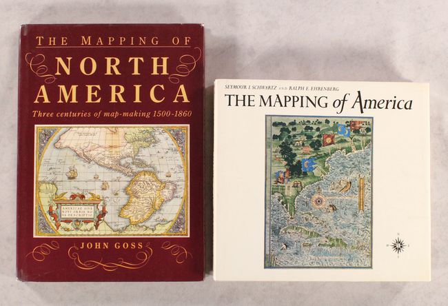
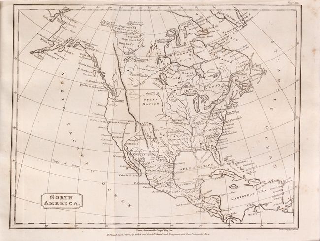
Auction 176, Lot 762
Subject: References, North America
[Lot of 2] The Mapping of America [and] The Mapping of North America - Three Centuries of Map-Making 1500-1860, 1980-90
Size: See Description
Estimate: $140 - $170
Sold for: $100
Closed on 2/12/2020
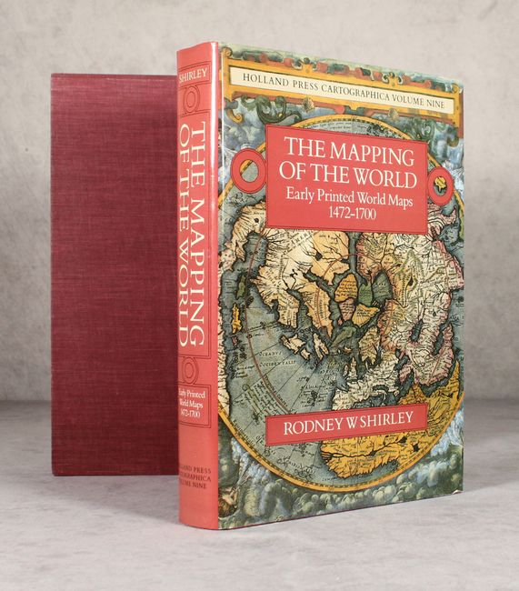
Auction 176, Lot 763
Subject: References, World
Shirley, Rodney W.
The Mapping of the World - Early Printed World Maps 1472-1700, 1984
Size: 9.6 x 13.6 inches (24.4 x 34.5 cm)
Estimate: $450 - $550
Sold for: $475
Closed on 2/12/2020
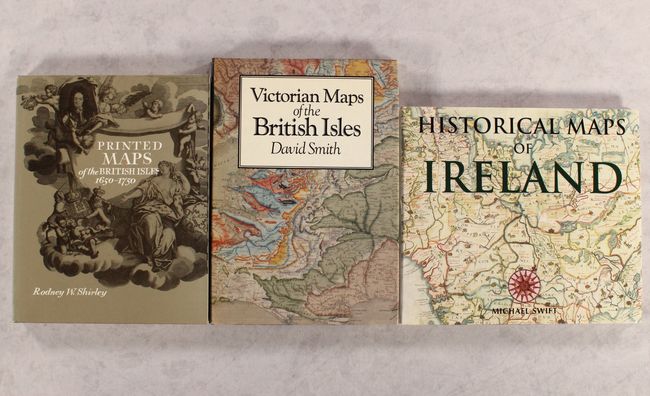
Auction 176, Lot 764
Subject: References, Britain
[Lot of 3] Printed Maps of the British Isles 1650-1750 [and] Victorian Maps of the British Isles [and] Historical Maps of Ireland, 1985-99
Size: See Description
Estimate: $120 - $150
Sold for: $90
Closed on 2/12/2020
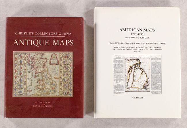
Auction 176, Lot 765
Subject: References
[Lot of 2] Christie's Collectors Guides - Antique Maps [and] American Maps 1795-1895 - A Guide to Values - Wall Maps, Folding Maps, Atlases & Maps from Atlases..., 1986-94
Size: See Description
Estimate: $70 - $90
NO RESERVE
Sold for: $21
Closed on 2/12/2020
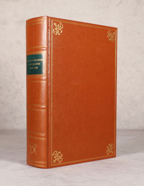
Auction 176, Lot 766
Subject: References, Facsimile Atlas
Munster, Sebastian
[Facsimile] Cosmographei oder Beschreibung Aller Lander..., 1987
Size: 9.3 x 13.7 inches (23.6 x 34.8 cm)
Estimate: $300 - $375
Sold for: $240
Closed on 2/12/2020
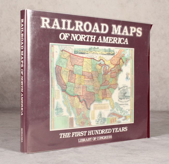
Auction 176, Lot 767
Subject: References, Railroads
Modelski, Andrew M.
Railroad Maps of North America - The First Hundred Years, 1987
Size: 14.3 x 11.3 inches (36.3 x 28.7 cm)
Estimate: $80 - $100
NO RESERVE
Sold for: $26
Closed on 2/12/2020
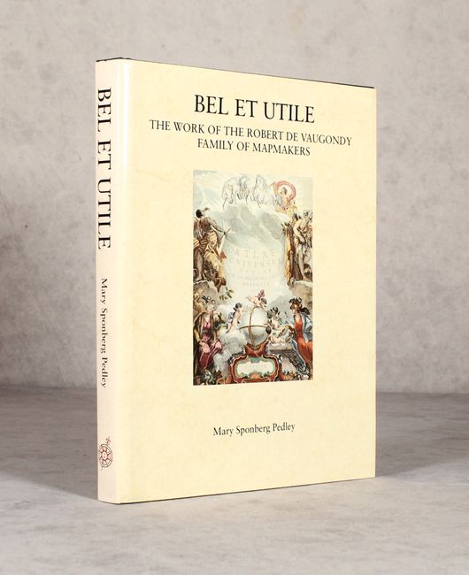
Auction 176, Lot 768
Subject: References
Bel et Utile - The Work of the Robert de Vaugondy Family of Mapmakers, 1992
Size: 9.3 x 12 inches (23.6 x 30.5 cm)
Estimate: $120 - $150
Sold for: $90
Closed on 2/12/2020
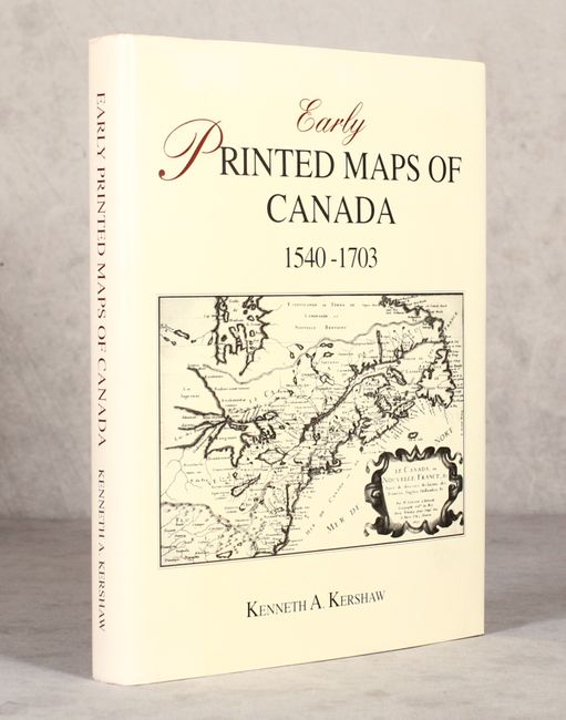
Auction 176, Lot 769
Subject: References, Canada
Kershaw, Kenneth A.
Early Printed Maps of Canada I. 1540-1703, 1993
Size: 8.9 x 11.4 inches (22.6 x 29 cm)
Estimate: $120 - $150
Sold for: $110
Closed on 2/12/2020
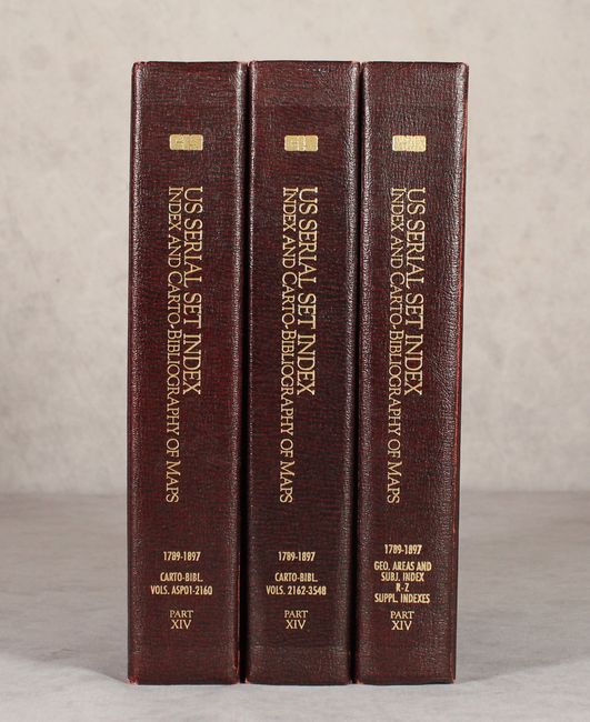
Auction 176, Lot 770
Subject: References, U.S. Government Maps
[Lot of 3] CIS US Serial Set Index Part XIV Index and Carto-Bibliography of Maps, 1789-1969 ... Serial Set Volumes ASP01-2160 [and] ... Serial Set Volumes 2162-3548 [and] ... Index by Geographic Areas and Subjects, R-Z..., 1995
Size: 8.7 x 11.3 inches (22.1 x 28.7 cm)
Estimate: $160 - $200
Sold for: $120
Closed on 2/12/2020

Auction 176, Lot 771
Subject: References, California
Wheat, Carl I.
The Maps of the California Gold Region 1848-1857 - A Biblio-Cartography of an Important Decade, 1995
Size: 9.2 x 12.3 inches (23.4 x 31.2 cm)
Estimate: $90 - $120
Sold for: $70
Closed on 2/12/2020
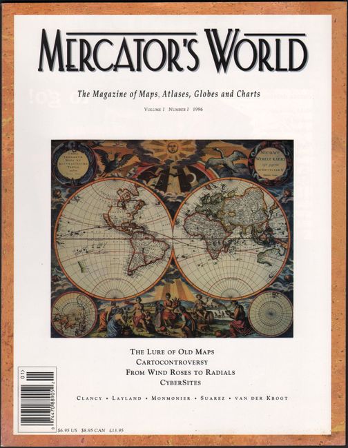
Auction 176, Lot 772
Subject: References
Mercator's World - The Magazine of Maps, Atlases, Globes and Charts Volume I Number I, 1996
Size: 8.4 x 10.9 inches (21.3 x 27.7 cm)
Estimate: $20 - $30
NO RESERVE
Sold for: $20
Closed on 2/12/2020
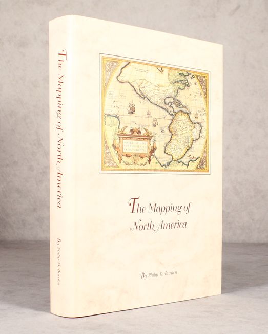
Auction 176, Lot 773
Subject: References, North America
Burden, Philip D.
The Mapping of North America - A List of Printed Maps 1511-1670, 1996
Size: 10.5 x 14.3 inches (26.7 x 36.3 cm)
Estimate: $200 - $230
Sold for: $150
Closed on 2/12/2020
Auction 176, Lot 774
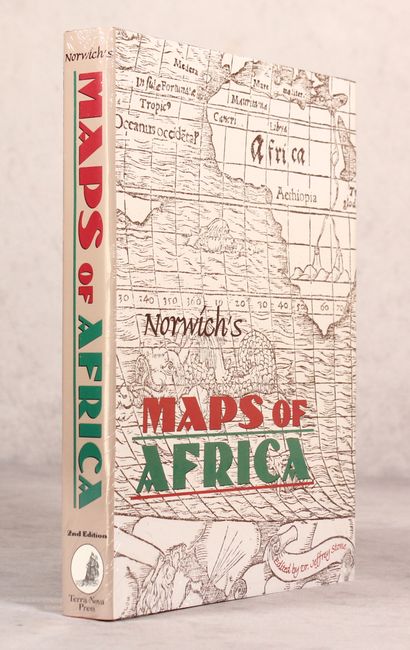
Subject: References, Africa
Norwich, Oscar I.
Norwich's Maps of Africa - An Illustrated and Annotated Carto-bibliography, 1997
Size: 8.7 x 11.3 inches (22.1 x 28.7 cm)
Estimate: $70 - $90
Sold for: $50
Closed on 2/12/2020
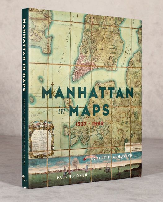
Auction 176, Lot 775
Subject: References, New York City
Manhattan in Maps 1527-1995, 1997
Size: 9.4 x 10.9 inches (23.9 x 27.7 cm)
Estimate: $80 - $100
NO RESERVE
Sold for: $16
Closed on 2/12/2020
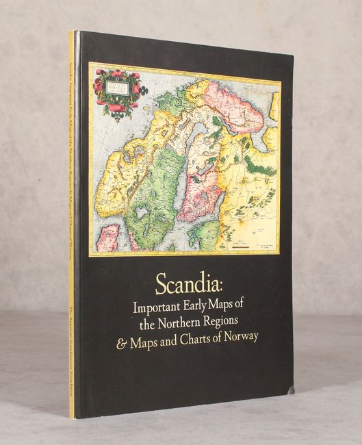
Auction 176, Lot 776
Subject: References, Scandinavia
Scandia: Important Early Maps of the Northern Regions & Maps and Charts of Norway, 2002
Size: 9 x 12 inches (22.9 x 30.5 cm)
Estimate: $35 - $55
NO RESERVE
Sold for: $55
Closed on 2/12/2020
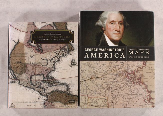
Auction 176, Lot 777
Subject: References, Colonial America
[Lot of 2] Degrees of Latitude - Mapping Colonial America [and] George Washington's America - A Biography Through His Maps, 2002-10
Size: See Description
Estimate: $120 - $150
NO RESERVE
Sold for: $60
Closed on 2/12/2020
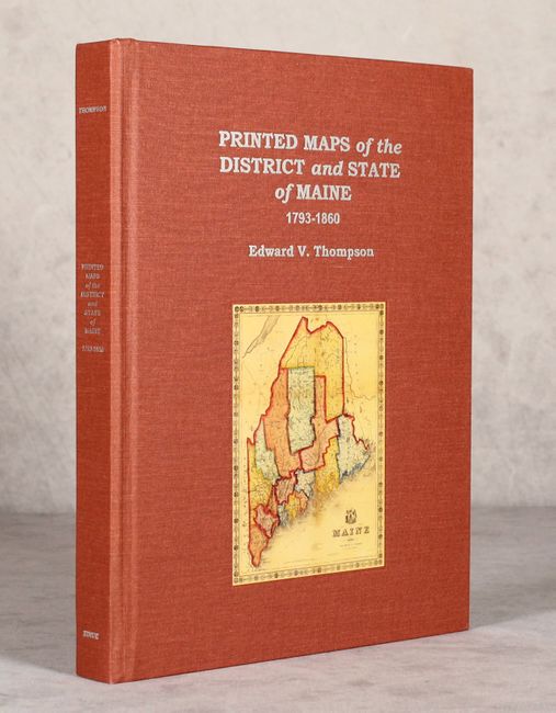
Auction 176, Lot 778
Subject: References, Maine
Printed Maps of the District and State of Maine 1793-1860 - An Illustrated and Comparative Study, 2010
Size: 8.8 x 11.3 inches (22.4 x 28.7 cm)
Estimate: $140 - $170
Sold for: $100
Closed on 2/12/2020
46 lots