Subject: United States & Canada, World
Period: 1853 (published)
Publication:
Color: Hand Color
Size:
5.5 x 8.8 inches
14 x 22.4 cm
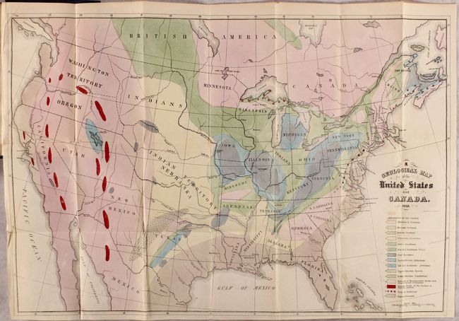
A. A Geological Map of the United States and Canada (24.1 x 15.8"). This is Hitchcock's landmark map of 1853. Essentially, it is a compilation of Lyell’s map for the eastern portion combined with M. Boue’s Geological Map of the World for the western portion modified by the author’s generalizations derived from the relations of geography to geology, as argued in the report. In this respect, he freely admits that such generalizations for the western US might be greatly erroneous. This map provides early detail of the geological formations. An explanatory key to the colors indicates fifteen geologic types. Condition: Near fine with some occasional faint color offsetting. (A)
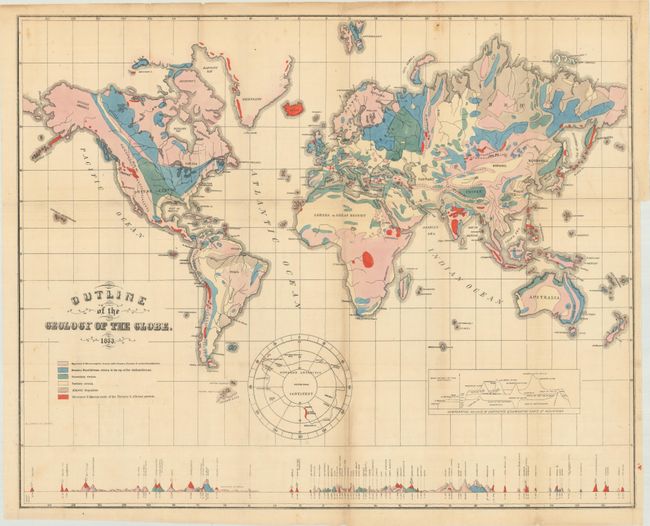
B. Outline of the Geology of the Globe (23.3 x 18.3"). Drawn on Mercator's Projection, this map shows the entire world with a separate hemisphere of the "Supposed Antarctic Continent" that locates Wilkes' Land, South Victoria, Enderby Land and Cook's sighting of 1774. This map uses six different colors to locate as many geological types. Along the bottom are the comparative heights of mountains and volcanoes aligned with the position on the map. Condition: The map is loose with a few minor fold separations and a 2.5" binding tear at right that have all been closed on verso with archival materials. (B+)
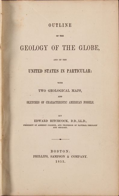
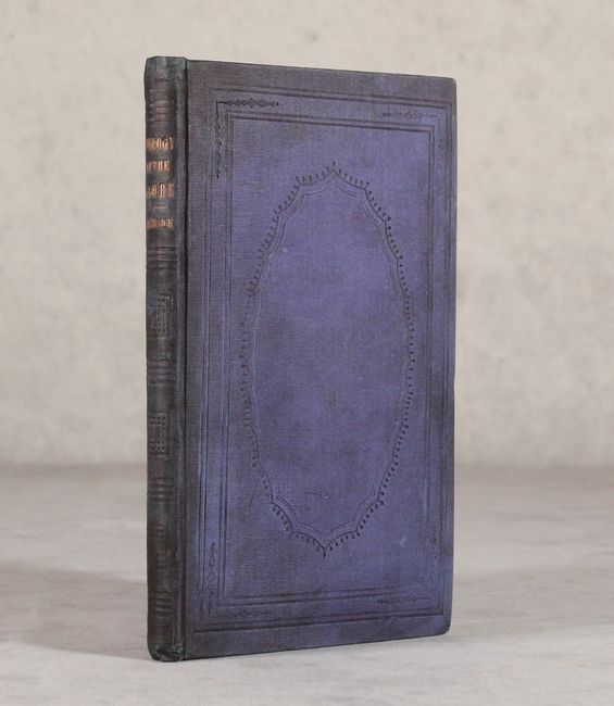
These important geological maps are bound in the original report "Outline of the Geology of the Globe, and of the United States in Particular; with Two Geological Maps, and Sketches of Characteristic American Fossils," published by Phillips, Sampson & Company in Boston. Octavo, 136 pages, 6 plates, and 2 folding hand-colored geological maps. Hardbound in blue cloth with blind-stamped decorative elements and gilt title on spine. This work is notable for containing his first attempt at a geological map of the United States. His son C. H. Hitchcock also notes that "the part relating to the United States is the first attempt to show the distribution of rocks from the Atlantic to the Pacific border." It is uncommon to see the report and its two maps together.
References:
Condition:
See description for details on the maps and condition grades. Report text is clean and tight. There is light staining and minor wear to the covers with bumped edges. (B+)