Filtered by Category:United States(Show All Categories)
Showing results for:Auction 176
Catalog Archive
186 lots
Page 1 of 4
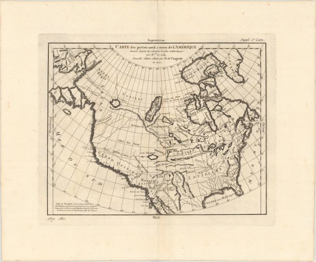
Auction 176, Lot 87
Subject: Colonial United States & Canada
Robert de Vaugondy, Didier
Carte des Parties Nord et Ouest de l'Amerique Dressee d'Apres les Relations les Plus Authentiques..., 1772
Size: 14.4 x 11.3 inches (36.6 x 28.7 cm)
Estimate: $180 - $220
Sold for: $220
Closed on 2/12/2020
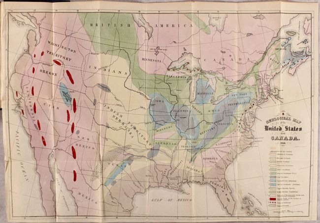
Auction 176, Lot 88
Subject: United States & Canada, World
Hitchcock, Edward
[Maps with Report] A Geological Map of the United States and Canada [and] Outline of the Geology of the Globe, 1853
Size: 5.5 x 8.8 inches (14 x 22.4 cm)
Estimate: $1,200 - $1,500
Includes Hitchcock's First Geological Map of the United States
Sold for: $850
Closed on 2/12/2020
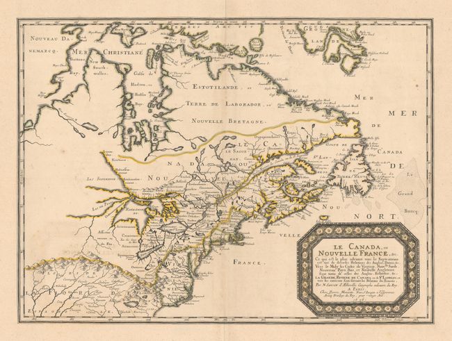
Auction 176, Lot 89
Subject: Colonial Eastern United States & Canada
Sanson/Mariette
Le Canada, ou Nouvelle France, &c. ce qui est le Plus Advance vers le Septentrion est Tire de Diverses Relations des Anglois, Danois, &c..., 1656
Size: 21.3 x 15.6 inches (54.1 x 39.6 cm)
Estimate: $4,000 - $5,000
Keystone Map for Great Lakes Collections
Sold for: $2,000
Closed on 2/12/2020
Auction 176, Lot 90
Subject: Colonial Eastern United States & Canada
Moll, Herman
A New and Exact Map of the Dominions of the King of Great Britain on ye Continent of North America..., 1715
Size: 24.1 x 39.9 inches (61.2 x 101.3 cm)
Estimate: $17,000 - $20,000
Moll's Rare and Highly Desirable "Beaver Map" in Contemporary Color
Sold for: $12,000
Closed on 2/12/2020
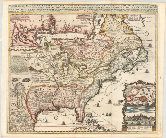
Auction 176, Lot 91
Subject: Colonial Eastern United States & Canada
Chatelain, Henry Abraham
Carte de la Nouvelle France, ou se voit le Cours des Grandes Rivieres de S. Laurens & de Mississipi Aujour d'hui S. Louis, aux Environs des-quelles se Trouvent les Etats, Pais, Nations, Peuples &c..., 1719
Size: 19.3 x 16.6 inches (49 x 42.2 cm)
Estimate: $3,000 - $3,750
One of the Most Informative 18th Century Maps of the French Possessions in North America
Sold for: $2,750
Closed on 2/12/2020
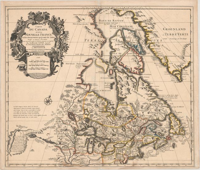
Auction 176, Lot 92
Subject: Colonial Eastern United States & Canada
Delisle/Covens & Mortier
Carte du Canada ou de la Nouvelle France et des Decouvertes qui y ont ete Faites..., 1730
Size: 22.6 x 19.3 inches (57.4 x 49 cm)
Estimate: $1,200 - $1,500
One of the Most Influential Maps of Canada, Great Lakes & Upper Midwest
Sold for: $900
Closed on 2/12/2020
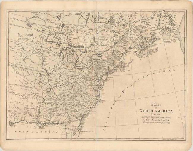
Auction 176, Lot 93
Subject: Colonial Eastern United States & Canada
Blair, Rev. John
A Map of North America from the Latest Surveys and Maps, 1768
Size: 22.6 x 16.5 inches (57.4 x 41.9 cm)
Estimate: $550 - $650
Sold for: $400
Closed on 2/12/2020
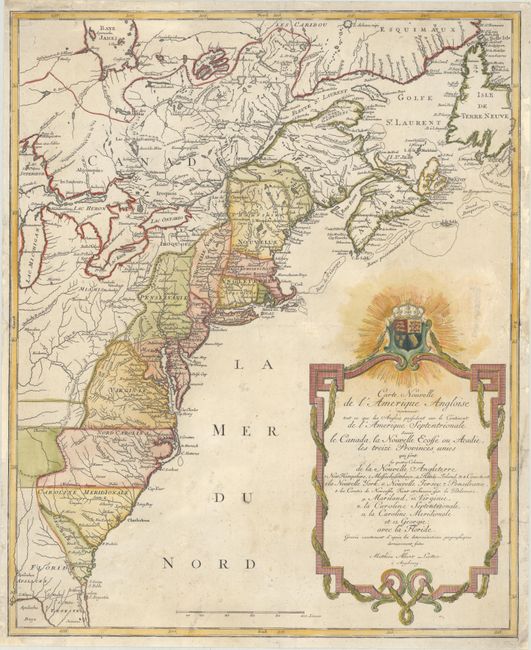
Auction 176, Lot 94
Subject: Colonial Eastern United States & Canada
Lotter, Mathias Albrecht
Carte Nouvelle de l'Amerique Angloise Contenant Tout ce que les Anglois Possedent sur le Continent de l'Amerique Septentrionale Savoir le Canada, la Nouvelle Ecosse ou Acadie, les Treize Provinces Unies..., 1776
Size: 19.5 x 23.8 inches (49.5 x 60.5 cm)
Estimate: $900 - $1,100
Sold for: $650
Closed on 2/12/2020
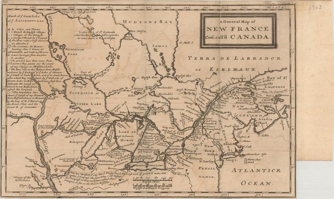
Auction 176, Lot 95
Subject: Colonial Eastern United States & Canada, Great Lakes
Lahontan, Louis Armand, Baron de
A General Map of New France Com. Call'd Canada, 1703
Size: 13.4 x 8.8 inches (34 x 22.4 cm)
Estimate: $1,200 - $1,500
Sold for: $600
Closed on 2/12/2020
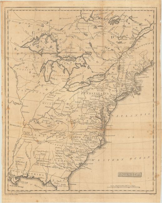
Auction 176, Lot 96
Subject: Eastern United States & Canada, Franklin
America, 1805
Size: 12.9 x 15.9 inches (32.8 x 40.4 cm)
Estimate: $750 - $900
Unique Map Depicting Both Franklinia and Morgania
Sold for: $550
Closed on 2/12/2020
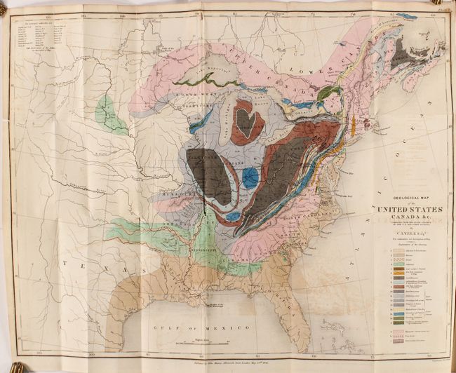
Auction 176, Lot 97
Subject: Eastern United States & Canada, Geology
Lyell, Charles
Geological Map of the United States Canada &c. [with] [2 Volumes] Travels in North America, in the Years 1841-2; with Geological Observations on the United States, Canada, and Nova Scotia, 1845
Size: 19.8 x 15.1 inches (50.3 x 38.4 cm)
Estimate: $600 - $750
First American Edition of Lyell's Important Account & Geological Map
Sold for: $600
Closed on 2/12/2020
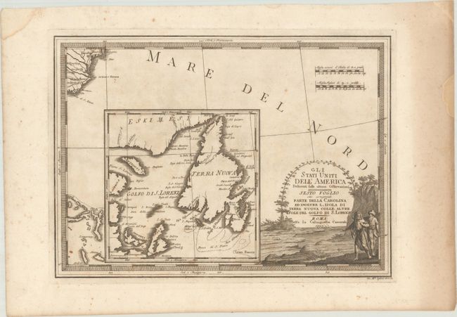
Auction 176, Lot 98
Subject: Eastern Canada & Southeast United States
Cassini, Giovanni Maria
Gli Stati Uniti dell'America Delineati Sulle Ultime Osservazioni - Sesto Foglio che Comprende Parte Della Carolina ed Inoltre l'Isola di Terra Nuova Colle Altre Isole del Golfo di S. Lorenzo, 1797
Size: 18.7 x 13.5 inches (47.5 x 34.3 cm)
Estimate: $375 - $450
Sold for: $150
Closed on 2/12/2020
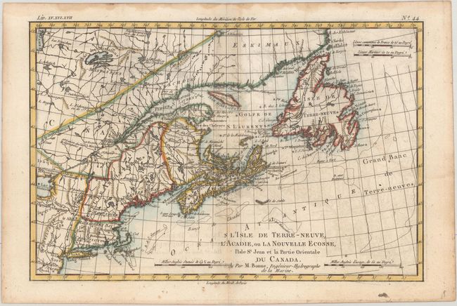
Auction 176, Lot 99
Subject: Colonial Northeastern United States & Canada
Bonne, Rigobert
L'Isle de Terre-Neuve, l'Acadie, ou la Nouvelle Ecosse, l'Isle St Jean et la Partie Orientale du Canada, 1775
Size: 12.6 x 8.3 inches (32 x 21.1 cm)
Estimate: $150 - $180
NO RESERVE
Sold for: $90
Closed on 2/12/2020
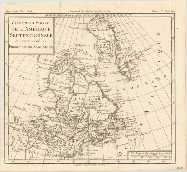
Auction 176, Lot 100
Subject: Colonial Northeastern United States & Canada
Brion de la Tour, Louis
Carte de la Partie de l'Amerique Septentrionale qui Comprend les Possessions Anglaises, 1782
Size: 10 x 8.8 inches (25.4 x 22.4 cm)
Estimate: $110 - $140
Sold for: $80
Closed on 2/12/2020
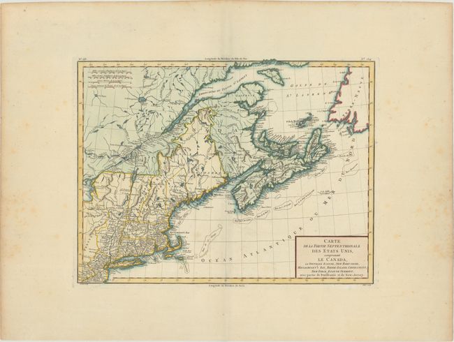
Auction 176, Lot 101
Subject: Northeastern United States & Canada
Tardieu, Pierre Francois
Carte de la Partie Septentrionale des Etats Unis, Comprenant le Canada, la Nouvelle Ecosse, New Hampshire, Massachuset's Bay, Rhode-Island, Connecticut, New-Yorck, Etat de Vermont..., 1797
Size: 16.7 x 12.8 inches (42.4 x 32.5 cm)
Estimate: $190 - $220
Sold for: $120
Closed on 2/12/2020
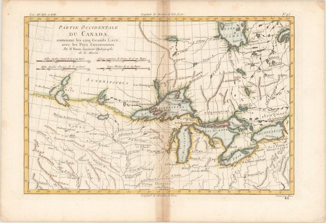
Auction 176, Lot 102
Subject: Colonial Great Lakes
Bonne, Rigobert
Partie Occidentale du Canada, Contenant les Cinq Grands Lacs, avec les Pays Circonvoisins, 1780
Size: 12.4 x 8.1 inches (31.5 x 20.6 cm)
Estimate: $160 - $190
Sold for: $120
Closed on 2/12/2020
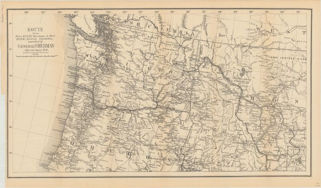
Auction 176, Lot 103
Subject: Northwestern United States, British Columbia
U.S. Government
Route from Fort Ellis Montana to Fort Hope, British Columbia, Travelled by General Sherman July and August 1883, as Shown by Heavy Black Line, 1883
Size: 27.4 x 15.2 inches (69.6 x 38.6 cm)
Estimate: $200 - $250
Sold for: $275
Closed on 2/12/2020
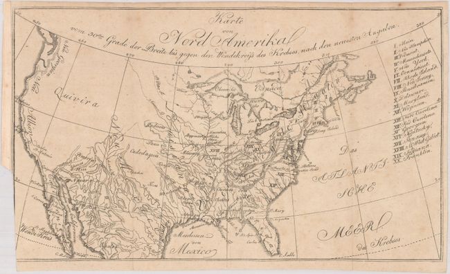
Auction 176, Lot 104
Subject: United States, Franklin
Zimmerman, Eberhard A.W.
Karte von Nord Amerika vom 50sten Grade der Breite bis Gegen den Wendekreiss des Krebses, nach den Neuesten Angaben, 1805
Size: 10.6 x 6.2 inches (26.9 x 15.7 cm)
Estimate: $220 - $250
Locates the State of Franklin
Sold for: $170
Closed on 2/12/2020
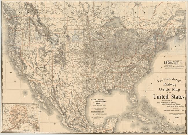
Auction 176, Lot 105
Subject: United States, Railroads
Rand McNally & Co.
The Rand-McNally Railway Guide Map of the United States with Portions of the Dominion of Canada, the Republic of Mexico, and the West Indies, 1893
Size: 42.3 x 30.5 inches (107.4 x 77.5 cm)
Estimate: $200 - $230
Sold for: $200
Closed on 2/12/2020
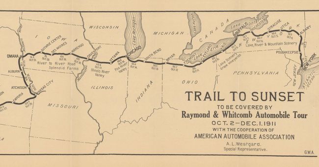
Auction 176, Lot 106
Subject: United States, Auto Trails
American Automobile Assoc.
[Brochure with Map] The Trail to the Sunset Coast to Coast by Automobile, 1911
Size: 29.9 x 6.5 inches (75.9 x 16.5 cm)
Estimate: $200 - $250
The First Commercial Transcontinental Auto Tour
Sold for: $210
Closed on 2/12/2020
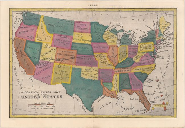
Auction 176, Lot 107
Subject: United States
Judge Company
Suggested Relief Map of the United States, 1926
Size: 14.6 x 9.6 inches (37.1 x 24.4 cm)
Estimate: $200 - $250
Satirical Prohibition Map
Sold for: $300
Closed on 2/12/2020
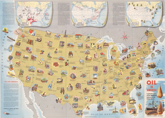
Auction 176, Lot 108
Subject: United States, Oil
Oil In America - A Pictorial Story of the Petroleum Industry in the United States, 1957
Size: 33.5 x 24 inches (85.1 x 61 cm)
Estimate: $220 - $250
Sold for: $180
Closed on 2/12/2020
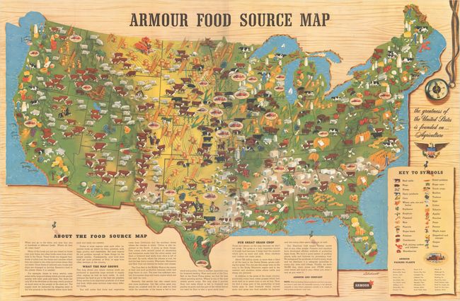
Auction 176, Lot 109
Subject: United States
Armour Food Source Map, 1960
Size: 36.7 x 24.2 inches (93.2 x 61.5 cm)
Estimate: $140 - $170
NO RESERVE
Sold for: $21
Closed on 2/12/2020
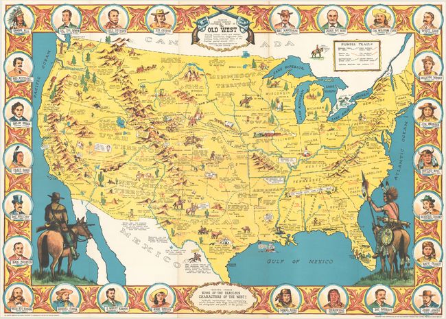
Auction 176, Lot 110
Subject: United States
Sheriff Danny Arnold's Pictorial Map of the Old West Showing Pioneer Trails and Battles, Indian's Territories, Stagecoach Lines, Military Forts, Historical Data of the Frontier Period Around 1840, 1960
Size: 34.3 x 24.3 inches (87.1 x 61.7 cm)
Estimate: $200 - $250
Sold for: $300
Closed on 2/12/2020
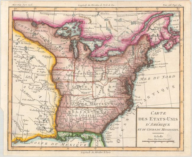
Auction 176, Lot 111
Subject: Eastern United States, Franklin
Brion de la Tour, Louis
Carte des Etats-Unis d'Amerique et du Cours du Mississipi, 1788
Size: 10.6 x 8.7 inches (26.9 x 22.1 cm)
Estimate: $800 - $950
One of the Earliest Maps to Feature the State of Franklin
Sold for: $800
Closed on 2/12/2020
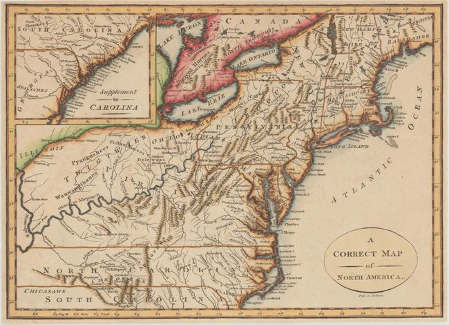
Auction 176, Lot 112
Subject: Eastern United States
A Correct Map of North America, 1800
Size: 11.5 x 8.3 inches (29.2 x 21.1 cm)
Estimate: $240 - $300
Sold for: $180
Closed on 2/12/2020
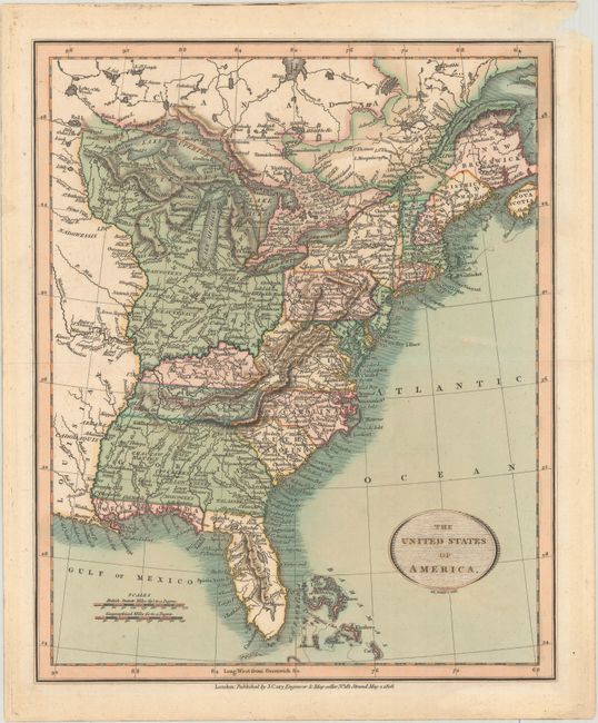
Auction 176, Lot 113
Subject: Eastern United States
Cary, John
The United States of America, 1808
Size: 9.1 x 11.1 inches (23.1 x 28.2 cm)
Estimate: $220 - $250
Sold for: $250
Closed on 2/12/2020
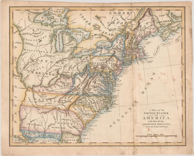
Auction 176, Lot 114
Subject: Eastern United States
Anon.
A Map of the United States, of America, with Part of the Adjoining Provinces, from the Latest Authorities, 1810
Size: 10.6 x 8.4 inches (26.9 x 21.3 cm)
Estimate: $160 - $190
Sold for: $160
Closed on 2/12/2020
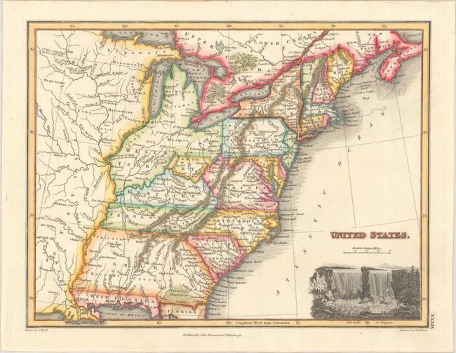
Auction 176, Lot 115
Subject: Eastern United States, Franklin
Wyld, James
United States, 1824
Size: 11.6 x 8.8 inches (29.5 x 22.4 cm)
Estimate: $550 - $700
Sold for: $500
Closed on 2/12/2020
Auction 176, Lot 116
Subject: Eastern United States
Hall, Sidney
United States, 1829
Size: 9.2 x 7.2 inches (23.4 x 18.3 cm)
Estimate: $120 - $150
Sold for: $250
Closed on 2/12/2020
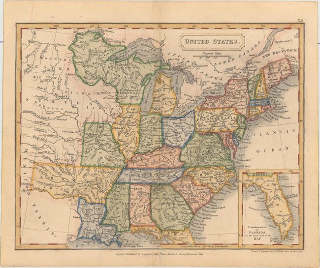
Auction 176, Lot 117
Subject: Eastern United States
Findlay, Alexander
United States, 1836
Size: 9.8 x 7.7 inches (24.9 x 19.6 cm)
Estimate: $120 - $150
Sold for: $90
Closed on 2/12/2020
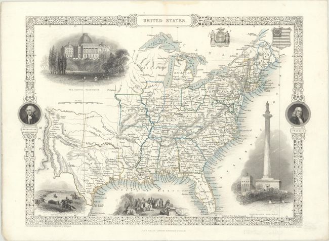
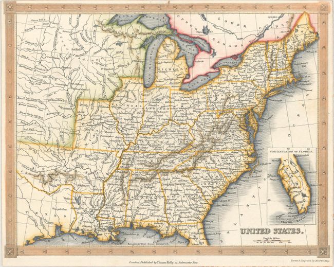
Auction 176, Lot 118
Subject: Eastern United States
Tallis, John
United States, 1850
Size: 13.4 x 9.7 inches (34 x 24.6 cm)
Estimate: $240 - $300
Sold for: $210
Closed on 2/12/2020
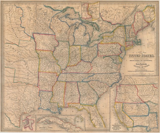
Auction 176, Lot 119
Subject: Eastern United States
Williams, Wellington
A New Map of the United States. Upon Which Are Delineated Its Vast Works of Internal Communication, Routes Across the Continent &c. Showing Also Canada and the Island of Cuba, 1852
Size: 29.4 x 24.5 inches (74.7 x 62.2 cm)
Estimate: $450 - $550
First Edition
Sold for: $325
Closed on 2/12/2020
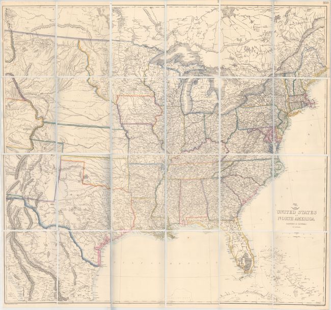
Auction 176, Lot 120
Subject: Eastern United States
Ettling, Theodor
United States of North America (Eastern & Central), 1860
Size: 37 x 33.9 inches (94 x 86.1 cm)
Estimate: $300 - $375
Sold for: $220
Closed on 2/12/2020
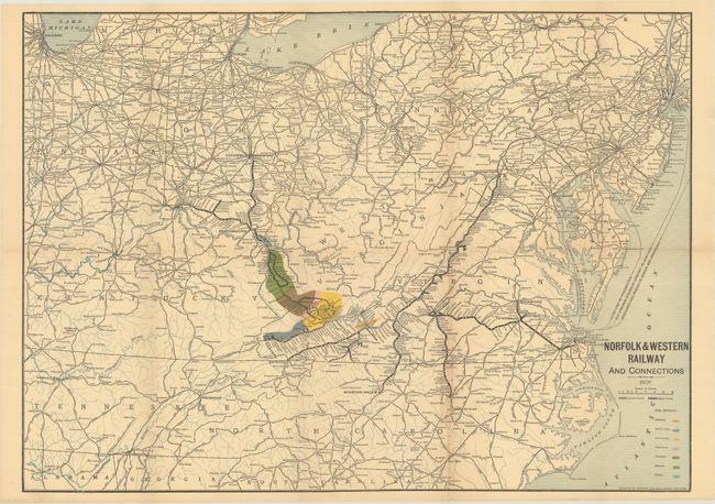
Auction 176, Lot 121
Subject: Eastern United States, Railroads
Norfolk & Western Railway and Connections, 1907
Size: 23.6 x 16.9 inches (59.9 x 42.9 cm)
Estimate: $100 - $130
Sold for: $75
Closed on 2/12/2020
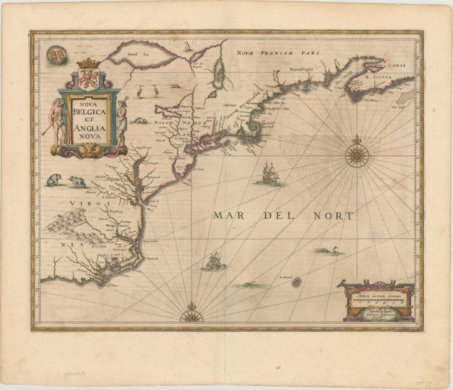
Auction 176, Lot 122
Subject: Colonial New England & Mid-Atlantic United States
Jansson, Jan
Nova Belgica et Anglia Nova, 1646
Size: 19.9 x 15.3 inches (50.5 x 38.9 cm)
Estimate: $1,600 - $1,900
Jansson's Influential Map of the East Coast - in Contemporary Color
Unsold
Closed on 2/12/2020
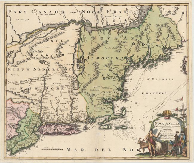
Auction 176, Lot 123
Subject: Colonial New England & Mid-Atlantic United States
Homann, Johann Baptist
Nova Anglia Septentrionali Americae Implantata Anglorumque Coloniis Florentissima , 1730
Size: 22.4 x 18.9 inches (56.9 x 48 cm)
Estimate: $750 - $900
Sold for: $750
Closed on 2/12/2020
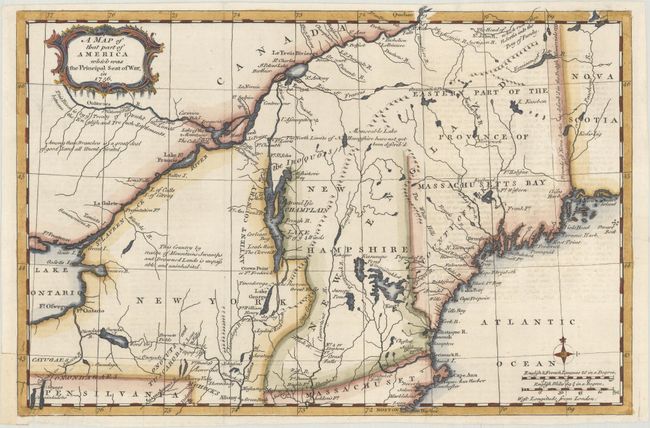
Auction 176, Lot 124
Subject: Colonial New England & Mid-Atlantic United States
Anon.
A Map of That Part of America Which Was the Principal Seat of War, in 1756, 1757
Size: 13.1 x 8.7 inches (33.3 x 22.1 cm)
Estimate: $375 - $450
Sold for: $275
Closed on 2/12/2020
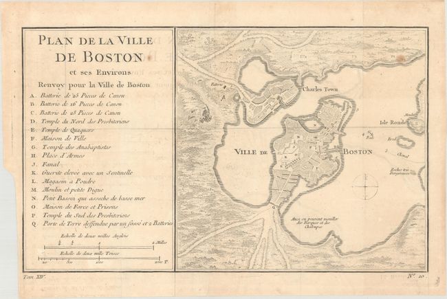
Auction 176, Lot 125
Subject: Colonial New England & Mid-Atlantic United States, Boston
Bellin, Jacques Nicolas
[Lot of 2] Plan de la Ville de Boston et ses Environs [and] Carte de la Nouvelle Angleterre Nouvelle Yorck et Pensilvanie pour Servir a l'Histoire Generale des Voyages, 1757
Size: See Description
Estimate: $325 - $400
Sold for: $200
Closed on 2/12/2020
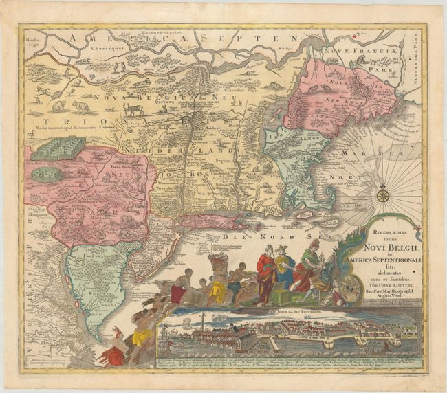
Auction 176, Lot 126
Subject: Colonial New England & Mid-Atlantic United States
Seutter/Lotter
Recens Edita Totius Novi Belgii, in America Septentrionali Siti, Delineatio Cura et Sumtibus, 1760
Size: 22.9 x 19.6 inches (58.2 x 49.8 cm)
Estimate: $2,750 - $3,500
Decorative Edition from Jansson-Visscher Series with View of Manhattan
Unsold
Closed on 2/12/2020
Auction 176, Lot 127
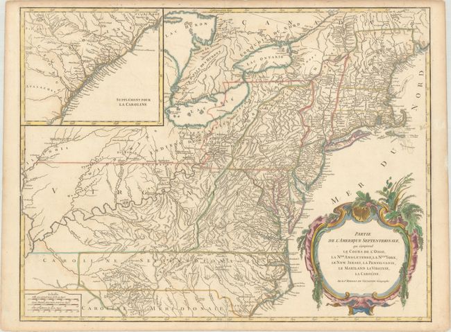
Subject: Colonial New England & Mid-Atlantic United States
Robert de Vaugondy, Didier
Partie de l'Amerique Septentrionale, qui Comprend le Cours de l'Ohio, la Nlle. Angleterre, la Nlle York, le New Jersey, la Pensylvanie, le Maryland la Virginie, la Caroline, 1768
Size: 24.6 x 18.8 inches (62.5 x 47.8 cm)
Estimate: $475 - $600
Sold for: $350
Closed on 2/12/2020
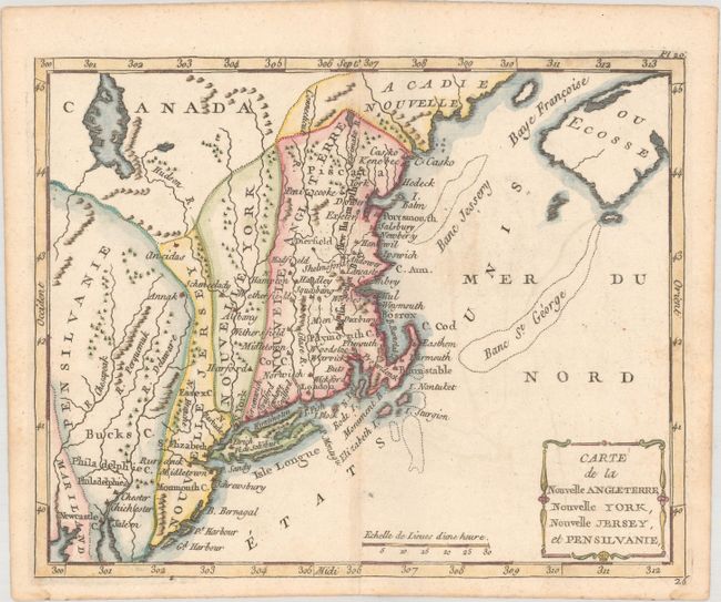
Auction 176, Lot 128
Subject: Colonial New England & Mid-Atlantic United States
Laporte, Joseph de
Carte de la Nouvelle Angleterre, Nouvelle York, Nouvelle Jersey, et Pensilvanie, 1783
Size: 8.7 x 7 inches (22.1 x 17.8 cm)
Estimate: $200 - $230
Sold for: $210
Closed on 2/12/2020
Auction 176, Lot 129
Subject: New England & Mid-Atlantic United States
Crevecoeur, Michel Guillaume De
Carte de la Partie Septentrionale des Etats-Unis, 1801
Size: 19.7 x 14.2 inches (50 x 36.1 cm)
Estimate: $275 - $350
Sold for: $200
Closed on 2/12/2020
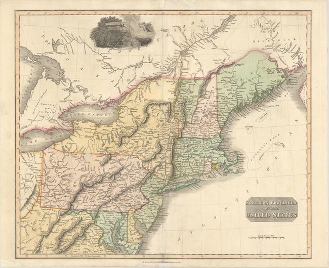
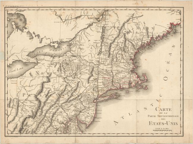
Auction 176, Lot 130
Subject: New England & Mid-Atlantic United States
Thomson, John
Northern Provinces of the United States, 1823
Size: 23.1 x 19.4 inches (58.7 x 49.3 cm)
Estimate: $275 - $350
Sold for: $150
Closed on 2/12/2020
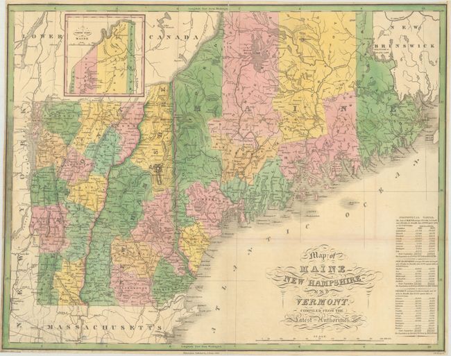
Auction 176, Lot 131
Subject: New England - United States
Finley, Anthony
Map of Maine New Hampshire and Vermont, Compiled from the Latest Authorities, 1826
Size: 21.4 x 16.9 inches (54.4 x 42.9 cm)
Estimate: $240 - $300
Sold for: $150
Closed on 2/12/2020
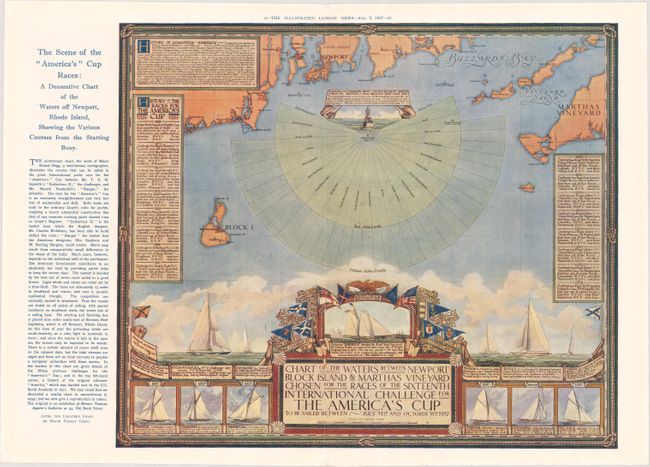
Auction 176, Lot 132
Subject: New England - United States
Chart of the Waters Between Newport Block Island & Marthas Vineyard Chosen for the Races of the Sixteenth International Challenge for the America's Cup..., 1937
Size: 15.6 x 13.3 inches (39.6 x 33.8 cm)
Estimate: $110 - $140
Map Promoting the 1937 America's Cup Race
Sold for: $120
Closed on 2/12/2020
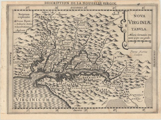
Auction 176, Lot 133
Subject: Colonial Mid-Atlantic United States
Jansson, Jan
Nova Virginiae Tabula, 1630
Size: 7.5 x 5.2 inches (19.1 x 13.2 cm)
Estimate: $700 - $850
Second Derivative of John Smith's Map of Virginia
Unsold
Closed on 2/12/2020
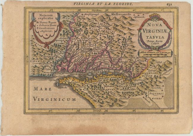
Auction 176, Lot 134
Subject: Colonial Mid-Atlantic United States
Mercator/Cloppenburgh
Nova Virginiae Tabula, 1630
Size: 10 x 7.3 inches (25.4 x 18.5 cm)
Estimate: $700 - $850
First Edition
Sold for: $450
Closed on 2/12/2020
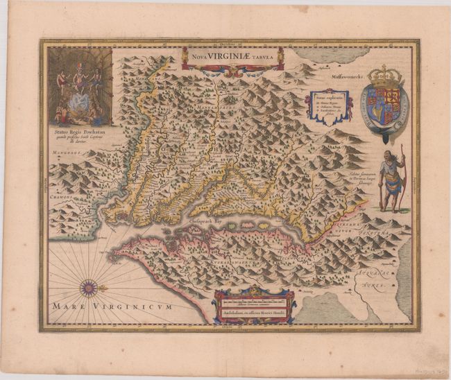
Auction 176, Lot 135
Subject: Colonial Mid-Atlantic United States
Hondius, Henricus
Nova Virginiae Tabula, 1646
Size: 19.4 x 15 inches (49.3 x 38.1 cm)
Estimate: $1,800 - $2,100
One of the Most Important 17th Century Maps of the Chesapeake Bay
Sold for: $1,100
Closed on 2/12/2020
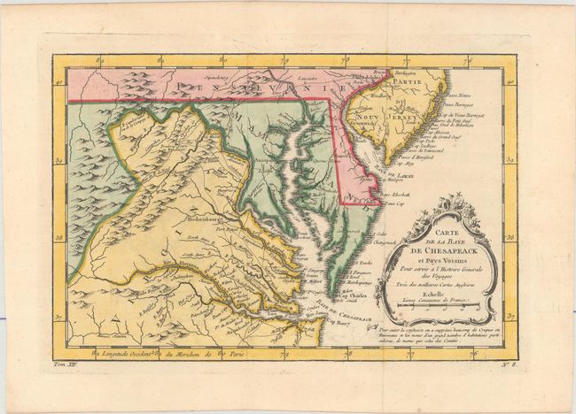
Auction 176, Lot 136
Subject: Colonial Mid-Atlantic United States
Bellin, Jacques Nicolas
Carte de la Baye de Chesapeack et Pays Voisins pour Servir a l'Histoire Generale des Voyages..., 1757
Size: 11.4 x 7.5 inches (29 x 19.1 cm)
Estimate: $220 - $250
Sold for: $220
Closed on 2/12/2020
186 lots
Page 1 of 4