Subject: Holy Land, History Book
Period: 1714 (published)
Publication:
Color: Black & White
Size:
10.8 x 16.4 inches
27.4 x 41.7 cm
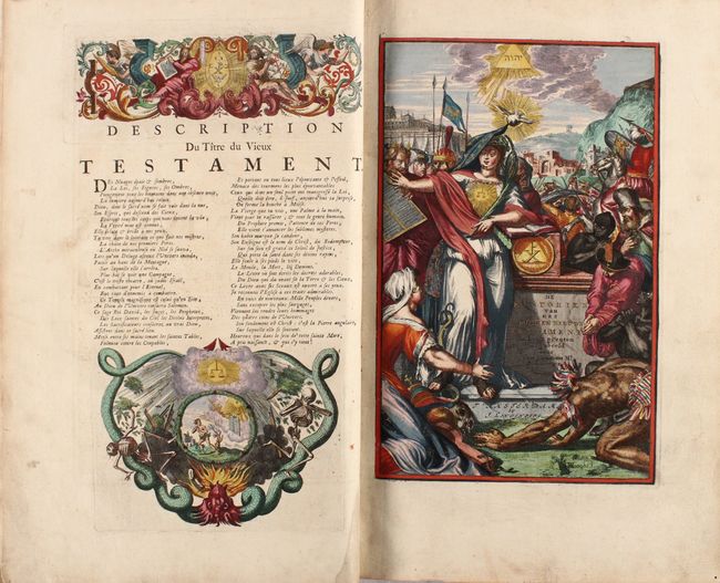
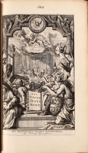
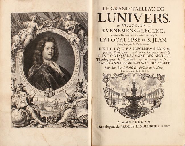
This important and highly-sought after ecclesiastical history includes 5 maps and over 100 engravings illustrating the Old and New Testament. This work was created by Jacques Basnage (1653-1723), a Protestant theologian and Minister. The magnificent maps and engravings were created by Dutch artist Romain de Hooge (1645-1708) and are representative of the Baroque style. In addition to the engravings of biblical scenes are two frontispieces and two full-page portraits of Jacques Basnage and Johannis Trip, head of the Dutch East India Company and the person to whom the book was dedicated. The maps included are:
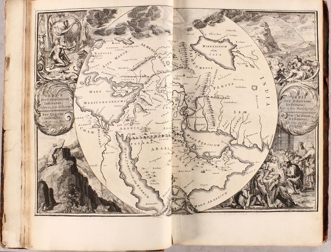
A. Orbis per Creationem Institutus... / Orbis per Diluvium Destitutus... This is one of the most unusual and decorative maps depicting the region of Paradise. It covers the region from Asia Minor to India and all of the Arabian peninsula within a circle. The Garden of Eden is located at center. At the top is the Tetragrammaton in a triangle. Surrounding the map are four scenes: Adam and Eve in the Garden, Noah's Ark after the Deluge, Moses receiving the Ten Commandments, and the birth of Christ. References: Laor #341; Poortman & Augusteijn #154.
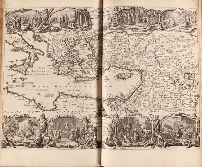
B. De Beschryvinge van de Reysen Pauli en van de Andere Apostelen... This beautiful map of the eastern Mediterranean region details the travels of Apostle Paul. It is richly decorated with scenes from St. Paul's travels in vignettes along the top and bottom and the track of his ship in the sea.
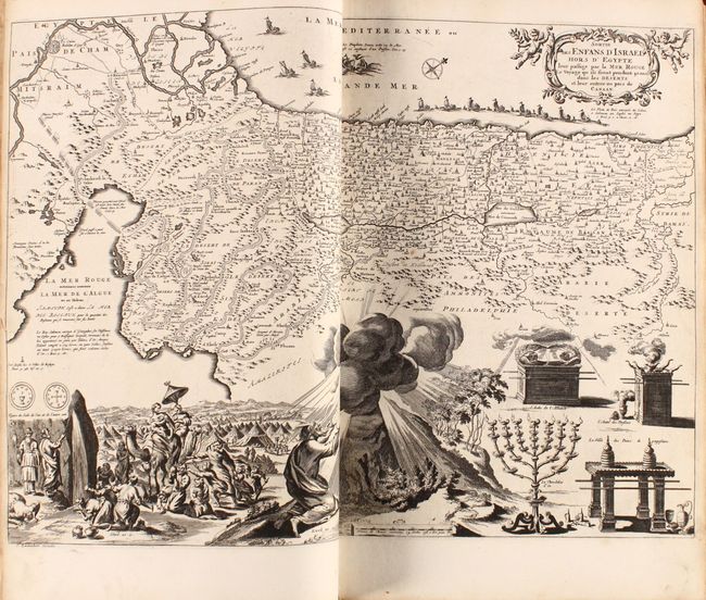
C. Sortie des Enfans d'Israel hors d'Egypte... This map depicts the Exodus from Egypt and the wanderings of the Children of Israel. The lower part of the map is elaborately engraved with a scene of the encampment and Moses receiving the Ten Commandments at Mt. Sinai.
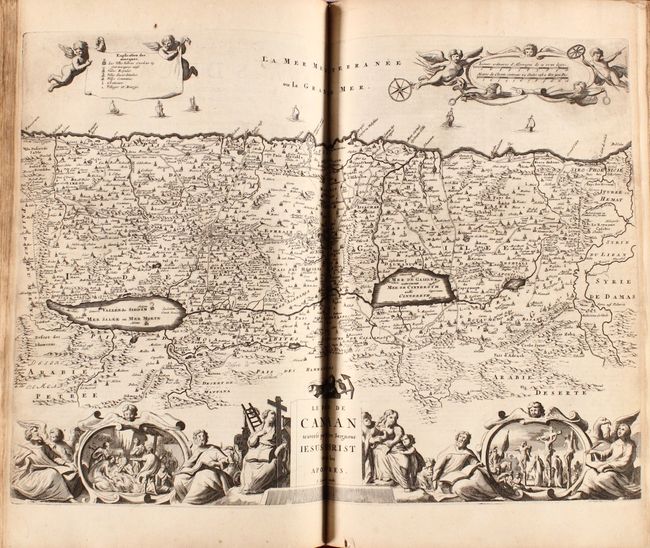
D. Le Pays de Canaan Traverse par Nostre Seigneur Iesus Christ et par les Apostres. Graphic map of Israel filled with biblical scenes. A compass rose orients the map with north in the top right corner. The large decorative title cartouche at bottom is flanked with the four evangelists and vignettes depicting the life of Christ, including his birth and crucifixion. At top, putti hold a banner with the key to the map and a cartouche with the scale of miles.
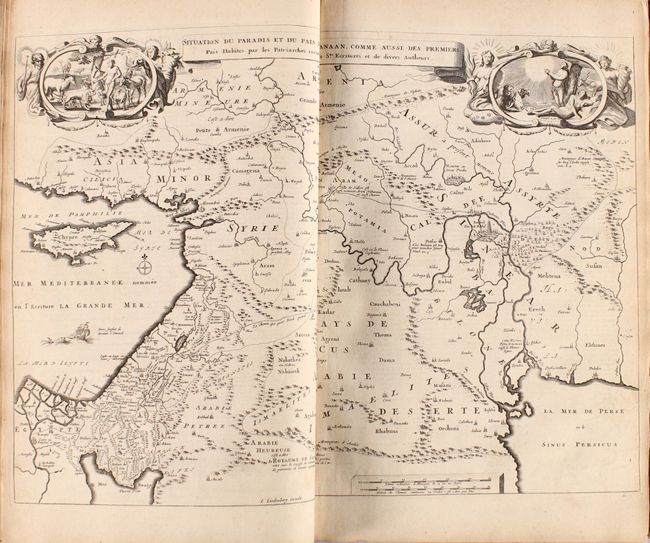
E. Situation du Paradis et du Pais de Canaan... This interesting map covers the region from the Mediterranean through the Persian Gulf. Two vignettes of the Garden of Eden fill the top corners.
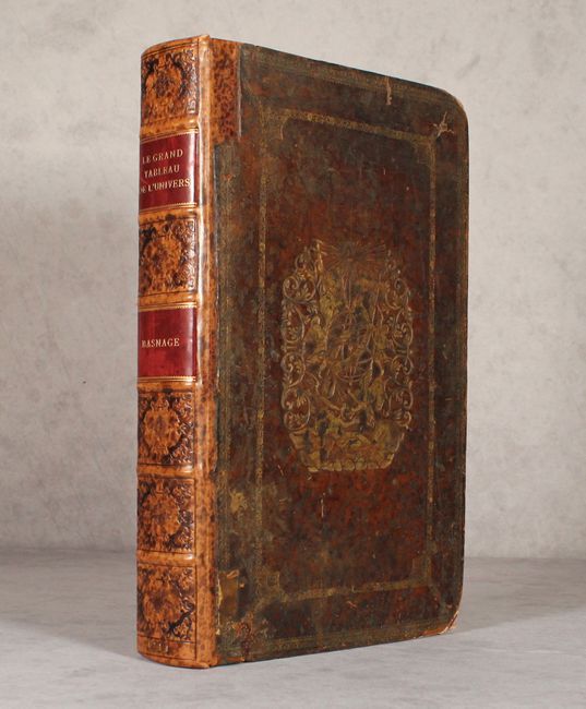
Folio. This is the 8th edition, published in Amsterdam by Jaques Lindenberg. Period calf covers with large stamped gilt vignette of an armillary sphere and angels. Spine rebacked with modern calf and red gilt title labels. New endpapers.
References:
Condition: B+
Maps are in very good to near fine condition with narrow side margins, as issued, light toning along the edges of the sheets, and a few short edge tears. The engravings are in excellent condition with occasional minor toning or soiling. Text has minor toning and soiling. The title page and first leaves are detached with small chips and tears along the edges, with one leaf pasted together obscuring at least one page of text. The covers are worn and scuffed with bumped and exposed corners.