Subject: References
Period: 1972-92 (published)
Publication:
Color:
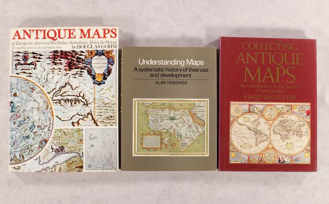
A. Understanding Maps - A Systematic History of Their Use and Development, by A.G. Hodgkiss, published 1981, black & white, (8.5 x 11.0"). This reference provides an overview of developments in mapmaking from ancient times to the modern era, emphasizing the ways in which maps communicate crucial information about the world by visual means. It contains great information of mapmaking techniques and printing methods. 209 pp. with 126 illustrations and a good bibliography. Hardbound in red buckram with gilt titles and dust jacket. Condition: Text is near fine with faint damp staining along top edge. Damp stains are also faintly visible on covers and dust jacket. (A)
B. Antique Maps of Europe, the Americas, West Indies, Australasia, Africa, the Orient, by Douglas Gohm, published 1972, printed color, (9.6 x 12.8"). This fine overview of antique maps features brief biographies of major cartographers. It covers a very wide selections of maps from the 15th to the 19th centuries. 128 pp., nearly 170 illustrations, 65 in full color. Hardbound in rust cloth with gold title and decoration on cover and an illustrated dust jacket. Condition: Contents are good with minor damp stains at the very top and bottom of the gutter. Hinges are starting. Damp stains are not visible on cover, but can be seen on the dust jacket, which also has a couple tears, one of which has been partially repaired with tape. (B+)
C. Collecting Antique Maps - An Introduction to the History of Cartography, by Jonathan Potter, published 1992, printed color, (8.8 x 12.0"). This is a very nice introduction to collecting antique maps. Text and illustrations, many in color, cover all parts of the world from about 1500 to 1850. The book is divided into three sections: Looking at Maps deals with collecting - how to look at antique maps and starting a collection; Mapping the World and Its Countries focuses on the great variety of antique maps, charts, plans, and globes; Globes, Curiosities and Miniatures looks at maps and globes with a difference - maps as objects, celestial and thematic maps and maps of amusement. 192 pp. Hardbound in red with gilt title on spine and an illustrated dust jacket. Condition: Contents are tight with faint damp stains visible on the top edge of the text. (A)
References:
Condition:
See description above.