Subject: Atlases
Period: 1835 (published)
Publication:
Color: Hand Color
Size:
15.4 x 22 inches
39.1 x 55.9 cm
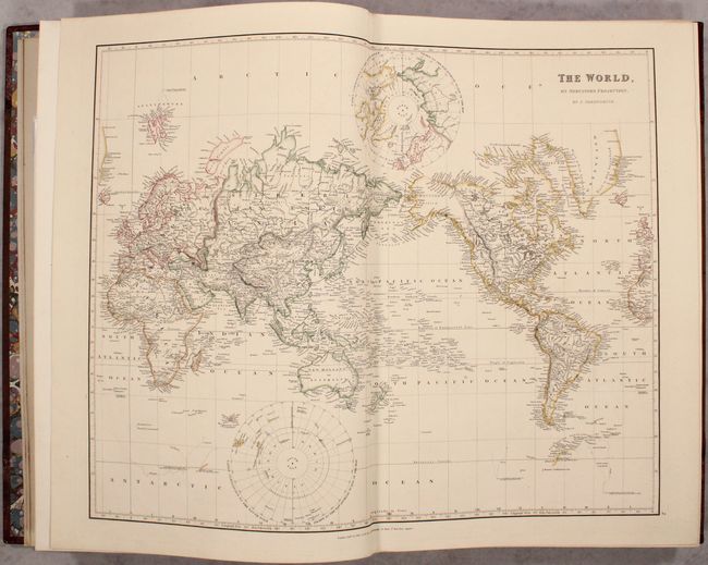
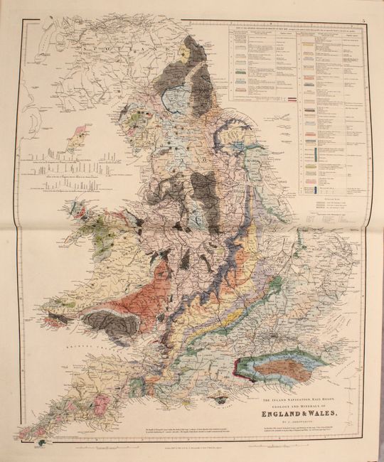
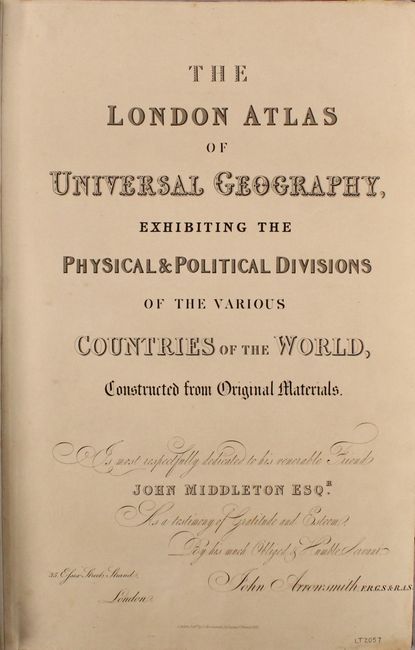
This is considered to be one of the finest 19th century English atlases produced and combines elegance and modern detail in its presentation. John Arrowsmith, nephew of Aaron Arrowsmith, first published the London Atlas in 1834, with subsequent publications in 1835, 1838, 1839, 1840, 1842 and 1858. This second edition example from 1835 contains 50 double-page maps consisting of the world (2), Europe (19), Africa (5), Asia (9), Australia (3), and Americas (12). The maps are dated 1832-1834.
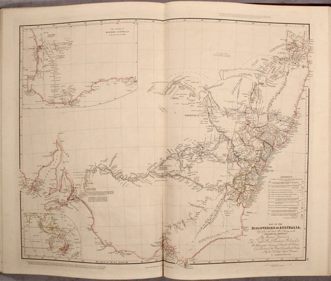
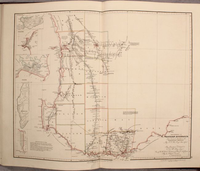
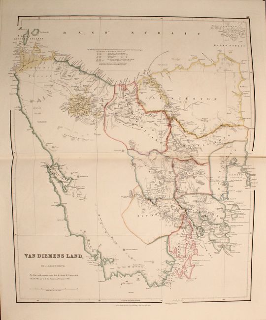
Of particular interest are the maps of Australia including Map of the Discoveries in Australia, Discoveries in Western Australia, and Van Diemen's Land. These three maps reflect British exploration over the last 50 years of settlement in the southern portion of the continent. The Map of the Discoveries in Australia depicts the southeastern portion of Australia from Spencer Gulf to Brisbane. Two insets are included, The Colony of Western Australia shows the area from Cape Le Grand to Perth. The second is untitled and shows a broad area from New Zealand northwest to India.
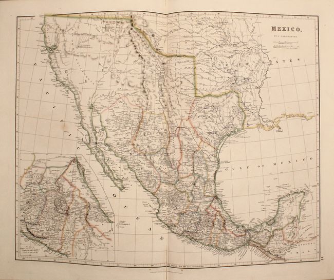
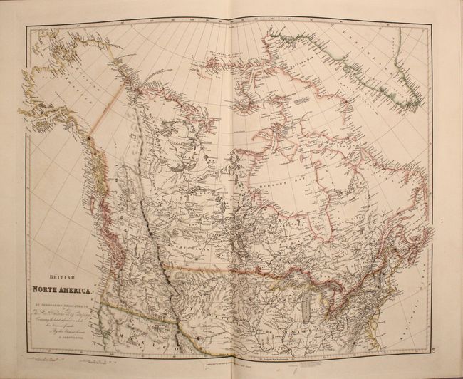
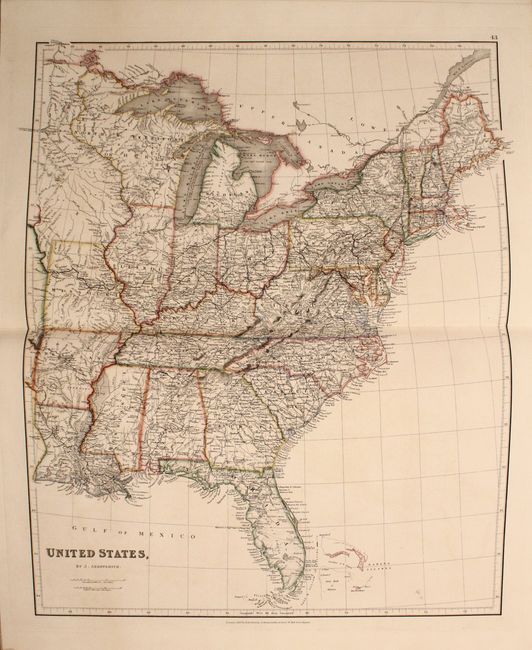
Also of interest are the seven maps of North America. Mexico depicts the southwestern United States, Texas and Mexico, and was published only one year prior to Texas gaining independence from Mexico. In Upr. or New California, there is an American Fur Co. Depot on the eastern shore of Youta or Gt. Salt L.. The Great Spanish Road is shown extending from the Red River on the US-Mexico boundary and past Santa Fe to Nutrias. A note through present-day New Mexico states that the area is "frequented by roving bands of Indians who roam about in the quest of game." The maps of America and British North America show the Pacific Northwest from a British point of view, with the United States boundary disappearing at the Rocky Mountains.
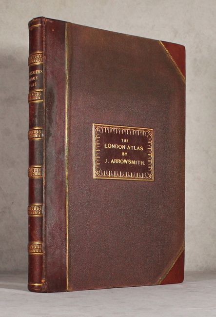
Title page, preface/contents page, and 50 tipped in double-page maps. A few of the maps have folded extensions to provide additional geographic detail. Elephant folio, hardbound in original quarter leather with tips and leather title label over pebbled cloth. Raised bands and gilt title on spine.
References: Phillips (Atlases) #764.
Condition: A
Crisp impressions on sturdy sheets with occasional faint offsetting or a spot of foxing. There is light external wear with bumped edges. An attractive example.