Subject: Colonial New England United States
Period: 1778 (dated)
Publication: London Magazine
Color: Hand Color
Size:
9.4 x 7.1 inches
23.9 x 18 cm
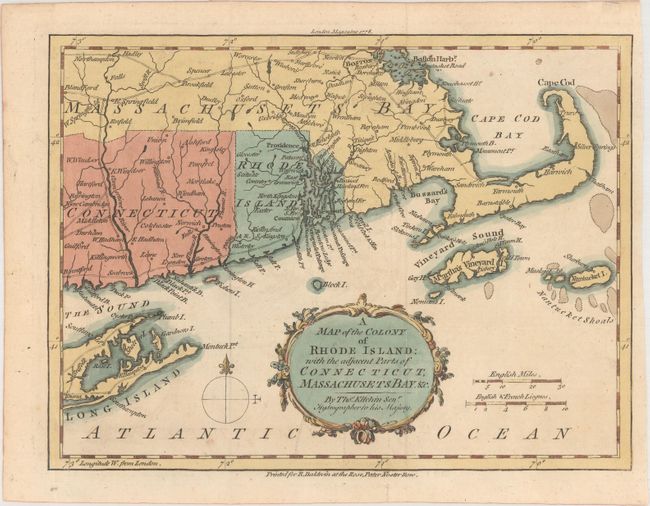
An uncommon, small map of Rhode Island extending north to Boston and Boston Harbor, and south to Long Island, New York. Martha's Vineyard and Nantucket Island are depicted, along with the roads, towns and rivers in the region. The map illustrates a major theater in the war for American independence following France’s recognition of the United States. American and British forces had been at a standoff at Newport since the beginning of the war. News of the French involvement rallied support for the cause, and militia began streaming into Rhode Island from the adjacent colonies. Several small conflicts culminated in the Siege and Battle of Rhode Island on August 29, 1778. The map is adorned with a decorative title cartouche and compass rose. Published in the November 1778 edition of London Magazine.
References: Jolly #LOND-327; Sellers & Van Ee #825.
Condition: A
Issued folding.


