Subject: United States, Oil
Period: 1952 (dated)
Publication:
Color: Printed Color
Size:
45.9 x 34.6 inches
116.6 x 87.9 cm
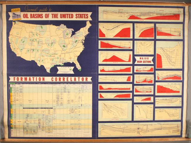
This detailed, linen-backed map was issued as a supplement to the Oil and Gas Journal (Volume 50, No. 46) by the Petroleum Publishing Company in Tulsa. The top left quadrant contains a map of the United States detailing the major oil basins in the lower 48 states. Below the map is a "formation correlator" which details geologic types by various geographic regions. The right half of the sheet consists of 23 geological cross-sections of the major oil basins with corresponding A-B red lines drawn on the map to show their respective paths.
References:
Condition: B+
The map, backed with linen, is mostly clean and colorful with some minor abrasions mostly at upper left. There are also a few pencil notations around the map image. Original rollers are present and intact.


