Subject: Colonial Northeastern United States & Canada
Period: 1757 (published)
Publication: Universal Magazine
Color: Hand Color
Size:
14.4 x 10.8 inches
36.6 x 27.4 cm
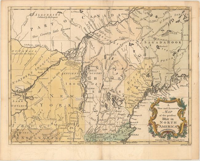
This uncommon French and Indian War map would have provided an invaluable glimpse into the war for readers across the Atlantic. The map covers the region from Boston north to Quebec, and goes as far west as Lake Ontario. There is excellent detail of the area, with many rivers, lakes, towns, and cities identified. Various forts and camps are located, and a note in New Hampshire indicates a Barrier against the Indians. Indian territories are labeled, with the Iroquois apparent as the dominant tribe in the vicinity. A decorative title cartouche adorns the bottom right corner. Engraved by R.W. Seale.
References: Jolly #UNIV-58; Sellers & van Ee #79.
Condition: A
Issued folding on watermarked paper with minor offsetting and a hint of toning. There is a binding trim at bottom right that has been replaced with old paper, and a couple short fold separations in the blank margins have been repaired with archival materials on verso.