Subject: Colonial Northeastern United States & Canada, Great Lakes
Period: 1784 (circa)
Publication: Atlas Universel
Color: Hand Color
Size:
23.8 x 18.8 inches
60.5 x 47.8 cm
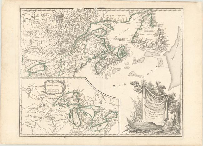
This is a handsome map of Newfoundland, Nova Scotia, and the entire course of the St. Lawrence River. The most prominent feature of the map is the very large inset of the 1744 Bellin version of the Great Lakes. The wonderful cartouche features the title on a blanket draped over a wooden canoe, which appears beside a threatening beaver. This is the fifth state, with Groux named as engraver of the cartouche and the date removed. This state is noted as the fourth state by Pedley and is not listed in Kershaw.
References: Karpinski p.141-42; cf. Kershaw #356; McCorckle #755.36; Pedley #459; Sellers and Van Ee #61.
Condition: A
On a watermarked sheet with a few minor spots in the image. There are professional repairs to chips in the top corners of the sheet, far from the map image.