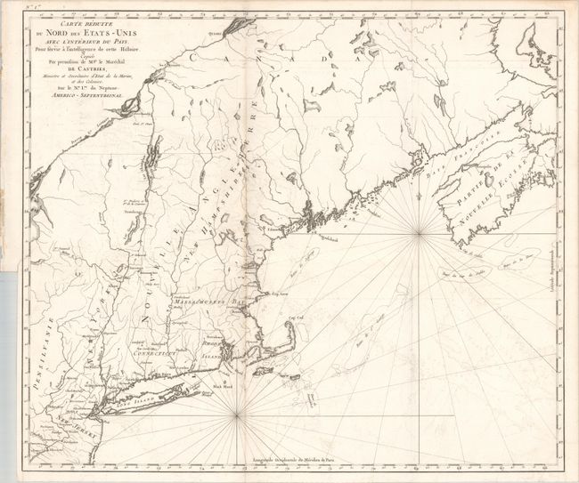
Subject: Northeastern United States & Canada
Period: 1830 (circa)
Publication: Histoire de la Guerre de l'Independance des Etats-Unis...
Color: Black & White
Size:
22.9 x 19.6 inches
58.2 x 49.8 cm
This map of the Northeast was issued in Odet-Julien Le Boucher's Histoire de la Guerre de l'Independance des Etats-Unis..., a notable French account of the Revolutionary War. Howes describes the volume (not included) as the "best French chronicle of the Revolution; particularly valuable on naval affairs." The map covers the region from Philadelphia north to above Nova Scotia and shows settlements primarily along the coastline with the river systems well developed in the interior. A number of forts are identified between Lake George and Quebec including Fort Chambly, Fort St. Jean, and Fort Frederick. Howes notes editions of the Histoire in 1787, 1788, and 1830.
References: Sabin #39613; Howes #L-169.
Condition: B+
Issued folding with light offsetting and minor toning along one fold. An 1" binding tear at left has been closed on verso with old paper.


