Subject: Colonial Eastern United States & Canada
Period: 1780 (circa)
Publication: Guthrie's New System of Modern Geography...
Color: Hand Color
Size:
14.8 x 13.4 inches
37.6 x 34 cm
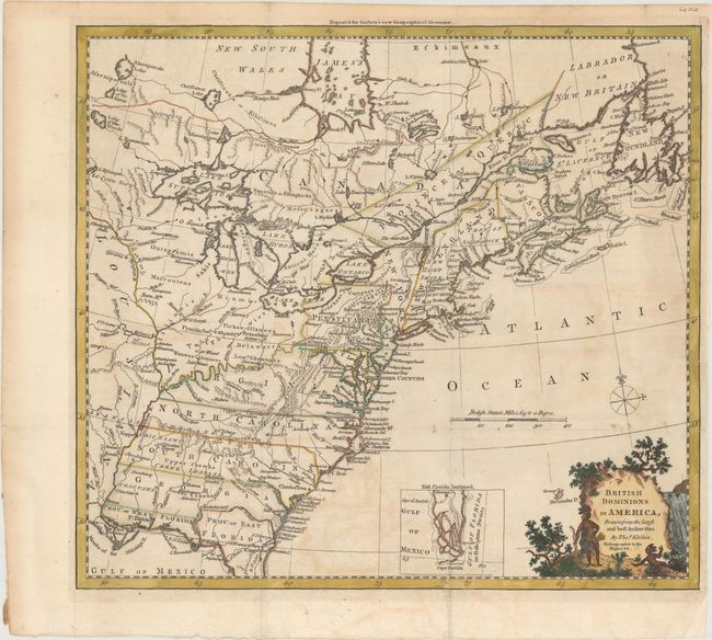
This handsome colonial period map covers the area east of the Mississippi River and from James Bay to the Gulf of Mexico. It shows the provinces and colonies, towns and cities, Indian villages and tribal territory, forts, and other points of interest. The British Colonies extend to the Mississippi River and include the Canadian Province of Quebec, Nova Scotia, Labrador, and Newfoundland, thus relegating the French colonies to the frontier. Florida is divided into two provinces with the northern boundary of East Florida extending north of the 31° parallel, reflecting a long boundary dispute between Britain and Spain. The southern tip of Florida is presented in an inset as a group of large islands.
References: McCorkle #780.6; Goss (NA) #64.
Condition: B+
Issued folding on paper with the watermark of a horn coat of arms and the initials "GR." There is minor offsetting and toning and some short fold separations that have been repaired with archival materials on verso.