Catalog Archive
Auction 171, Lot 141

"Johnson's New Military Map of the United States Showing the Forts, Military Posts &c. with Enlarged Plans of Southern Harbors...", Johnson and Ward

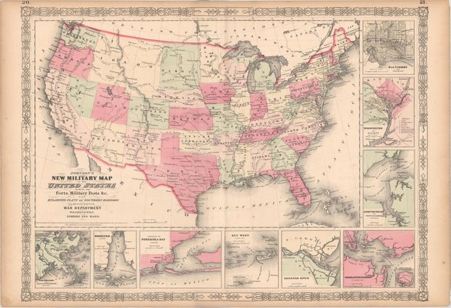
Subject: United States, Civil War

Period: 1861 (dated)

Publication:

Color: Hand Color

Size:
23.9 x 17.4 inches
60.7 x 44.2 cm
Download High Resolution Image
(or just click on image to launch the Zoom viewer)

This is the more desirable issue of this Civil War period map, with the state and territory borders instead of the Military Districts. The large western territories include Dakota, Idaho (incorporating present-day Wyoming), Montana, and a truncated Nevada with Arizona encompassing the region containing Las Vegas. Hundreds of military forts are located. The map has at bottom and right nine inset plans of the major towns and harbors including Hampton Roads, Charleston Harbor, Key West, Baltimore, and Washington. Copyright date 1861, but published circa 1864

References:

Condition: B+

There is faint offsetting, some small spots, and light toning along the sheet's edges.

Estimate: $200 - $230

Sold for: $100

Closed on 2/6/2019

Archived