Subject: Niagara Falls, New York, Canada
Period: 1853 (dated)
Publication:
Color: Hand Color
Size:
28.3 x 22.7 inches
71.9 x 57.7 cm
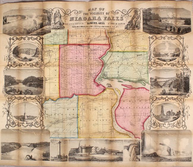
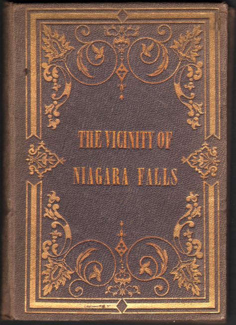
This attractive, rare map is centered on Niagara Falls and extends to include Niagara and Erie counties on the American side, and the former Welland County on the Canadian side. Details include individual property owners/buildings, railroads, wagon roads, the Tuscarora Indian reservation, and more. The map is surrounded by thirteen vignettes of the region including four of the Falls in the corners of the sheet. It is further decorated by an Indian and settler flanking the title. Folds into brown cloth boards (3.75 x 5.25") with gilt title and decorative elements on the front cover. Published by Samuel Geil and J.L. Delp in Philadelphia. Only one example has been offered for sale in the last thirty years.
References:
Condition: B
Issued folding with light toning along the fold lines and several short splits at fold intersections and minor edge tears that have been partially closed on verso with archival tape. There is minor loss at a few fold intersections, and the covers are sunned.