Filtered by Category:United States(Show All Categories)
Showing results for:Auction 117
Catalog Archive
251 lots
Page 1 of 6
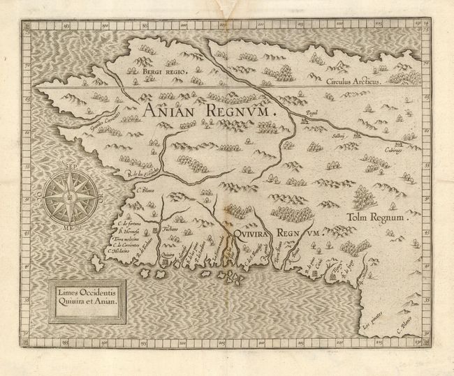
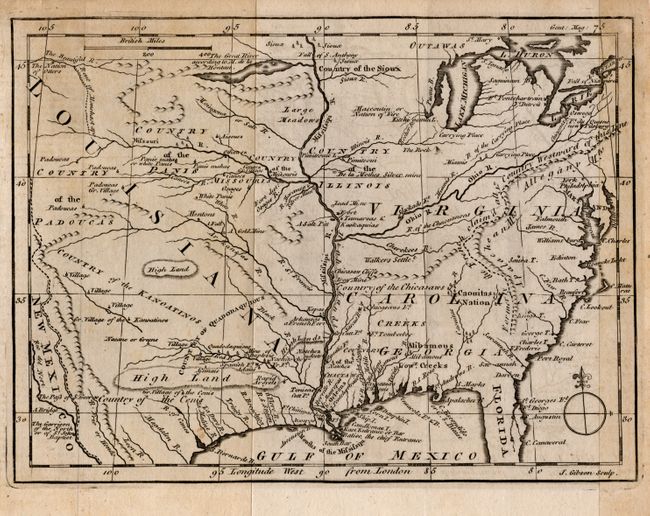
Auction 117, Lot 94
Subject: Western Canada & Alaska
Wytfliet, Cornelis
Limes Occidentis Quivira et Anian, 1607
Size: 11.5 x 9.2 inches (29.2 x 23.4 cm)
Estimate: $1,900 - $2,100
Unsold
Closed on 12/6/2006
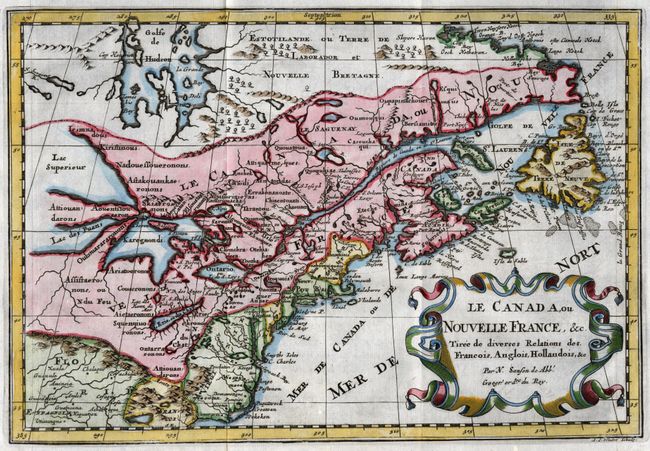
Auction 117, Lot 112
Subject: Colonial United States and Canada - Great Lakes
Sanson, Nicolas
Le Canada, ou Nouvelle France, &c. Tiree de diverses Relations des Francois, Anglois, Hollandois, &c., 1699
Size: 12 x 8.2 inches (30.5 x 20.8 cm)
Estimate: $600 - $700
Sold for: $850
Closed on 12/6/2006
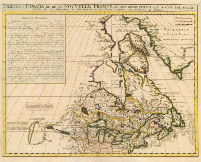
Auction 117, Lot 113
Subject: Colonial United States and Canada - Great Lakes
Chatelain, Henry Abraham
Carte du Canada ou de la Nouvelle France, & Des Decouvertes Qui Y Ont Ete Faites, Dressee sur les observations les plus Nouvelles, & sur divers Memoires tant Manuscrits qu' imprimez, 1719
Size: 20.4 x 15.8 inches (51.8 x 40.1 cm)
Estimate: $850 - $1,000
Sold for: $1,100
Closed on 12/6/2006
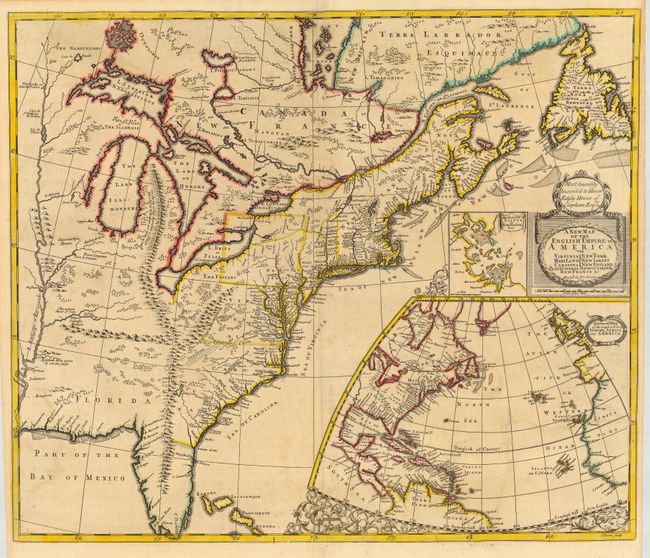
Auction 117, Lot 114
Subject: Colonial United States and Canada
Morden/Senex
A New Map of the English Empire in America viz Virginia, Maryland, Carolina, New York, New Iarsey, New England…, 1719
Size: 23.3 x 19.8 inches (59.2 x 50.3 cm)
Estimate: $2,000 - $2,500
Sold for: $2,500
Closed on 12/6/2006
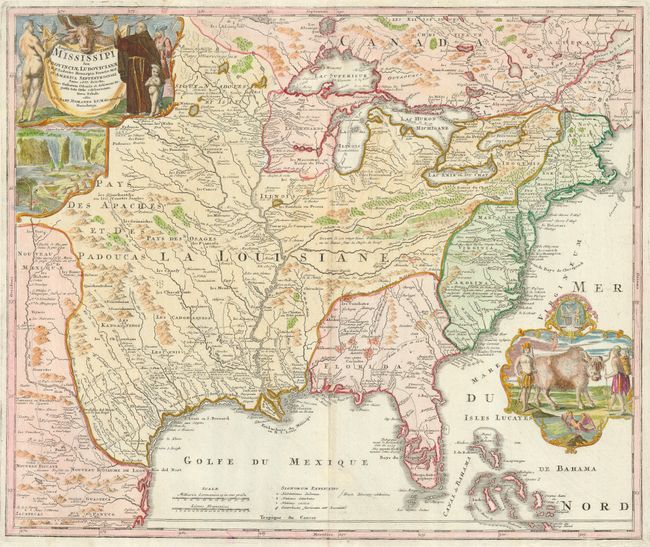
Auction 117, Lot 116
Subject: Colonial United States and Canada
Homann, Johann Baptist
Amplissimae Regionis Mississipi Seu Provinciae Ludovicianae…, 1740
Size: 23 x 19.3 inches (58.4 x 49 cm)
Estimate: $2,100 - $2,400
Sold for: $1,600
Closed on 12/6/2006
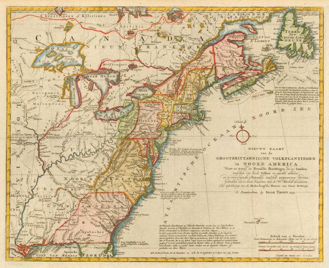
Auction 117, Lot 117
Subject: Colonial United States and Canada
Tirion, Isaac
Nieuwe Kaart van de Grootbrittannische Volkplantingen in Noord America, 1755
Size: 18 x 14.3 inches (45.7 x 36.3 cm)
Estimate: $800 - $900
Sold for: $600
Closed on 12/6/2006
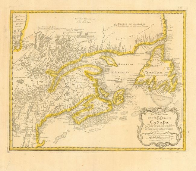
Auction 117, Lot 118
Subject: Colonial United States and Canada
Homann Heirs
Partie Orientale de la Nouvelle France ou du Canada, 1755
Size: 21.2 x 16.8 inches (53.8 x 42.7 cm)
Estimate: $550 - $650
Sold for: $350
Closed on 12/6/2006
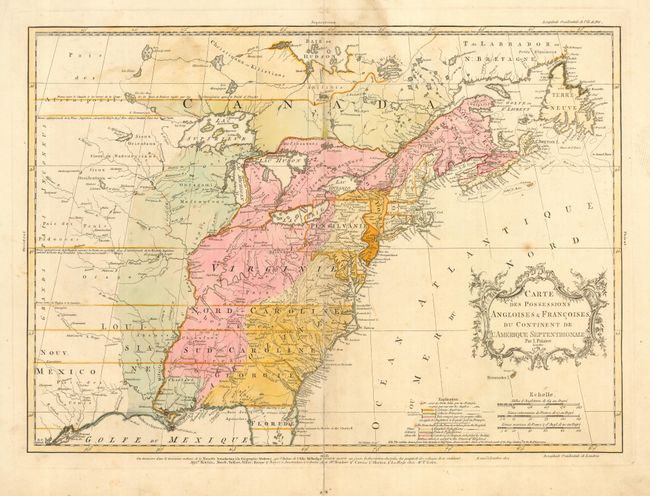
Auction 117, Lot 119
Subject: Colonial United States and Canada
Palairet, Jean
Carte des Possessions Angloises & Francoises du Continent de l'Amerique Septentrionale, 1756
Size: 22.5 x 16.7 inches (57.2 x 42.4 cm)
Estimate: $2,200 - $2,400
Sold for: $1,600
Closed on 12/6/2006
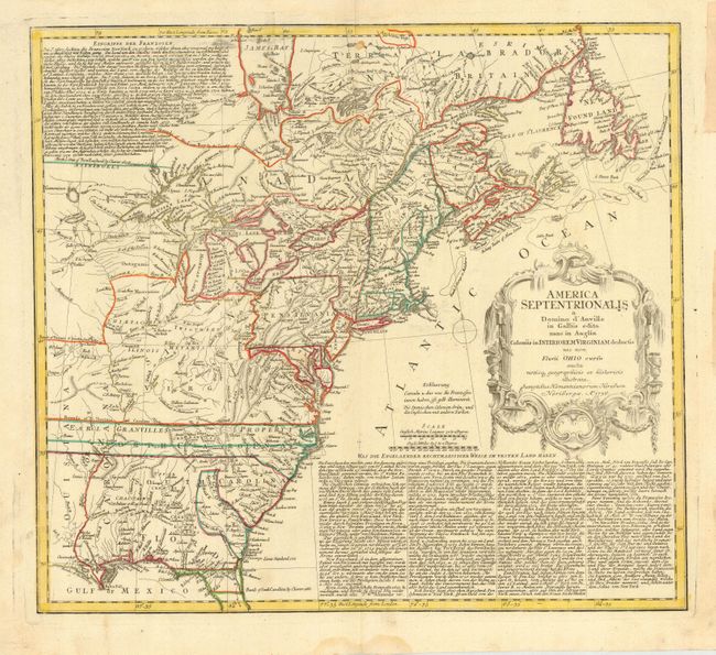
Auction 117, Lot 120
Subject: Colonial United States and Canada
Homann Heirs
America Septentrionalis a Domino d'Anville in Galliis edita nunc in Anglia Coloniis in Interiorem Virginiam deductis nec non Fluvii Ohio cursu…, 1756
Size: 19.8 x 17.8 inches (50.3 x 45.2 cm)
Estimate: $800 - $900
Unsold
Closed on 12/6/2006
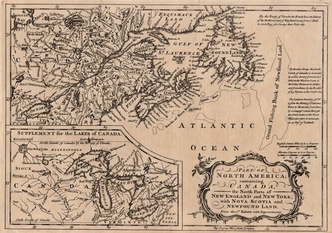
Auction 117, Lot 121
Subject: Colonial United States and Canada
Anon.
Part of North America; containing Canada, the North Parts of New England and New York; with Nova Scotia and Newfoundland. From the Sr. Robert with Improvements, 1760
Size: 11.5 x 8 inches (29.2 x 20.3 cm)
Estimate: $300 - $400
Sold for: $200
Closed on 12/6/2006
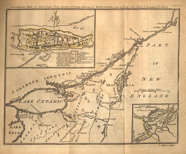
Auction 117, Lot 122
Subject: Colonial United States and Canada
Gibson, John
A Particular Map, to Illustrate Gen. Amherst's Expedition, to Montreal; with a Plan of the Town & Draught of ye Island, 1760
Size: 9 x 7 inches (22.9 x 17.8 cm)
Estimate: $170 - $200
Sold for: $160
Closed on 12/6/2006
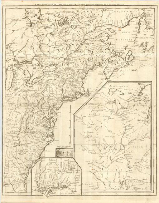
Auction 117, Lot 123
Subject: United States & Canada
Le Rouge, George Louis
Carte d'une Partie de l'Amerique Septentrionale, pour servir a l'Histoire de la derniere Guerre, 1787
Size: 19.5 x 24.2 inches (49.5 x 61.5 cm)
Estimate: $1,500 - $1,700
Unsold
Closed on 12/6/2006

Auction 117, Lot 124
Subject: Colonial Canada, New York
Bellin, Jacques Nicolas
Partie du Fleuve St. Laurent depuis Quebec jusqu'au Lac St. Francois [on sheet with] Carte du Lac Champlain, 1764
Size: 12.2 x 8.2 inches (31 x 20.8 cm)
Estimate: $140 - $180
Sold for: $120
Closed on 12/6/2006
Auction 117, Lot 125
Subject: Colonial Great Lakes
Bellin/Homann Heirs
Partie Occidentale de la Nouvelle France ou du Canada, 1755
Size: 21.3 x 16.9 inches (54.1 x 42.9 cm)
Estimate: $1,800 - $2,000
Sold for: $1,600
Closed on 12/6/2006
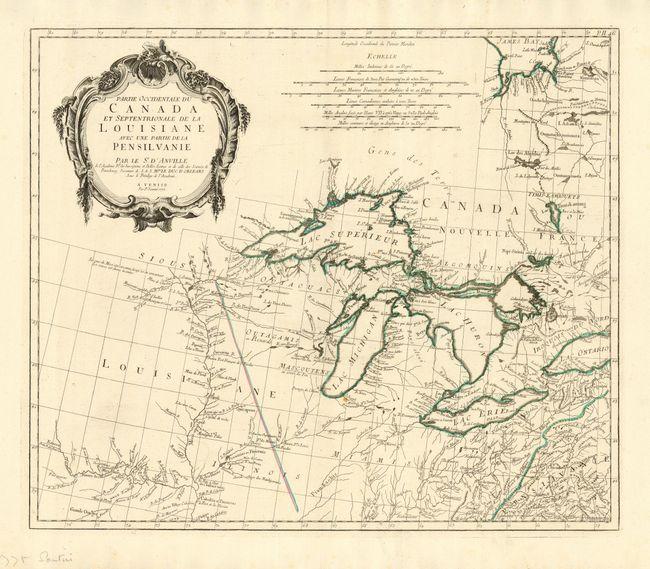
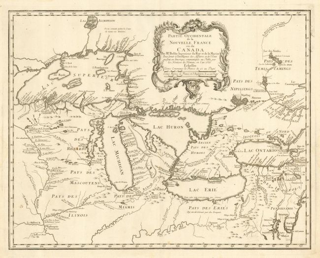
Auction 117, Lot 126
Subject: Colonial Great Lakes
D'Anville/Santini
Partie Occidentale du Canada et Septentrionale de la Louisiane avec une partie de la Pensilvanie, 1775
Size: 22.3 x 18.9 inches (56.6 x 48 cm)
Estimate: $1,100 - $1,300
Sold for: $750
Closed on 12/6/2006
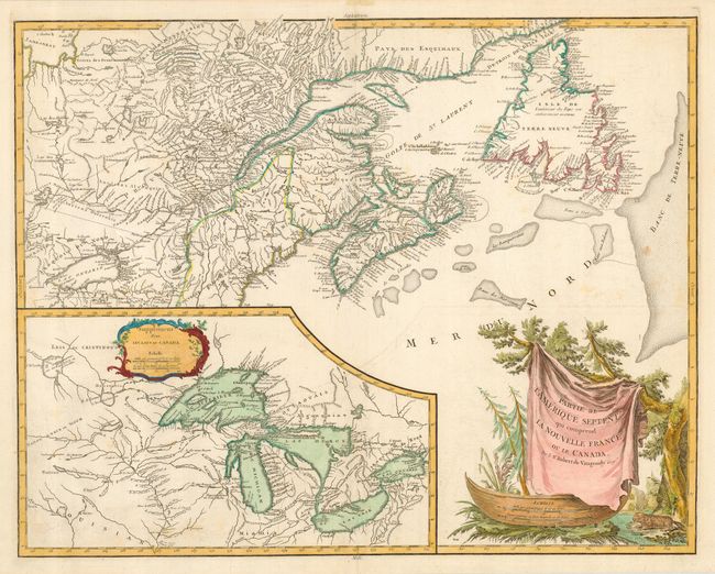
Auction 117, Lot 127
Subject: Colonial United States and Canada - Great Lakes
Robert de Vaugondy
Partie de l'Amerique Septent? qui comprend la Nouvelle France ou le Canada, 1799
Size: 23.5 x 18.7 inches (59.7 x 47.5 cm)
Estimate: $850 - $1,000
Sold for: $525
Closed on 12/6/2006
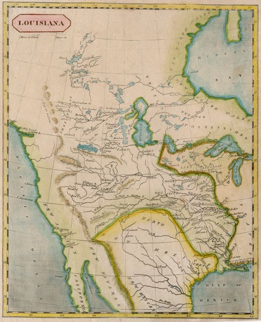
Auction 117, Lot 128
Subject: Canada & United States
Arrowsmith & Lewis
Louisiana, 1804
Size: 8 x 9.8 inches (20.3 x 24.9 cm)
Estimate: $350 - $400
Sold for: $900
Closed on 12/6/2006
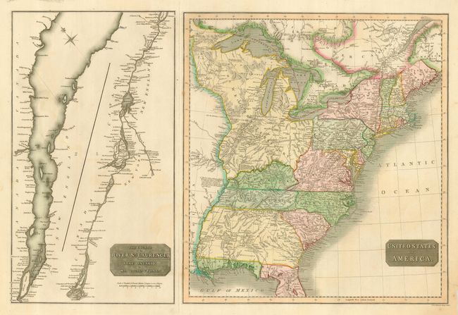
Auction 117, Lot 129
Subject: Canada & United States
Thomson, John
United States of America [on sheet with] The Course of the River St. Laurence, from Lake Ontario, to Manicouagan Point, 1814
Size: 24.5 x 16.1 inches (62.2 x 40.9 cm)
Estimate: $300 - $350
Sold for: $170
Closed on 12/6/2006
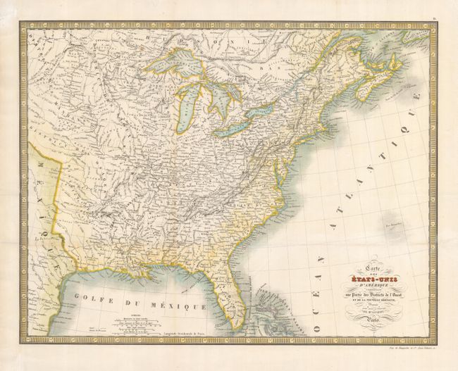
Auction 117, Lot 130
Subject: Eastern Canada and United States
Lapie, Alexander Emile & Pierre
Carte des Etats-Unis d'Amerique Comprenant une Partie des Districts de l'Ouest et da la Nouvelle Bretagne, 1840
Size: 19.5 x 15 inches (49.5 x 38.1 cm)
Estimate: $150 - $200
Unsold
Closed on 12/6/2006
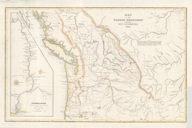
Auction 117, Lot 131
Subject: Northwestern United States and Canada
Wilkes, Charles
Map of the Oregon Territory from the Best Authorities, 1849
Size: 13 x 8 inches (33 x 20.3 cm)
Estimate: $250 - $300
Sold for: $180
Closed on 12/6/2006
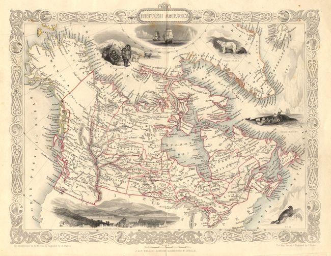
Auction 117, Lot 132
Subject: Canada and Alaska
Tallis, John
British America, 1851
Size: 13 x 10.3 inches (33 x 26.2 cm)
Estimate: $120 - $200
Sold for: $210
Closed on 12/6/2006
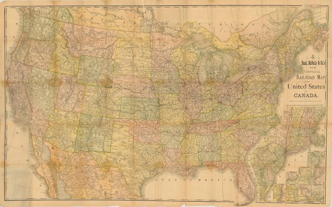
Auction 117, Lot 133
Subject: Canada & United States
Rand McNally & Co.
Rand McNally & Co.'s New Official Railroad Map of the United States and Canada, 1876-1880
Size: 42 x 27 inches (106.7 x 68.6 cm)
Estimate: $250 - $300
Sold for: $130
Closed on 12/6/2006
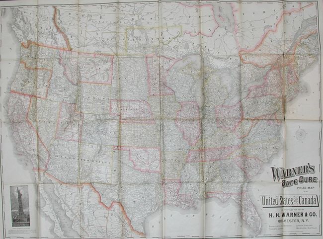
Auction 117, Lot 134
Subject: Canada & United States
Rand McNally & Co.
Warner's Safe Cure Prize Map of the United States and Canada, 1887
Size: 52.5 x 38 inches (133.4 x 96.5 cm)
Estimate: $400 - $500
Unsold
Closed on 12/6/2006
Auction 117, Lot 135
Subject: Colonial United States
Gentleman's Magazine
[Colonial North America, Louisiana, Virginia & Carolina], 1763
Size: 9 x 7 inches (22.9 x 17.8 cm)
Estimate: $220 - $275
Sold for: $275
Closed on 12/6/2006
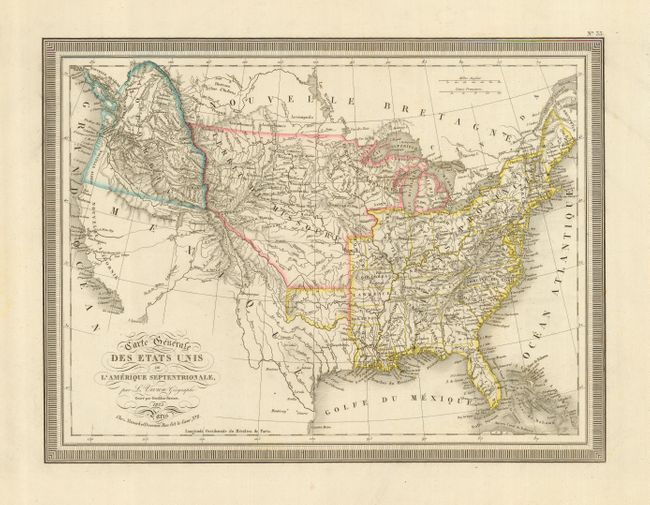
Auction 117, Lot 136
Subject: Canada and United States
Vivien de Saint Martin, Louis
Carte Generale des Etats Unis de l'Amerique Septentrionale, 1825
Size: 16 x 12 inches (40.6 x 30.5 cm)
Estimate: $200 - $250
Sold for: $240
Closed on 12/6/2006
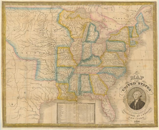
Auction 117, Lot 137
Subject: United States - Eastern
Phelps, Humphrey
Map of the United States Published by J. Webster, 1836
Size: 19.8 x 19 inches (50.3 x 48.3 cm)
Estimate: $900 - $1,200
Unsold
Closed on 12/6/2006
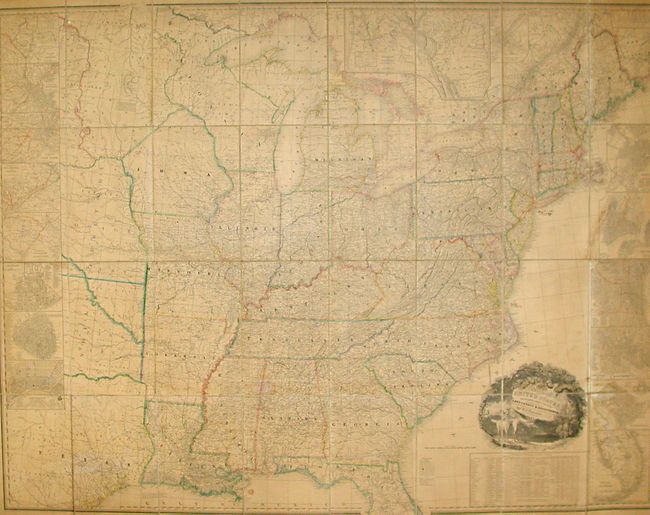
Auction 117, Lot 138
Subject: United States
Tanner, Henry Schenck
A Map of the United States Including Every County Enumerated in the Last Census & Since Formed with Population, of the several States, Railroads Canals &c., 1845
Size: 61 x 46 inches (154.9 x 116.8 cm)
Estimate: $14,000 - $18,000
Unsold
Closed on 12/6/2006
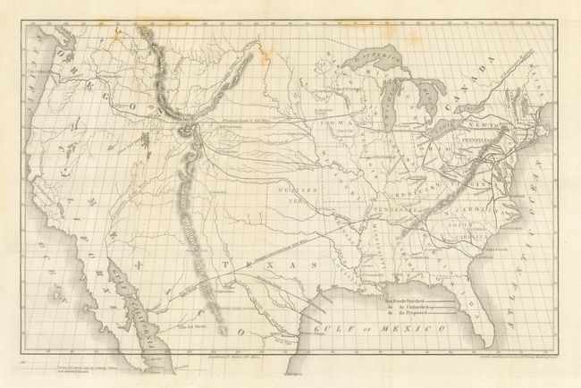
Auction 117, Lot 139
Subject: United States
Whitney, Asa
[Map of Proposed Routes of Western Railroads], 1846
Size: 15.5 x 9.6 inches (39.4 x 24.4 cm)
Estimate: $120 - $140
Sold for: $150
Closed on 12/6/2006
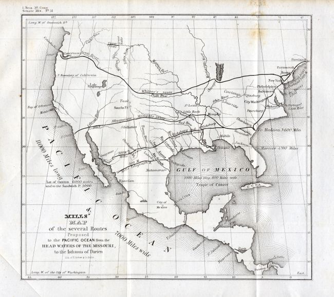
Auction 117, Lot 140
Subject: United States
U.S. Government
Mills' Map of the several Routes Proposed to the Pacific Ocean from the Head Waters of the Missouri, to the Isthmus of Darien, 1848
Size: 9 x 8.3 inches (22.9 x 21.1 cm)
Estimate: $140 - $200
Sold for: $100
Closed on 12/6/2006
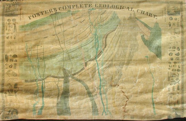
Auction 117, Lot 141
Subject: United States
Foster, J.T.
Foster's Complete Geological Chart. Exhibiting in their Successive Order of Deposition, the Various Rocks, Which Form the Crust of our Globe, Arranged According to the Best Authorities in Europe & America, 1849
Size: 67.5 x 47.5 inches (171.5 x 120.7 cm)
Estimate: $300 - $500
Sold for: $210
Closed on 12/6/2006
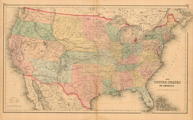
Auction 117, Lot 142
Subject: United States
Colton, Joseph Hutchins
The United States of America, 1859
Size: 25 x 15 inches (63.5 x 38.1 cm)
Estimate: $275 - $325
Sold for: $210
Closed on 12/6/2006
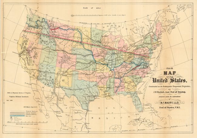
Auction 117, Lot 143
Subject: United States
Maury, M. F.
Plate III. Map of the United States. Constructed on the Rectangular Tangential Projection, by J. H. Waddell, Asst. Prof.of Drawing…, 1868
Size: 26.3 x 18 inches (66.8 x 45.7 cm)
Estimate: $275 - $325
Sold for: $200
Closed on 12/6/2006
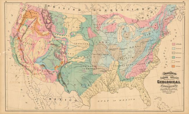
Auction 117, Lot 144
Subject: United States
Gray, Frank
[Lot of 4 - Theamatic Maps], 1873
Size: See Description
Estimate: $150 - $250
Sold for: $160
Closed on 12/6/2006
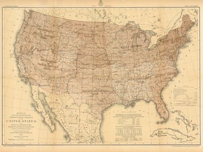
Auction 117, Lot 145
Subject: United States
Wheeler, George (Lt)
Sketch Indicating a Distribution of the Territorial Domain of the United States into Districts Favorable to the Operations of Parties Prosecuting General Government Surveys…, 1879
Size: 28.3 x 19.6 inches (71.9 x 49.8 cm)
Estimate: $120 - $200
Sold for: $50
Closed on 12/6/2006
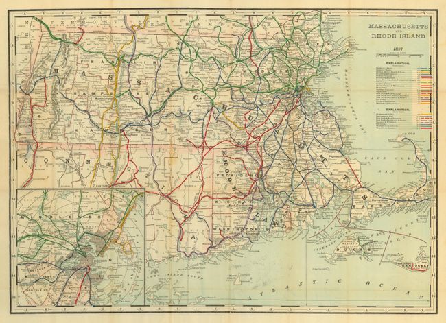
Auction 117, Lot 146
Subject: United States
Cram, George F. & Company
[Lot of 3 Township and Rail Road Maps] Massachusetts and Rhode Island [with] Virginia and West Virginia [and] Louisiana, 1891-1897
Size: See Description
Estimate: $120 - $150
Sold for: $90
Closed on 12/6/2006
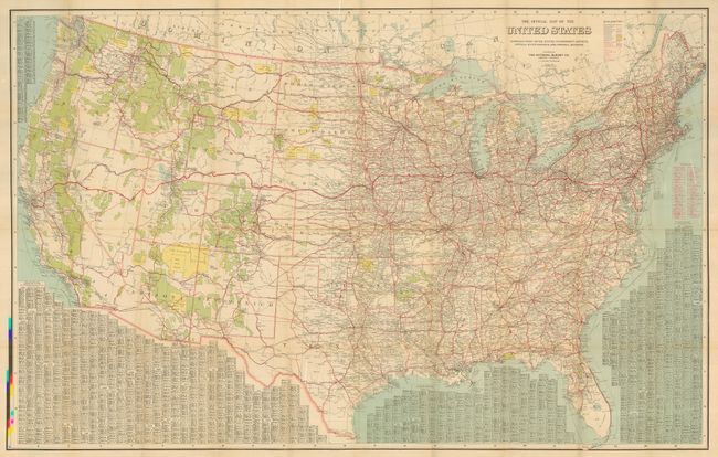
Auction 117, Lot 147
Subject: United States
National Survey Co.
The Official Map of the United States, 1916
Size: 49 x 31.5 inches (124.5 x 80 cm)
Estimate: $150 - $200
Sold for: $85
Closed on 12/6/2006
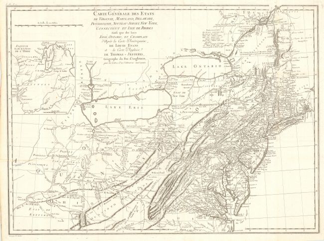
Auction 117, Lot 148
Subject: Eastern United States
Crevecoeur, Michel Guillaume De
Carte Generale des Etats de Virginie, Maryland, Delaware, Pensilvanie, Nouveau-Jersey, New-York, Connecticut et Isle de Rhodes Ainsi que des Lacs Erie, Ontario, et Champlain…, 1787
Size: 25.6 x 18.8 inches (65 x 47.8 cm)
Estimate: $1,500 - $1,800
Unsold
Closed on 12/6/2006
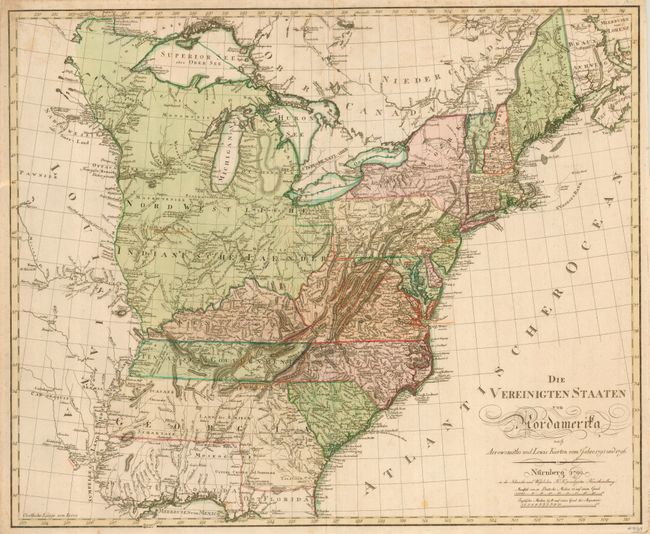
Auction 117, Lot 149
Subject: Eastern United States
Schneider and Weigel
Die Vereinigten Staaten von Nordamerika…, 1799
Size: 25.5 x 21 inches (64.8 x 53.3 cm)
Estimate: $3,000 - $3,250
Sold for: $2,400
Closed on 12/6/2006
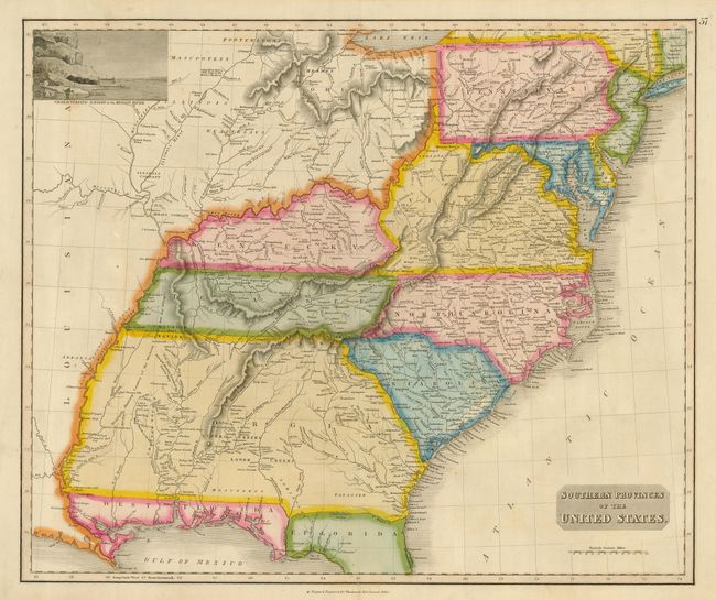
Auction 117, Lot 150
Subject: Eastern United States
Thomson, John
Southern Provinces of the United States, 1817
Size: 23.3 x 19.5 inches (59.2 x 49.5 cm)
Estimate: $600 - $700
Sold for: $500
Closed on 12/6/2006
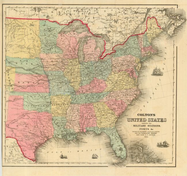
Auction 117, Lot 151
Subject: Eastern United States
Colton, Joseph Hutchins
Colton's United States shewing the Military Stations Forts &c., 1861
Size: 16 x 15 inches (40.6 x 38.1 cm)
Estimate: $375 - $425
Unsold
Closed on 12/6/2006

Auction 117, Lot 152
Subject: Eastern United States
Norie, John William
Chart of North America from Boston to the Strait of Florida and Havana, 1896
Size: 105.5 x 33.75 inches (268 x 85.7 cm)
Estimate: $1,200 - $2,500
Sold for: $1,800
Closed on 12/6/2006
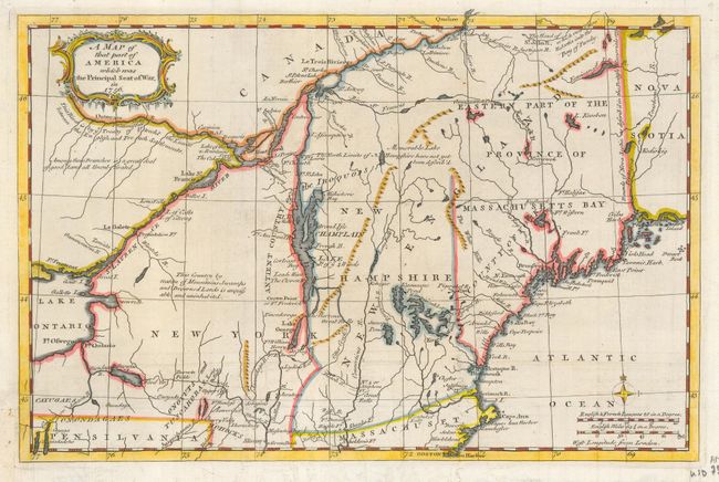
Auction 117, Lot 153
Subject: Colonial New England
Anon.
A Map of that part of America which was the Principal Seat of War, in 1756, 1757
Size: 13 x 8.5 inches (33 x 21.6 cm)
Estimate: $425 - $550
Sold for: $325
Closed on 12/6/2006
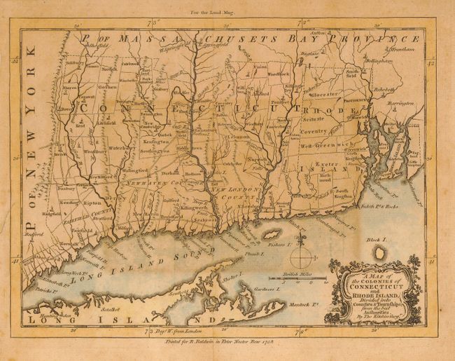
Auction 117, Lot 154
Subject: Colonial New England
Kitchin, Thomas
A Map of the Colonies of Connecticut and Rhode Island, Divided into Counties & Townships, from the best Authorities, 1758
Size: 9 x 7 inches (22.9 x 17.8 cm)
Estimate: $180 - $220
Sold for: $160
Closed on 12/6/2006
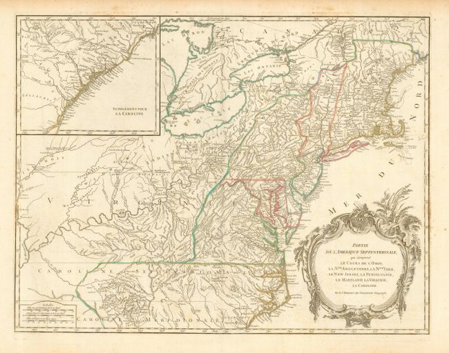
Auction 117, Lot 155
Subject: Eastern United States
Robert de Vaugondy
Partie de l'Amerique Septentrionale, qui comprend le Cours de l'Ohio, la Nlle. Angleterre, la Nlle York, le New Jersey, la Pensylvanie, le Maryland la Virginie, la Caroline, 1788
Size: 24 x 19 inches (61 x 48.3 cm)
Estimate: $900 - $1,200
Unsold
Closed on 12/6/2006
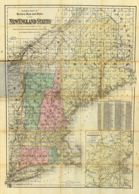
Auction 117, Lot 156
Subject: New England
Johnson & Co., Thomas R.
Johnson's Section Map and Index of the New England States, 1894
Size: 36 x 26 inches (91.4 x 66 cm)
Estimate: $150 - $300
Sold for: $75
Closed on 12/6/2006
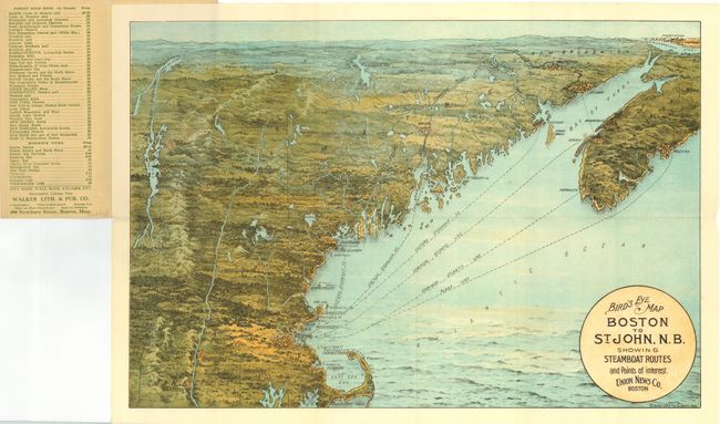
Auction 117, Lot 157
Subject: Boston, New England
Bird's Eye Map Boston to St. John, N.B. Showing Steamboat Routes and Points of Interest. Union News Co. Boston, 1910
Size: 19 x 13.3 inches (48.3 x 33.8 cm)
Estimate: $100 - $140
Sold for: $130
Closed on 12/6/2006
Auction 117, Lot 158
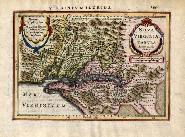
Subject: Colonial Mid Atlantic
Jansson, Jan
Nova Virginiae Tabula, 1628
Size: 7.5 x 5.2 inches (19.1 x 13.2 cm)
Estimate: $750 - $900
Sold for: $650
Closed on 12/6/2006
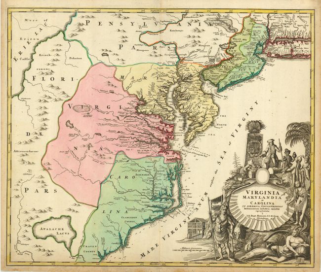
Auction 117, Lot 159
Subject: Colonial Mid Atlantic
Homann, Johann Baptist
Virginia Marylandia et Carolina in America Septentrionali Britannorum industria excultae, 1714
Size: 22.6 x 19 inches (57.4 x 48.3 cm)
Estimate: $2,100 - $2,500
Sold for: $1,600
Closed on 12/6/2006
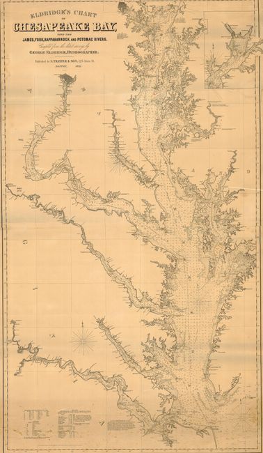
Auction 117, Lot 160
Subject: United States - Mid-Atlantic
Eldridge, George
Eldridge's Chart of Chesapeake Bay with the James, York, Rappahannock and Potomac Rivers, 1898
Size: 32.5 x 56.5 inches (82.6 x 143.5 cm)
Estimate: $1,500 - $2,000
Sold for: $950
Closed on 12/6/2006
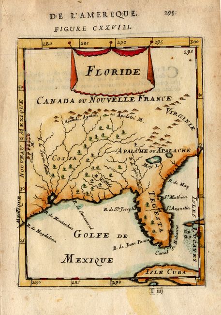
Auction 117, Lot 161
Subject: Colonial Southern United States
Mallet, Alain Manesson
Floride, 1683
Size: 4.5 x 6 inches (11.4 x 15.2 cm)
Estimate: $200 - $250
Sold for: $240
Closed on 12/6/2006
251 lots
Page 1 of 6