Subject: Western Canada & Alaska
Period: 1607 (circa)
Publication:
Color: Black & White
Size:
11.5 x 9.2 inches
29.2 x 23.4 cm
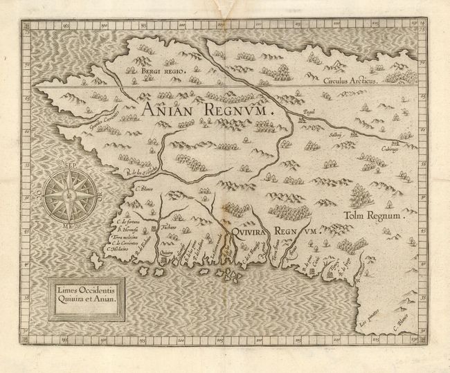
This early copperplate engraving depicts the northwestern coast of North America and is generally considered the first map of Alaska, even though it is mostly an imaginary depiction. The general shape of the map is based on Gerard Mercator's world map of 1569. The mythical realms of Anian, Quivera and Tolm fill the interior and numerous place names are shown along the coastline. Several rivers are shown including a large one that flows into the sea to the north, which forms the fabled Northwest Passage. Second state with the date removed from the cartouche.
References: Burden #107; Wagner #189.
Condition: B
Slight toning on centerfold. Paper restoration in top margin forming a 'V' at center with tiny bit of neatline in facsimile. Couple of small edge tears, tiny hole in margin not affecting map. Remnants of framer's hinges on verso.