Subject: Colonial United States and Canada
Period: 1719 (dated)
Publication: A New General Atlas
Color: Hand Color
Size:
23.3 x 19.8 inches
59.2 x 50.3 cm
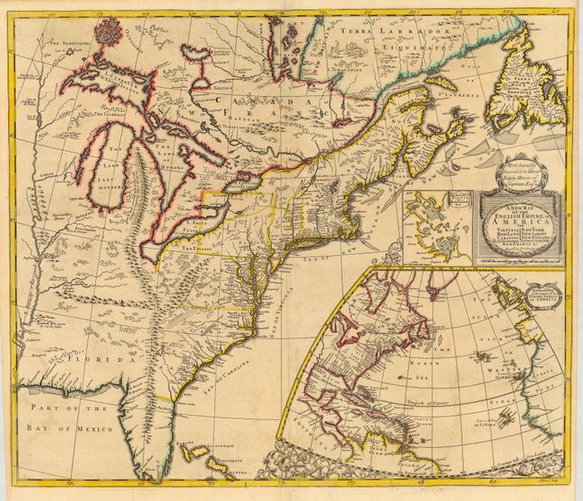
This is a great map of the eastern part of North America with a prominent, entirely fictitious, mountain range extending from Michigan, connecting with the Appalachians, and continuing into Florida. The map closely follows Richard Daniel's map of 1679 and is based on numerous Jesuit and French sources for information on the Great Lakes and Canada. In the Southeast the features of Lederer's maps are seen, including Ashley Lake, the Large Savana, and the Desert Arenosa. Off the eastern seaboard is a large inset map of the North Atlantic showing the eastern part of North America and the West Indies, as well as the coastlines of Europe and Africa. Above that is a smaller inset of Boston and vicinity with the title cartouche. This is the second state, with Robert Morden's imprint replaced with John Senex, and the royal arms replaced with a dedication cartouche to Hewer Edgly Hewer of Clapham.
References: Cumming (SE) #172; Kershaw #326; McCorkle #719.7; Stevens & Tree #20b.
Condition: A
Generally very good with nice original outline color. Couple of minor repairs in bottom margin and border and a bit of faint offsetting.